mail_outline sales@mediastorehouse.com
3,393 items
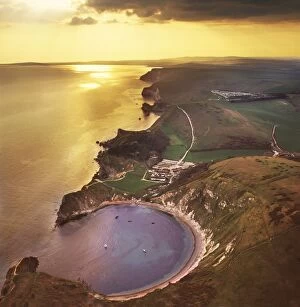
Picture No. 10741205Lulworth Cove, a natural landform harbour, near West Lulworth, on the Jurassic Coast World Heritage Site, Dorset Date
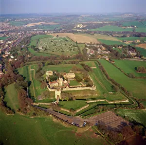
Picture No. 10741229Carisbrooke Castle, a historic motte-and-bailey castle, village of Carisbrooke, near Newport, Isle of Wight Date
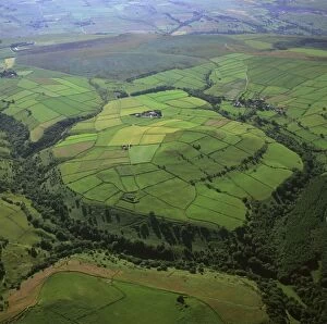
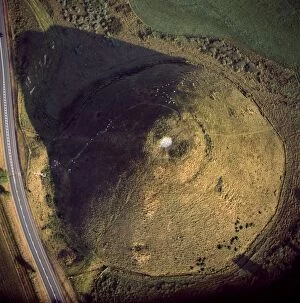
Picture No. 10741266England - Aerial view of the oval shaped hill of Abney Low, 347 metres above sea level. Date
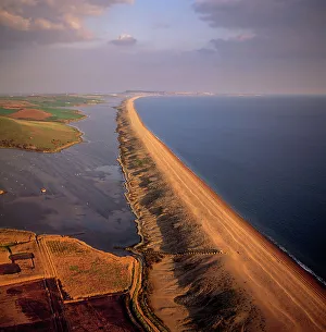
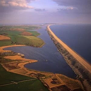
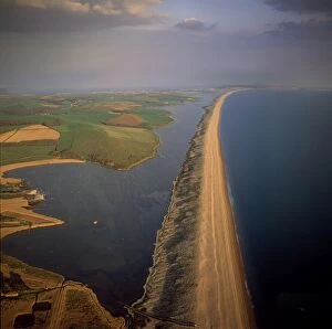
Picture No. 10741203Chesil Beach (Chesil Bank), 29 km long shingle beach, Dorset. A tombolo connecting mainland to the Isle of Portland. It is a part of the Jurassic Coast. Date
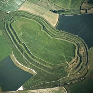
Picture No. 10741221Battlesbury Camp, an Iron Age Hill fort, Warminster, Wiltshire Date
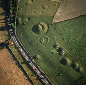
Picture No. 10741273England - Aerial view. Cluster of Neolithic sacred sites and Bronze Age barrows situated to the south-west of Cranbourne Date
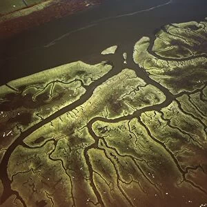
Picture No. 10741199Salt Marsh on River Lune, Lancaster, Lancashire Date
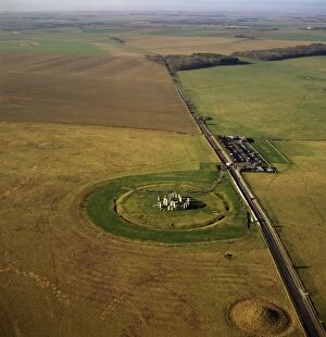
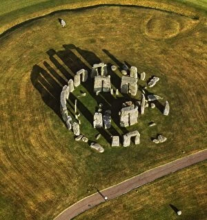
Picture No. 10741212Stonehenge, , World Heritage Site, prehistoric monument and stone circle, Wiltshire Date
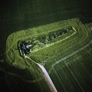
Picture No. 10741217West Kennet Long Barrow, a Neolithic tomb or barrow, on a prominent chalk ridge, near Silbury Hill, Avebury, Wiltshire Date
Picture No. 10741284England - Aerial view, Otterburn Date
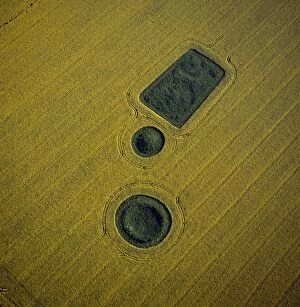
Picture No. 10741218Round and square Barrows at North Down in rape field, near Calstone wellington, Wiltshire Date
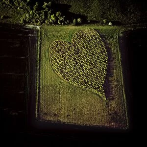
Picture No. 10741299England - Aerial view, Heart Orchard, Date
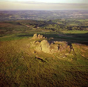
Picture No. 10741265England - Aerial view, Haytor Rocks, Dartmoor, Devon Date
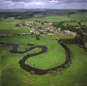
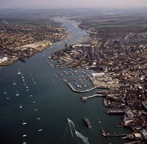
Picture No. 10741255Cowes, on the west bank of the estuary of the River Medina facing the smaller town of East Cowes on the east Bank, Isle of Wight Date
Picture No. 10741220Winterbourne Poor Lot (Round) Barrows, Winterbourne Abbas, Dorset Date
Picture No. 10741262England - Aerial view, Castlerigg Stone Circle, Date
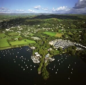
Picture No. 10741263England - Aerial view, Bowness-on-Windermere, Date
Picture No. 10741280England - Aerial view, Blakeney Point Date
Picture No. 10741250Lamb Down Military Badge, The badge of the Australian Commonwealth Military Forces cut on a steep slope just by the A36, at the top of Lamb down, Wiltshire Date
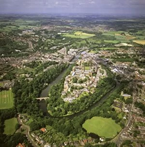
Picture No. 10741276England - Aerial view, Durham Castle, Cathedral and city Date
Picture No. 10741268England - Aerial view. Lundy Island. Date
Picture No. 10741216Silbury Hill, a prehistoric human-made chalk and clay mound near Avebury, part of the Stonehenge, Avebury and Associated Sites UNESCO World Heritage Site, Wiltshire Date
Picture No. 10741271England - Aerial view of linear storm beach of shingle, stretching 29 kilometres from Bridport to the Isle of Portland. Date
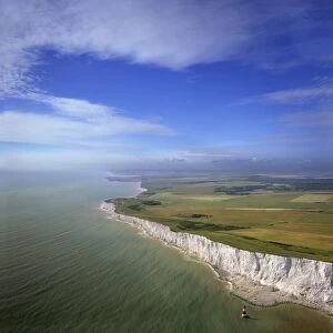
Picture No. 10741277England - Aerial view White Cliffs at Beachy Head. The English Channel. Date
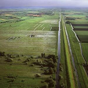
Picture No. 10741274England - Aerial view, New and Old Bedford Rivers on the Fens near Mepal, Cambridgeshire Date
Picture No. 10741240Osborne House, Isle of Wight Date
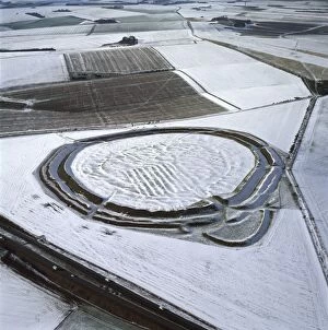
Picture No. 10741223Yarnbury Castle (Hill Fort) in snow, Wiltshire Date
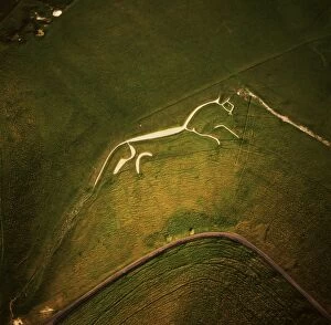
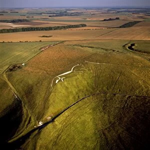
Picture No. 10741286England - Aerial view of the Uffington White Horse, a 110 metre long chalk hill figure. Date
Picture No. 10741282England - Aerial view, Norfolk Broads at Ludham Bridge Date
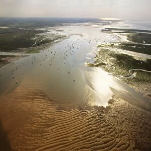
Picture No. 10741198Solway Firth, Mudflats with sunset, border between England and Scotland, between Cumbria and Dumfries and Galloway Date
Picture No. 10741249Westbury White Horse, and an Iron Age Bratton Camp Hill Fort, Wiltshire Date
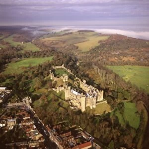
Picture No. 10741290England - Aerial view of Arundel Castle, Arundel Park and the Arun valley where it breaks through the South Downs. Date
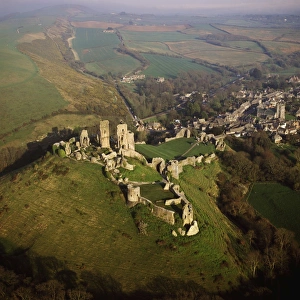
Picture No. 10741231Corfe Castle Castle, Purbeck Hills, between Wareham and Swanage, Dorset Date
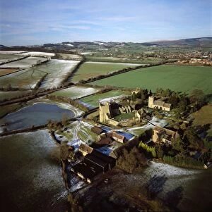
Picture No. 10741194Stokesay Castle Date
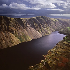
Picture No. 10741230England - Aerial view of Wast Water, Wasdale valley. Date
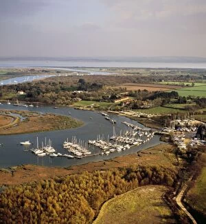
Picture No. 10741260Bucklers Hard, hamlet situated on the banks of the Beaulieu River, the birthplace of many British naval vessels, Hampshire Date
Picture No. 10741204Chesil Beach (Chesil Bank), 29 km long shingle beach, Dorset. A tombolo connecting mainland to the Isle of Portland. It is a part of the Jurassic Coast. Date
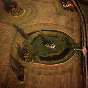
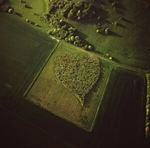
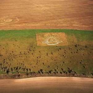
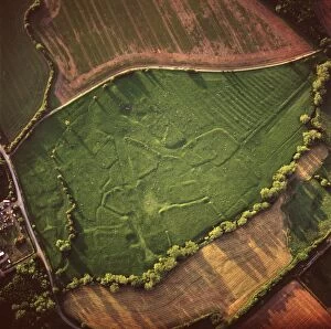
Picture No. 10741232Heart Shape Orchard, near Huish Hill earthwork, Oare, Wiltshire Date
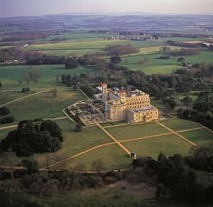
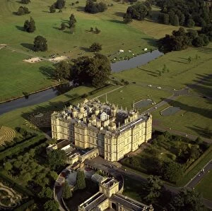
Picture No. 10741239Longleat, an English country house, Horningsham, near Warminster, Wiltshire Date
Picture No. 10741285England - Aerial view, Sherwood Forest and River Poulter, Date
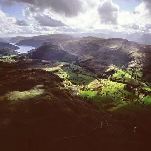
Picture No. 10741242England - Aerial view, Valley north of Lake Thirlmere, Date
Picture No. 10741213Stonehenge, World Heritage Site, prehistoric monument and stone circle, Wiltshire Date
Picture No. 10741278England - Aerial view, Deserted Village Date
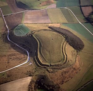
Picture No. 10741226Maiden Castle, an Iron Age hill fort, Winterborne Monkton, near Dorchester, Dorset Date
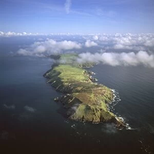
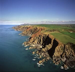
Picture No. 10741241UK - aerial of Shag Point, Lee Bay Date
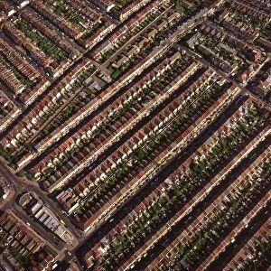
Picture No. 10741252Terraced housing, Portsmouth, Hampshire Date
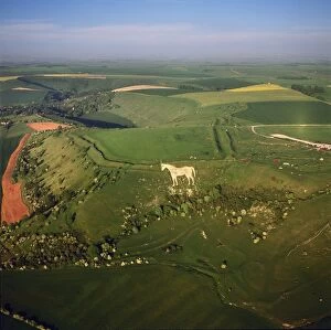
Picture No. 10741246Uffington White Horse with Uffington Castle hill fort, Berkshire Downs, Vale of White Horse, Oxfordshire Date
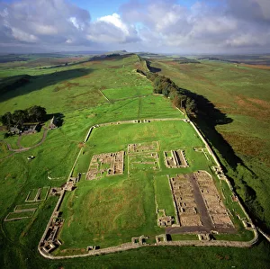
Picture No. 10741283England - Aerial view, Housesteads Roman Fort and Hadrian's Wall, Date