mail_outline sales@mediastorehouse.com
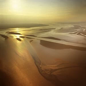
Picture No. 10741198Solway Firth, Mudflats with sunset, border between England and Scotland, between Cumbria and Dumfries and Galloway Date:
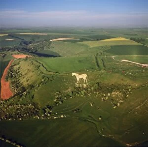
Picture No. 10741249Westbury White Horse, and an Iron Age Bratton Camp Hill Fort, Wiltshire Date:
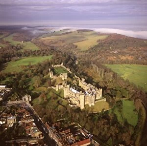
Picture No. 10741290England - Aerial view of Arundel Castle, Arundel Park and the Arun valley where it breaks through the South Downs. Date:
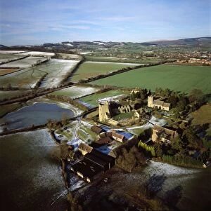
Picture No. 10741194Stokesay Castle Date:
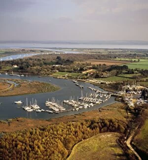
Picture No. 10741260Bucklers Hard, hamlet situated on the banks of the Beaulieu River, the birthplace of many British naval vessels, Hampshire Date:
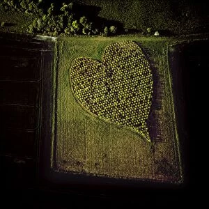
Picture No. 10741232Heart Shape Orchard, near Huish Hill earthwork, Oare, Wiltshire Date:
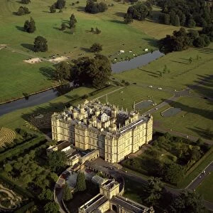
Picture No. 10741239Longleat, an English country house, Horningsham, near Warminster, Wiltshire Date:
Picture No. 10741285England - Aerial view, Sherwood Forest and River Poulter, Date:
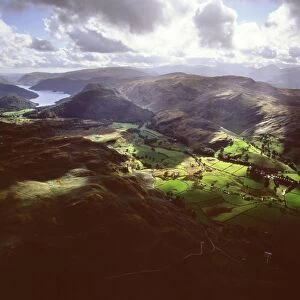
Picture No. 10741242England - Aerial view, Valley north of Lake Thirlmere, Date:
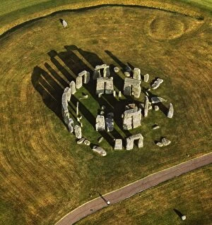
Picture No. 10741213Stonehenge, World Heritage Site, prehistoric monument and stone circle, Wiltshire Date:
Picture No. 10741278England - Aerial view, Deserted Village Date:
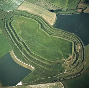
Picture No. 10741226Maiden Castle, an Iron Age hill fort, Winterborne Monkton, near Dorchester, Dorset Date:
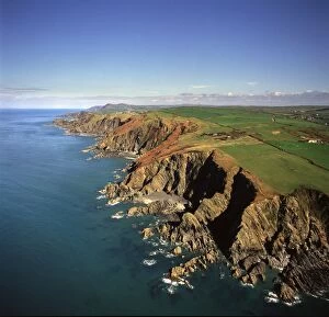
Picture No. 10741241UK - aerial of Shag Point, Lee Bay Date:
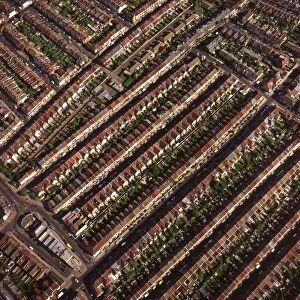
Picture No. 10741252Terraced housing, Portsmouth, Hampshire Date:
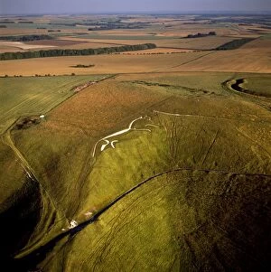
Picture No. 10741246Uffington White Horse with Uffington Castle hill fort, Berkshire Downs, Vale of White Horse, Oxfordshire Date:
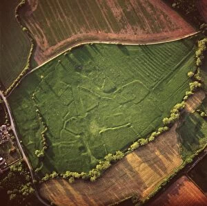
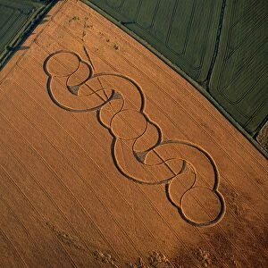
Picture No. 10741237Crop Circle, Wiltshire Date:
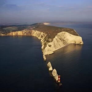
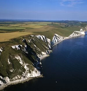
Picture No. 10741200The Needles, a row of three stacks of chalk and Lighthouse, off the western extremity of the Isle of Wight, Alum Bay Date:
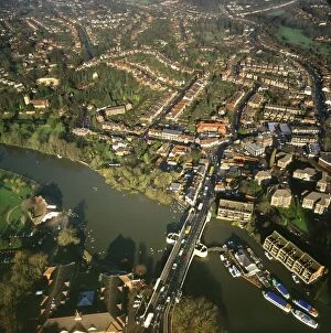
Picture No. 10741281England - Aerial view, Reading and River Thames, Berkshire Date:
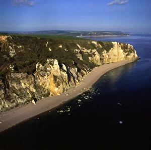
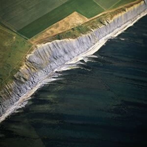
Picture No. 10741267England - Aerial view of chalk cliffs, between Beer and Branscombe Date:
Picture No. 10741243Cerne Abbas giant, Cerne Abbas, north of Dorchester, Dorset Date:
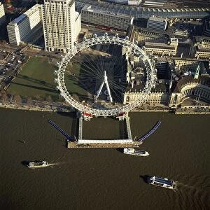
Picture No. 10865380Millennium Wheel (London Eye) and the River Thames Date:
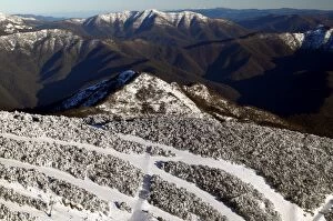
Picture No. 10863131Aerial view of ski runs on Mount Buller in winter. Mount Buller Alpine Resort, Northeast Victoria, Australia. Date:
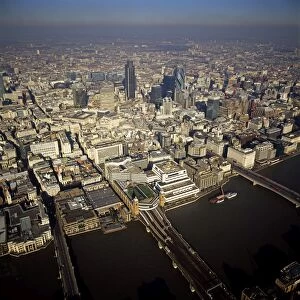
Picture No. 10865374Aerial view of Canon Street, the River Thames and city of London Date:
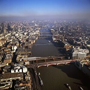
Picture No. 10865378Chain of Bridges and the River Thames Date:
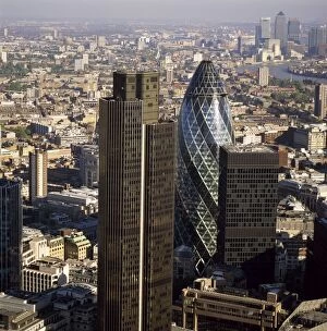
Picture No. 10865373London Aerial view of Tower 42, Gherkin (Swiss Re) Date:
Picture No. 10865377England - Aerial view, Kimmeridge Ledges, Jurassic Coast, Dorset Date:
Picture No. 10865376England - Aerial view, White North, Jurassic Coast Date:
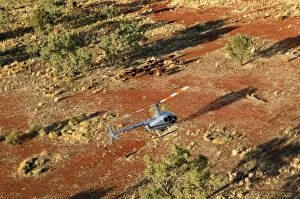
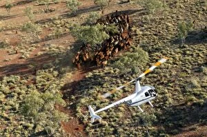
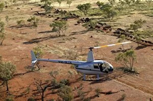
Picture No. 10863273Cattle mustering with helicopter - aerial photograph.In remote locations where cattle stations cover vast expanses, helicopters are used to muster the cattle
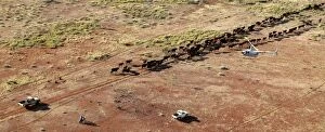
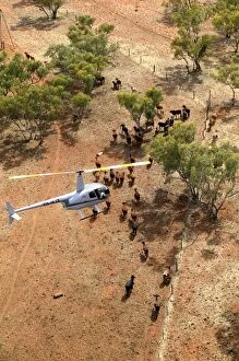
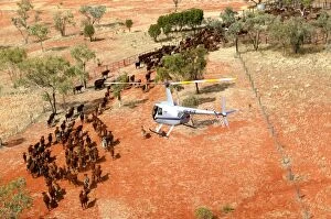
Picture No. 10863260Cattle mustering - aerial image.Helicopter mustering : stockmen and stockwomen on the ground help push the cattle towards the yards while the helicopter keeps them on the track
Picture No. 10863275Cattle mustering with helicopter - aerial photograph.In remote locations where cattle stations cover vast expanses, helicopters are used to muster the cattle
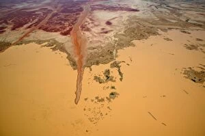
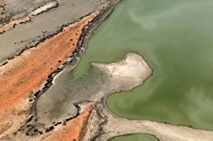
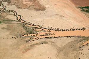
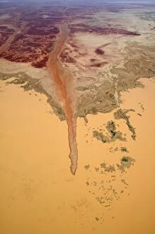
Picture No. 10863196Diamantina River flooding onto the Strzelecki Desert.aerial. near Birdsville, South australia Date:
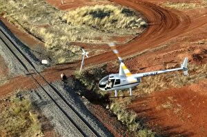
Picture No. 10863259Helicopter and outback letterbox - aerial image.Twice a week the train will stop to deliver and pick up the mail for this station. Bushy Park Cattle Station, North Queensland, Australia Date:
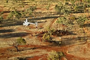
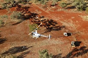
Picture No. 10863258Cattle mustering - aerial image.Helicopters are used to push the cattle into yards for drafting.. Bushy Park Cattle Station, North Queensland, Australia Date:
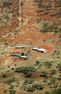
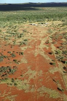
Picture No. 10863267Remote cattle station - aerial photograph.with airstrip in the background. Bushy Park Cattle Station, Northern Queensland, Australia Date:
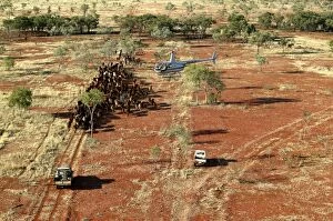
Picture No. 10863274Cattle mustering with helicopter - aerial photograph.In remote locations where cattle stations cover vast expanses, helicopters are used to muster the cattle
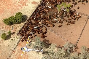
Picture No. 10863257Cattle mustering - aerial photograph.Helicopters are used to push the cattle into yards for drafting. Note the use of a funnel shaped fence to direct the cattle
Picture No. 10863279Diamantina River.in flood near Birdsville. Aerial photograph. Near Birdsville, Strzelecki Desert, South Australia Date:
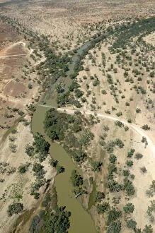
Picture No. 10863212Cooper Creek.aerial. near Innamincka, South australia Date:
Picture No. 10863277Cattle mustering with helicopter - aerial photograph.In remote locations where cattle stations cover vast expanses, helicopters are used to muster the cattle
Picture No. 10863252Cattle mustering - aerial photograph.by helicopter on outback station..Bushy Park Cattle Station, North Queensland, Australia Date:
Picture No. 10863197Diamantina River flooding onto the Strzelecki Desert.aerial. near Birdsville, South australia Date:
Picture No. 10863276Cattle mustering with helicopter - aerial photograph.In remote locations where cattle stations cover vast expanses, helicopters are used to muster the cattle
Picture No. 10863256Cattle mustering - aerial photograph.Helicopters are used to push the cattle into yards for drafting. Note the use of a funnel shaped fence to direct the cattle
Picture No. 10863280Diamantina River.in flood near Birdsville. Aerial photograph. Near Birdsville, Strzelecki Desert, South Australia Date:
Picture No. 10863209Bushy Park Cattle Station.aerial. 60km south of Mount Isa, Queensland, .Australia Date:
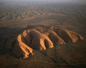
Picture No. 10863045Uluru (formerly: Ayers Rock).aerial image. Uluru-Kata Tjuta National Park (World Heritage Area), Northern Territory, Australia Date:
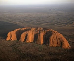
Picture No. 10863044Uluru (Ayers rock).aerial image. Uluru-Kata Tjuta National Park (World Heritage Area), Northern Territory, Australia Date:
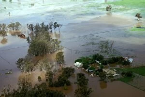
Picture No. 10863043Shepparton flood, 1993.aerial of farm during the flood. northeastern Victoria, Australia Date: