mail_outline sales@mediastorehouse.com
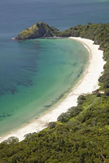
DDE-90026445New Chums Beach and Motuto Point, Coromandel Peninsula, North Island, New Zealand - aerial Date: 02/08/2006
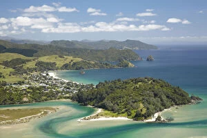
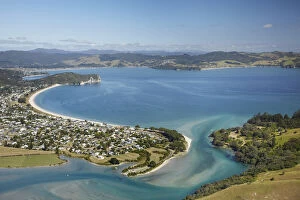
DDE-90026444Whangapoua and Whangapoua Harbour, Coromandel Peninsula, North Island, New Zealand - aerial Date: 02/08/2006
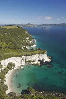
DDE-90026443Cook Bluff, near Cathedral Cove, Coromandel Peninsula, North Island, New Zealand - aerial Date: 02/08/2006
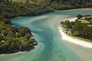
DDE-90026442Inlet, Cooks Beach, Coromandel Peninsula, North Island, New Zealand - aerial Date: 02/08/2006
DDE-90026441Cooks Beach, Coromandel Peninsula, North Island, New Zealand - aerial Date: 02/08/2006
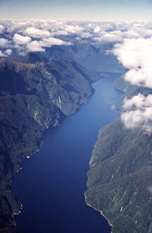
DDE-90026395New Zealand, Nancy Sound, Fiordland - Aerial Date: 05/03/2005
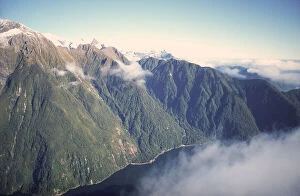
DDE-90026394New Zealand, Fiordland Coast near Milford Sound - Aerial Date: 05/03/2005
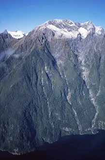
DDE-90026393New Zealand, Fiordland Coast near Milford Sound - Aerial Date: 05/03/2005
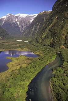
DDE-90026386New Zealand, Lake Brown & Arthur River, Arthur Valley, Milford Track, Fiordland National Park - aerial Date: 05/03/2005
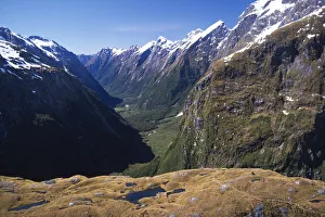
DDE-90026382New Zealand, Mackinnon Pass (& shelter) Clinton Canyon, Milford Track, Fiordland National Park - aerial Date: 05/03/2005
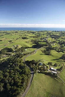
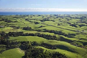
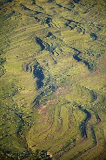
DDE-90026359Farmland near New Plymouth, Taranaki, North Island, New Zealand - aerial Date: 05/03/2005
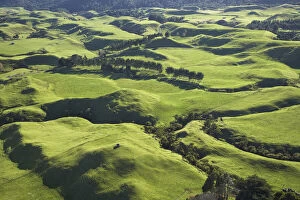
DDE-90026358Farmland near Okato, Taranaki, North Island, New Zealand - aerial Date: 05/03/2005
DDE-90026357Farmland near Okato, Taranaki, North Island, New Zealand - aerial Date: 05/03/2005
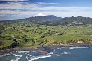
DDE-90026356Farmland near Okato, and Mt Taranaki / Mt Egmont, Taranaki, North Island, New Zealand - aerial Date: 05/03/2005
DDE-90026355Farmland near Okato, and Mt Taranaki / Mt Egmont, Taranaki, North Island, New Zealand - aerial Date: 05/03/2005
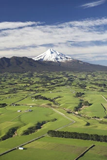
DDE-90026354Taranaki Coastline near New Plymouth, Farmland and Mt Taranaki / Mt Egmont, Taranaki, North Island, New Zealand Date: 05/03/2005
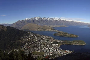
DDE-90026350View from Skyline Gondola, Queenstown, South Island, New Zealand Date: 07/04/2005
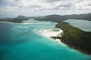
DDE-90026303Australia, Queensland, Whitsunday Coast, Whitsunday Islands. Aerial View of Whitehaven Beach. Date: 14/10/2005
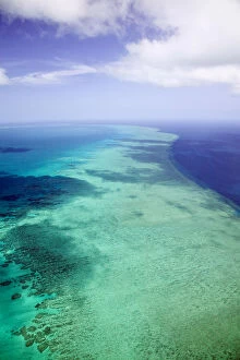
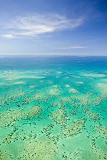
DDE-90026291Australia, Queensland, Whitsunday Coast, Great Barrier Reef. Aerial of the Great Barrier Reef by the Whitsunday Coast. Date: 14/10/2005
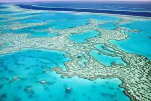
DDE-90026292Australia, Queensland, Whitsunday Coast, Great Barrier Reef. Aerial of the Great Barrier Reef by the Whitsunday Coast. Date: 14/10/2005
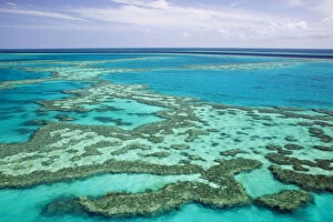
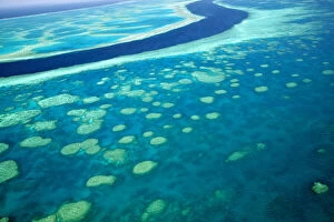
DDE-90026290Australia, Queensland, Whitsunday Coast, Great Barrier Reef. Aerial of the Great Barrier Reef by the Whitsunday Coast with its River'. Date: 14/10/2005
DDE-90026289Australia, Queensland, Whitsunday Coast, Great Barrier Reef. Aerial of the Great Barrier Reef by the Whitsunday Coast with its River'. Date: 14/10/2005
DDE-90026288Australia, Queensland, Whitsunday Coast, Great Barrier Reef. Aerial of the Great Barrier Reef by the Whitsunday Coast with its River'. Date: 14/10/2005
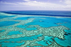
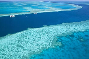
DDE-90026287Aerial view of The Great Barrier Reef by the Whitsunday Coast with diving boats anchored in its river, Whitsunday Coast, Queensland, Australia Date: 15/10/2009
DDE-90026269The Great Barrier Reef, aerial view of Green Island, Cairns Area, North Coast, Queensland, Australia Date: 15/10/2009
DDE-90026031Kakadu National Park, Northern Territory, Australia - aerial Date: 02/02/2008
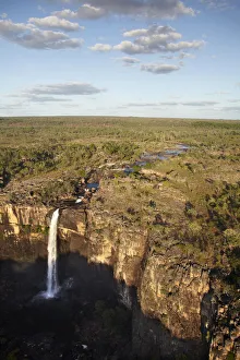
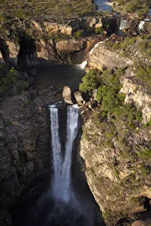
DDE-90026018Magela Falls, Kakadu National Park, Northern Territory, Australia - aerial Date: 02/02/2008
DDE-90026017Magela Falls, Kakadu National Park, Northern Territory, Australia - aerial Date: 02/02/2008
DDE-90026016Magela Falls, Kakadu National Park, Northern Territory, Australia - aerial Date: 02/02/2008
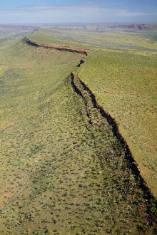
DDE-90026015Osmand Ranges, East Kimberley Region, Western Australia, Australia - aerial Date: 02/02/2008
DDE-90026014Osmand Ranges, East Kimberley Region, Western Australia, Australia - aerial Date: 02/02/2008
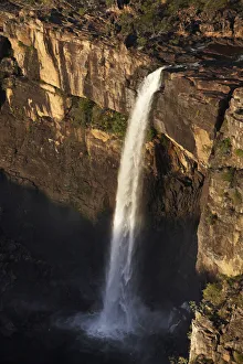
DDE-90026013Jim Jim Falls, Kakadu National Park, Northern Territory, Australia - aerial Date: 02/02/2008
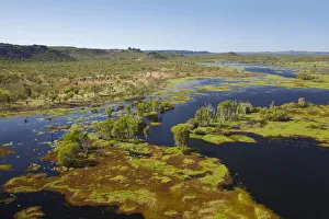
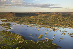
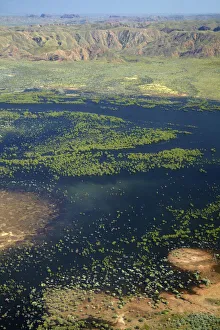
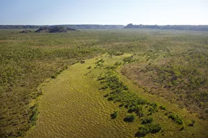
DDE-90026012Magela Wetlands, Kakadu National Park, Northern Territory, Australia - aerial Date: 02/02/2008
DDE-90026010Carr Boyd Ranges, East Kimberley Region, Western Australia, Australia - aerial Date: 02/02/2008
DDE-90026011Magela Wetlands, Kakadu National Park, Northern Territory, Australia - aerial Date: 02/02/2008
DDE-90026004Texas Downs Station, East Kimberley Region, Western Australia, Australia - aerial Date: 02/02/2008
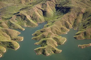
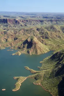
DDE-90026003Shoreline of Lake Argyle, Kimberley Region, Western Australia, Australia - aerial Date: 02/02/2008
DDE-90026002Shoreline of Lake Argyle, Kimberley Region, Western Australia, Australia - aerial Date: 02/02/2008
DDE-90026001Shoreline of Lake Argyle, Kimberley Region, Western Australia, Australia - aerial Date: 02/02/2008
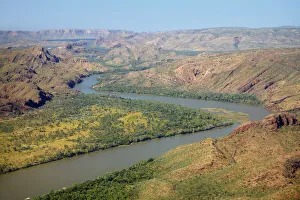
DDE-90026000Ord River, near Kununurra, Kimberley Region, Western Australia, Australia - aerial Date: 02/02/2008
DDE-90025992Floodplain near Jabiru, Kakadu National Park, Northern Territory, Australia - aerial Date: 02/02/2008
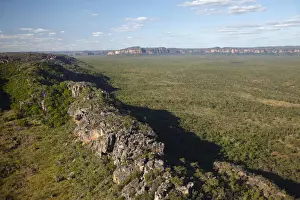
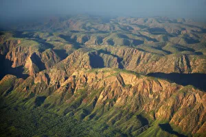
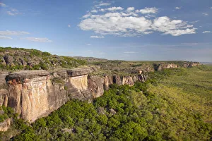
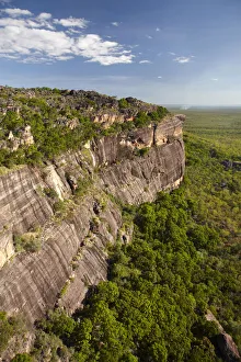
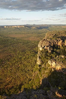
DDE-90025991Arnhem Land Escarpment, Kakadu National Park, Northern Territory, Australia - aerial Date: 02/02/2008
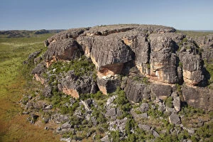
DDE-90025990Arnhem Land Escarpment, Kakadu National Park, Northern Territory, Australia - aerial Date: 02/02/2008
DDE-90025987Rock outcrops near Ubirr, Kakadu National Park, Northern Territory, Australia - aerial Date: 02/02/2008
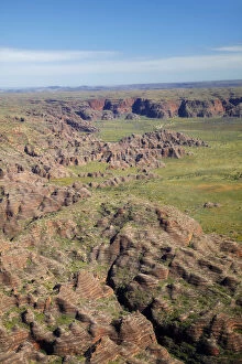
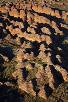
DDE-90025977Beehives, Bungle Bungles, Purnululu National Park, Kimberley Region, Western Australia, Australia - aerial Date: 02/02/2008
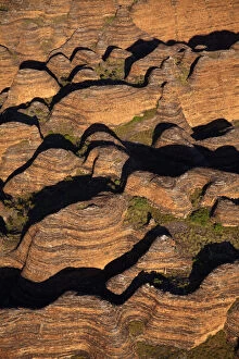
DDE-90025976Beehives, Bungle Bungles, Purnululu National Park, Kimberley Region, Western Australia, Australia - aerial Date: 02/02/2008
DDE-90025975Beehives, Bungle Bungles, Purnululu National Park, Kimberley Region, Western Australia, Australia - aerial Date: 02/02/2008
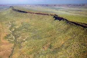
DDE-90025972Arnhem Land escarpment, at the edge of Kakadu National Park, Arnhem Land, Northern Territory, Australia - aerial Date: 02/02/2008