
Home > Images Dated > 2009 > January > 14 Jan 2009

Images Dated 14th January 2009 (page 2)

128 items

Background imageImages Dated 14th January 2009: Vineyards of the Lower Hunter Valley on the slopes of Broken Back Range, Hunter Valley

Vineyards of the Lower Hunter Valley on the slopes of Broken Back Range, Hunter Valley, New South Wales
JPF-13828 Vineyards of the Lower Hunter Valley on the slopes of Broken Back Range Hunter Valley, New South Wales, Australia Jean-Paul Ferrero Please note that prints are for personal display purposes

Background imageImages Dated 14th January 2009: Byron Bay lighthouse - aerial, Byron Bay, New South Wales, Australia JPF48933

Byron Bay lighthouse - aerial, Byron Bay, New South Wales, Australia JPF48933
JPF-13830 Byron Bay lighthouse - aerial Byron Bay, New South Wales, Australia Jean-Paul Ferrero Please note that prints are for personal display purposes only and may not be reproduced in anyway

Background imageImages Dated 14th January 2009: Aerial - Sisters Beach and farmland north coast Tasmania, Australia JPF49103

Aerial - Sisters Beach and farmland north coast Tasmania, Australia JPF49103
JPF-13839 Aerial - Sisters Beach and farmland north coast Tasmania, Australia Jean-Paul Ferrero Please note that prints are for personal display purposes only and may not be reproduced in anyway

Background imageImages Dated 14th January 2009: Vineyards of the Lower Hunter Valley on the slopes of Broken Back Range, Hunter Valley

Vineyards of the Lower Hunter Valley on the slopes of Broken Back Range, Hunter Valley, New South Wales
JPF-13829 Vineyards of the Lower Hunter Valley on the slopes of Broken Back Range Hunter Valley, New South Wales, Australia Jean-Paul Ferrero Please note that prints are for personal display purposes

Background imageImages Dated 14th January 2009: Aerial - Port Campbell National Park with Muttonbird Island in foreground, the Island Archway

Aerial - Port Campbell National Park with Muttonbird Island in foreground, the Island Archway
JPF-13825 Aerial - Port Campbell National Park with Muttonbird Island in foreground the Island Archway, and Twelve Apostles beyond, Victoria

Background imageImages Dated 14th January 2009: Aerial - Port Davey (northern shores) North Head - World Heritage Area, Southwest National Park

Aerial - Port Davey (northern shores) North Head - World Heritage Area, Southwest National Park
JPF-13836 Aerial - Port Davey (northern shores) North Head World Heritage Area, Southwest National Park, Tasmania (World Heritage Area)

Background imageImages Dated 14th January 2009: Boucaut Bay, aerial sandy beach & mangroves, Arnhemland, Northern Territory, Australia JPF48703

Boucaut Bay, aerial sandy beach & mangroves, Arnhemland, Northern Territory, Australia JPF48703
JPF-13824 Boucaut Bay, aerial sandy beach & mangroves Arnhemland, Northern Territory, Australia Jean-Paul Ferrero Please note that prints are for personal display purposes only

Background imageImages Dated 14th January 2009: Boucaut Bay, aerial sandy beach & mangrove, Bushfires in background Arnhemland

Boucaut Bay, aerial sandy beach & mangrove, Bushfires in background Arnhemland, Northern Territory, Australia JPF48707
JPF-13823 Boucaut Bay, aerial sandy beach & mangrove Bushfires in background Arnhemland, Northern Territory, Australia Jean-Paul Ferrero Please note that prints are for personal display purposes only

Background imageImages Dated 14th January 2009: Boucaut Bay, aerial sandy beach & mangrove, bushfire in distance, Arnhemland, Northern Territory

Boucaut Bay, aerial sandy beach & mangrove, bushfire in distance, Arnhemland, Northern Territory, Australia JPF48711
JPF-13822 Boucaut Bay, aerial sandy beach & mangrove, bushfire in distance Arnhemland, Northern Territory, Australia Jean-Paul Ferrero Please note that prints are for personal display purposes only

Background imageImages Dated 14th January 2009: Boucaut Bay, aerial sandy beach & mangroves, Arnhemland, Northern Territory, Australia JPF48713

Boucaut Bay, aerial sandy beach & mangroves, Arnhemland, Northern Territory, Australia JPF48713
JPF-13821 Boucaut Bay, aerial sandy beach & mangroves Arnhemland, Northern Territory, Australia Jean-Paul Ferrero Please note that prints are for personal display purposes only

Background imageImages Dated 14th January 2009: Boucaut Bay, aerial sandy beach & mangroves, Arnhemland, Northern Territory, Australia JPF48714

Boucaut Bay, aerial sandy beach & mangroves, Arnhemland, Northern Territory, Australia JPF48714
JPF-13820 Boucaut Bay, aerial sandy beach & mangroves Arnhemland, Northern Territory, Australia Jean-Paul Ferrero Please note that prints are for personal display purposes only

Background imageImages Dated 14th January 2009: Gin Arm Creek aerial showing oxbows (meanders), Gulf of Carpentaria, Queensland, Australia JPF48727

Gin Arm Creek aerial showing oxbows (meanders), Gulf of Carpentaria, Queensland, Australia JPF48727
JPF-13818 Gin Arm Creek aerial showing oxbows (meanders) Gulf of Carpentaria, Queensland, Australia Jean-Paul Ferrero Please note that prints are for personal display purposes only

Background imageImages Dated 14th January 2009: Aerial - Noosa: Heads, main beach & Sound Sunshine Coast, Queensland, Australia JPF48318

Aerial - Noosa: Heads, main beach & Sound Sunshine Coast, Queensland, Australia JPF48318
JPF-13810 Aerial - Noosa: Heads, main beach & Sound Sunshine Coast, Queensland, Australia Jean-Paul Ferrero Please note that prints are for personal display purposes only

Background imageImages Dated 14th January 2009: Caloundra aerial, Sunshine Coast, Queensland, Australia JPF48341

Caloundra aerial, Sunshine Coast, Queensland, Australia JPF48341
JPF-13809 Caloundra aerial, Sunshine Coast Queensland, Australia Jean-Paul Ferrero Please note that prints are for personal display purposes only and may not be reproduced in anyway.

Background imageImages Dated 14th January 2009: Aerial - Borroloola Northern Territory, Australia JPF48663

Aerial - Borroloola Northern Territory, Australia JPF48663
JPF-13807 Aerial - Borroloola Northern Territory, Australia Jean-Paul Ferrero Please note that prints are for personal display purposes only and may not be reproduced in anyway.

Background imageImages Dated 14th January 2009: Pineapple & Macadamia plantations Sunshine Coast, Queensland, Australia JPF48685

Pineapple & Macadamia plantations Sunshine Coast, Queensland, Australia JPF48685
JPF-13806 Pineapple & Macadamia plantations Sunshine Coast Queensland, Australia Jean-Paul Ferrero Please note that prints are for personal display purposes only and may not be reproduced in anyway

Background imageImages Dated 14th January 2009: Aerial - Agricultural land & distant Gold Coast high-rises near Beechmont, Queensland JPF48697

Aerial - Agricultural land & distant Gold Coast high-rises near Beechmont, Queensland JPF48697
JPF-13805 Aerial - Agricultural land & distant Gold Coast high-rises near Beechmont, Queensland Jean-Paul Ferrero Please note that prints are for personal display purposes only

Background imageImages Dated 14th January 2009: Aerial - Eroded sand cliffs Lake Eyre National Park, South Australia JPF48144

Aerial - Eroded sand cliffs Lake Eyre National Park, South Australia JPF48144
JPF-13802 Aerial - Eroded sand cliffs Lake Eyre National Park, South Australia Jean-Paul Ferrero Please note that prints are for personal display purposes only and may not be reproduced in anyway

Background imageImages Dated 14th January 2009: Aerial - Lake Eyre North filling up Lake Eyre National Park, South Australia JPF48134

Aerial - Lake Eyre North filling up Lake Eyre National Park, South Australia JPF48134
JPF-13801 Aerial - Lake Eyre North filling up Lake Eyre National Park, South Australia Jean-Paul Ferrero Please note that prints are for personal display purposes only

Background imageImages Dated 14th January 2009: Aerial - Oxley River Valley farmland, between Mount Warning & the McPherson Range New South Wales

Aerial - Oxley River Valley farmland, between Mount Warning & the McPherson Range New South Wales, Australia JPF48229
JPF-13797 Aerial - Oxley River Valley farmland between Mount Warning & the McPherson Range New South Wales, Australia Jean-Paul Ferrero Please note that prints are for personal display purposes only

Background imageImages Dated 14th January 2009: Aerial - Oxley River Valley farmland, between Mount Warning & the McPherson Range New South Wales

Aerial - Oxley River Valley farmland, between Mount Warning & the McPherson Range New South Wales, Australia JPF48233
JPF-13795 Aerial - Oxley River Valley farmland, between Mount Warning & the McPherson Range New South Wales Australia Jean-Paul Ferrero Please note that prints are for personal display purposes only

Background imageImages Dated 14th January 2009: Aerial - Lake Gairdner, aerial About 160 kilometres long and 50 kilometres across

Aerial - Lake Gairdner, aerial About 160 kilometres long and 50 kilometres across
JPF-13794 Aerial - Lake Gairdner, aerial About 160 kilometres long and 50 kilometres across with salt more than a metre thick at some points

Background imageImages Dated 14th January 2009: Aerial - Everard Ranges on the northern edge of the Great Victoria Desert

Aerial - Everard Ranges on the northern edge of the Great Victoria Desert, northern edge of Great Victoria Desert
JPF-13793 Aerial - Everard Ranges on the northern edge of the Great Victoria Desert northern edge of Great Victoria Desert

Background imageImages Dated 14th January 2009: Aerial - Gosse Bluff, meteorite crater created about 130 years ago, showing ramparts 250 m high

Aerial - Gosse Bluff, meteorite crater created about 130 years ago, showing ramparts 250 m high
JPF-13792 Aerial - Gosse Bluff, meteorite crater created about 140 million years ago, showing ramparts 250 m high and inner crater 4 km wide Northern Territory

Background imageImages Dated 14th January 2009: Aerial - Lake Amadeus salt lake, Kajiti Aboriginal Land, Northern Territory, Australia JPF47718

Aerial - Lake Amadeus salt lake, Kajiti Aboriginal Land, Northern Territory, Australia JPF47718
JPF-13791 Aerial - Lake Amadeus salt lake Kajiti Aboriginal Land, Northern Territory, Australia Jean-Paul Ferrero Please note that prints are for personal display purposes only

Background imageImages Dated 14th January 2009: Aerial - Opal mining, aerial Coober Pedy, South Australia JPF47785

Aerial - Opal mining, aerial Coober Pedy, South Australia JPF47785
JPF-13790 Aerial - Opal mining, aerial Coober Pedy, South Australia Jean-Paul Ferrero Please note that prints are for personal display purposes only and may not be reproduced in anyway.

Background imageImages Dated 14th January 2009: Aerial - Opal mining, aerial Coober Pedy, South Australia JPF47786

Aerial - Opal mining, aerial Coober Pedy, South Australia JPF47786
JPF-13789 Aerial - Opal mining, aerial Coober Pedy South Australia Jean-Paul Ferrero Please note that prints are for personal display purposes only and may not be reproduced in anyway.

Background imageImages Dated 14th January 2009: Aerial - James Ranges (Ltalaltuma Aboriginal Land) Northern Territory, Australia JPF47798

Aerial - James Ranges (Ltalaltuma Aboriginal Land) Northern Territory, Australia JPF47798
JPF-13788 Aerial - James Ranges (Ltalaltuma Aboriginal Land) Northern Territory, Australia Jean-Paul Ferrero Please note that prints are for personal display purposes only

Background imageImages Dated 14th January 2009: Aerial - Uluru (Ayers Rock), base, aerial Uluru-Kata Tjuta National Park (World Heritage Area)

Aerial - Uluru (Ayers Rock), base, aerial Uluru-Kata Tjuta National Park (World Heritage Area), Northern Territory
JPF-13786 Aerial - Uluru (Ayers Rock), base, aerial Uluru-Kata Tjuta National Park (World Heritage Area), Northern Territory

Background imageImages Dated 14th January 2009: Aerial - Great Victoria Desert South Australia JPF47857

Aerial - Great Victoria Desert South Australia JPF47857
JPF-13785 Aerial - Great Victoria Desert South Australia Jean-Paul Ferrero Please note that prints are for personal display purposes only and may not be reproduced in anyway.

Background imageImages Dated 14th January 2009: Aerial - Katherine Gorge Nitmiluk National Park, Northern Territory, Australia JPF47937

Aerial - Katherine Gorge Nitmiluk National Park, Northern Territory, Australia JPF47937
JPF-13784 Aerial - Katherine Gorge Nitmiluk National Park Northern Territory, Australia Jean-Paul Ferrero Please note that prints are for personal display purposes only

Background imageImages Dated 14th January 2009: Aerial - Katherine Gorge Nitmiluk National Park, Northern Territory, Australia JPF47951

Aerial - Katherine Gorge Nitmiluk National Park, Northern Territory, Australia JPF47951
JPF-13782 Aerial - Katherine Gorge Nitmiluk National Park, Northern Territory, Australia Jean-Paul Ferrero Please note that prints are for personal display purposes only

Background imageImages Dated 14th January 2009: Aerial - Gosse Bluff, meteorite crater created about 130 years ago, showing ramparts 250 m high

Aerial - Gosse Bluff, meteorite crater created about 130 years ago, showing ramparts 250 m high
JPF-13781 Aerial - Gosse Bluff, meteorite crater created about 140 million years ago, showing ramparts 250 m high and inner crater 4 km wide Tnorala Conservation Reserve, Missionary Plain

Background imageImages Dated 14th January 2009: Aerial - Cremorne Point & Mosman Bay Sydney, New South Wales, Australia JPF46914

Aerial - Cremorne Point & Mosman Bay Sydney, New South Wales, Australia JPF46914
JPF-13766 Aerial - Cremorne Point & Mosman Bay Sydney New South Wales, Australia Jean-Paul Ferrero Please note that prints are for personal display purposes only and may not be reproduced in anyway

Background imageImages Dated 14th January 2009: Rainbow Beach aerial, Cooloolah Section, Great Sandy National Park, Queensland, Australia

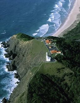
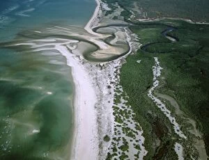
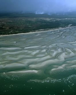
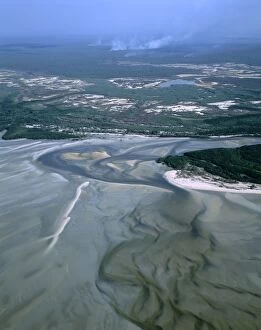
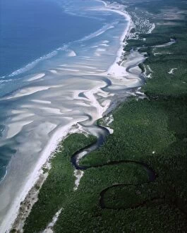
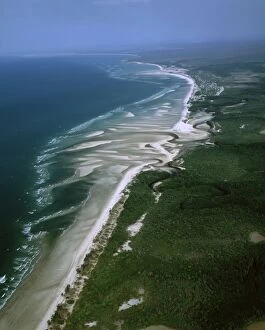
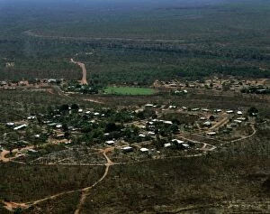
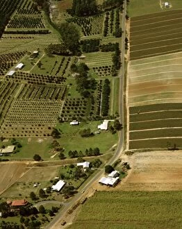
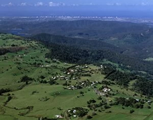
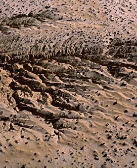
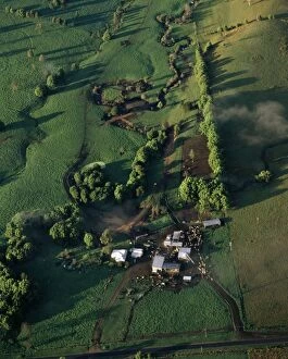
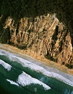
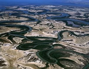
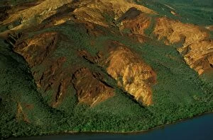
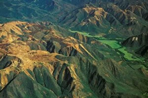
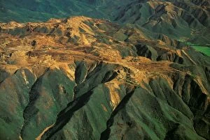
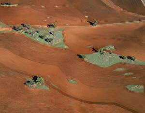
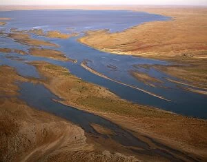
Rainbow Beach aerial, Cooloolah Section, Great Sandy National Park, Queensland, Australia, Sunshine Coast
JPF-13760 Rainbow Beach aerial, Cooloolah Section, Great Sandy National Park Queensland, Australia, Sunshine Coast, Queensland Jean-Paul Ferrero Please note that prints are for personal display

Background imageImages Dated 14th January 2009: Aerial - Suburbs along the Parramatta River Sydney, New South Wales, Australia JPF47114

Aerial - Suburbs along the Parramatta River Sydney, New South Wales, Australia JPF47114
JPF-13759 Aerial - Suburbs along the Parramatta River Sydney New South Wales, Australia Jean-Paul Ferrero Please note that prints are for personal display purposes only

Background imageImages Dated 14th January 2009: Aerial - Lake Barrine Crater Lakes National Park, Queensland, Australia JPF47122

Aerial - Lake Barrine Crater Lakes National Park, Queensland, Australia JPF47122
JPF-13758 Aerial - Lake Barrine Crater Lakes National Park Queensland, Australia Jean-Paul Ferrero Please note that prints are for personal display purposes only and may not be reproduced in anyway

Background imageImages Dated 14th January 2009: Aerial - Gladesville & other suburbs on the Parramatta River Sydney, New South Wales

Aerial - Gladesville & other suburbs on the Parramatta River Sydney, New South Wales, Australia JPF47167
JPF-13757 Aerial - Gladesville & other suburbs on the Parramatta River Sydney, New South Wales, Australia Jean-Paul Ferrero Please note that prints are for personal display purposes only

Background imageImages Dated 14th January 2009: Aerial - Sydney Opera House & Bridge from the air Sydney, New South Wales, Australia JPF46843

Aerial - Sydney Opera House & Bridge from the air Sydney, New South Wales, Australia JPF46843
JPF-13751 Aerial - Sydney Opera House & Bridge from the air Sydney New South Wales, Australia Jean-Paul Ferrero Please note that prints are for personal display purposes only

Background imageImages Dated 14th January 2009: Aerial - Sylvania Waters Sydney, New South Wales, Australia JPF46735

Aerial - Sylvania Waters Sydney, New South Wales, Australia JPF46735
JPF-13745 Aerial - Sylvania Waters Sydney New South Wales, Australia Jean-Paul Ferrero Please note that prints are for personal display purposes only and may not be reproduced in anyway.

Background imageImages Dated 14th January 2009: Aerial of city of Sydney with Drummoyne in foreground, Sydney, New South Wales, Australia JPF46763

Aerial of city of Sydney with Drummoyne in foreground, Sydney, New South Wales, Australia JPF46763
JPF-13744 Aerial of city of Sydney with Drummoyne in foreground Sydney, New South Wales, Australia Jean-Paul Ferrero Please note that prints are for personal display purposes only

Background imageImages Dated 14th January 2009: Aerial - City of Sydney with Drummoyne in foreground Sydney, New South Wales, Australia JPF46765

Aerial - City of Sydney with Drummoyne in foreground Sydney, New South Wales, Australia JPF46765
JPF-13743 Aerial - City of Sydney with Drummoyne in foreground Sydney New South Wales, Australia Jean-Paul Ferrero Please note that prints are for personal display purposes only

Background imageImages Dated 14th January 2009: Aerial - McArthur River delta, Gulf of Carpentaria Northern Territory, Australia JPF46824

Aerial - McArthur River delta, Gulf of Carpentaria Northern Territory, Australia JPF46824
JPF-13739 Aerial - McArthur River delta, Gulf of Carpentaria Northern Territory, Australia Jean-Paul Ferrero Please note that prints are for personal display purposes only

Background imageImages Dated 14th January 2009: Aerial - Eroded slopes - Oueen Island New Caledonia JPF46246

Aerial - Eroded slopes - Oueen Island New Caledonia JPF46246
JPF-13735 Aerial - Eroded slopes Oueen Island New Caledonia Jean-Paul Ferrero Please note that prints are for personal display purposes only and may not be reproduced in anyway.

Background imageImages Dated 14th January 2009: Aerial - Nickel mines, Thio east coast, New Caledonia JPF46280

Aerial - Nickel mines, Thio east coast, New Caledonia JPF46280
JPF-13734 Aerial - Nickel mines Thio east coast, New Caledonia Jean-Paul Ferrero Please note that prints are for personal display purposes only and may not be reproduced in anyway.

Background imageImages Dated 14th January 2009: Aerial - Nickel mines, Thio east coast, New Caledonia JPF46282

Aerial - Nickel mines, Thio east coast, New Caledonia JPF46282
JPF-13733 Aerial - Nickel mines Thio east coast, New Caledonia Jean-Paul Ferrero Please note that prints are for personal display purposes only and may not be reproduced in anyway.

Background imageImages Dated 14th January 2009: Aerial - Agricultural land north of Northam, Western Australia JPF46478

Aerial - Agricultural land north of Northam, Western Australia JPF46478
JPF-13732 Aerial - Agricultural land north of Northam Western Australia Jean-Paul Ferrero Please note that prints are for personal display purposes only and may not be reproduced in anyway

Background imageImages Dated 14th January 2009: Aerial - Margaret River flowing into L. Eyre South Lake Eyre National Park, South Australia JPF46553

Aerial - Margaret River flowing into L. Eyre South Lake Eyre National Park, South Australia JPF46553
JPF-13729 Aerial - Margaret River flowing into Lake Eyre South Lake Eyre National Park, South Australia Jean-Paul Ferrero Please note that prints are for personal display purposes only


All Professionally Made to Order for Quick Shipping