mail_outline sales@mediastorehouse.com
3,393 items
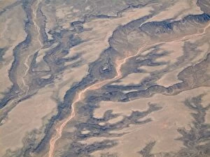
Picture No. 10761750Fissured Ridges - Aerial view Date
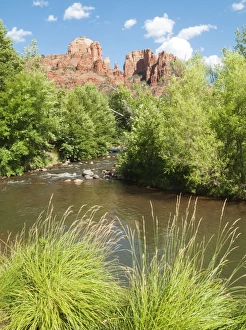
Picture No. 10761758Oak Creek and Cathedral Rock which is the most prominent natural landmark of the Red Rock Country around the town of Sedona and considered a strong vortex point Date
Picture No. 10761759Aardwolf - checks the ground for termites (its main food) underneath the surface (Proteles cristata) Date
Picture No. 10761754Train - the historic diesel engines and trains of the Santa Fe Southern Railway are used for touristic excursions only Date
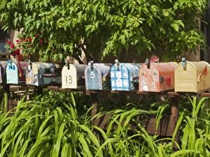
Picture No. 10761756Mailboxes Date
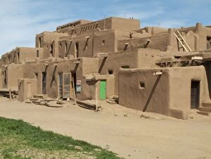
Picture No. 10761757Multy-storey Adobe Complex of the Pueblo Indians in Taos Pueblo at the northern outskirts of the town of Taos Date
Picture No. 10761746Dried-up riverbeds arid desert country - Aerial view Date
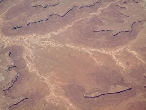
Picture No. 10761748Dried-up riverbeds arid desert country Date
Picture No. 10761752Rocky Mountains foothills - Aerial view Date
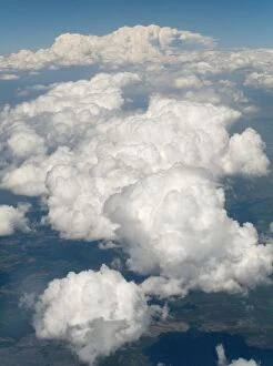
Picture No. 10761751Cloud-covered Rocky Mountains foothills Date
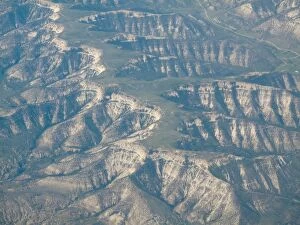
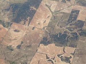
Picture No. 10761749Segmented land - Aerial view Date
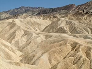
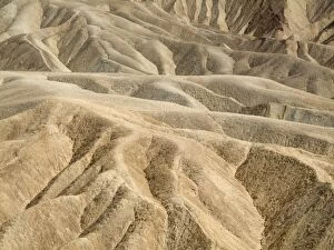
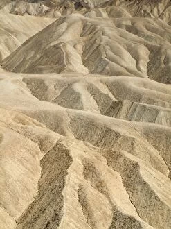
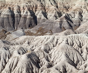
Picture No. 10761743Eroded badlands around Zabriskie Point in the Death Valley Date
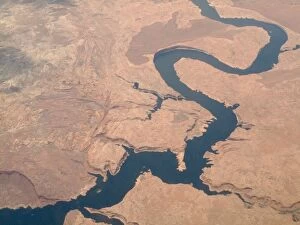
Picture No. 10761747Colorado River - Aerial view Date
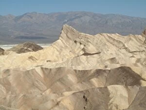
Picture No. 10761745Manley Beacon and the eroded badlands around Zabriskie Point in the Death Valley - in the background one of the whitish salt pans of the Death Valley and the Panamint Range Date
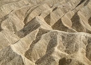
Picture No. 10761742Eroded badlands around Zabriskie Point in the Death Valley Date
Picture No. 10761744Eroded badlands around Zabriskie Point in the Death Valley Date
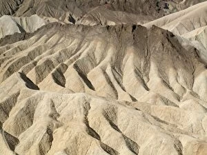
Picture No. 10761740Eroded badlands around Zabriskie Point in the Death Valley Date
Picture No. 10761741Eroded badlands around Zabriskie Point in the Death Valley Date
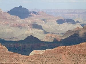
Picture No. 10761736USA - View of the Grand Canyon from Yavapai Point at the South Rim Date
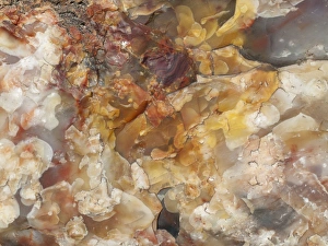
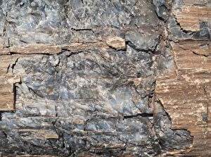
Picture No. 10761733Crystals embedded in the logs of Petrified Wood Date
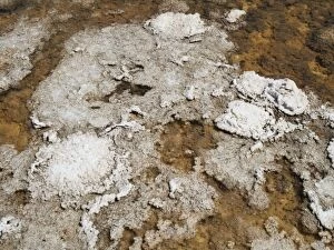
Picture No. 10761739Layers of salt at a shallow pool in the Death Valley at the Badwater Basin salt flats which is the lowest elevation in North America at 86m below sea level Date
Picture No. 10761734Crystals embedded in the logs of Petrified Wood - Crystal Forest Date
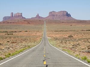
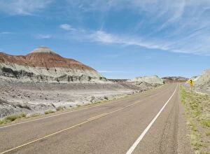
Picture No. 10761738Monument Valley - long straight road (US 163) leading across flat desert towards sandstone buttes and pinnacles of rock Date
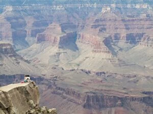
Picture No. 10761737Couple on a rock spur at the South Rim high above the Grand Canyon Date
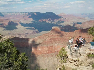
Picture No. 10761735Lookout Platform - Javapai Point at the South Rim high above the Grand Canyon Date
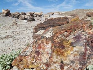
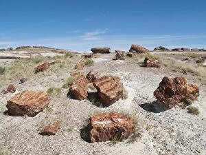
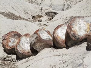
Picture No. 10761727Logs of Petrified Wood - Long Logs Trail at the southern end of the park Date
Picture No. 10761729Logs of Petrified Wood - when breaking into segments millions of years ago the crystal nature of the quartz created clean fractures evenly spaced along the tree trunk giving the appearance today of
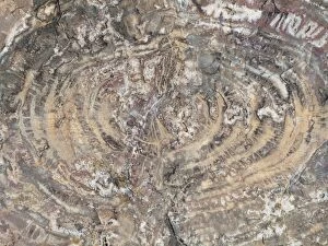
Picture No. 10761732Crystals embedded in the logs of Petrified Wood Date
Picture No. 10761730Logs of Petrified Wood - when breaking into segments millions of years ago the crystal nature of the quartz created clean fractures evenly spaced along the tree trunk giving the appearance today of
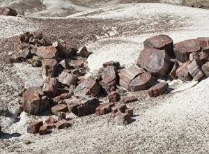
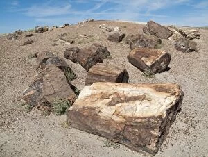
Picture No. 10761728Logs of Petrified Wood at the Crystal Forest Date
Picture No. 10761731Crystals embedded in the logs of Petrified Wood Date
Picture No. 10761722USA - The Tepees (on the left) are cone-shaped formations of differently coloured layers of minerals, mainly iron, carbon and manganese. Date
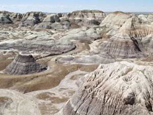
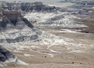
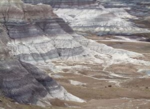
Picture No. 10761725Badland hills of bluish bentonite clay at Blue Mesa Date
Picture No. 10761726Badland hills of bluish bentonite clay at Blue Mesa Date
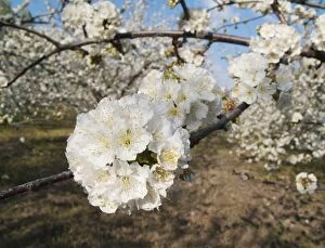
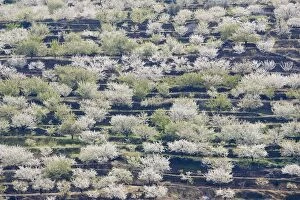
Picture No. 10761719Cherry Tree / Wild Cherry / Sweet Cherry - in full blossom - Valle del Jerte (Prunus avium) Date
Picture No. 10761724Badland hills of bluish bentonite clay at Blue Mesa Date
Picture No. 10761721Cherry Tree / Wild Cherry / Sweet Cherry - in full blossom - Valle del Jerte (Prunus avium) Date
Picture No. 10761723Badland hills of bluish bentonite clay at Blue Mesa Date
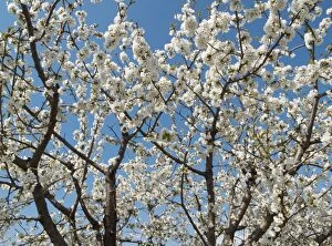
Picture No. 10761720Cherry Tree / Wild Cherry / Sweet Cherry - in full blossom - Valle del Jerte (Prunus avium) Date
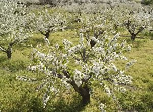
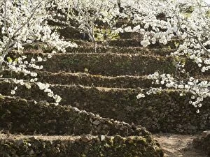
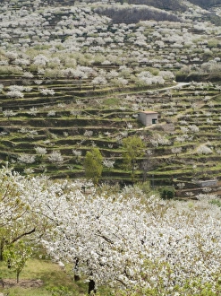
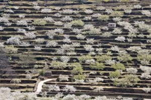
Picture No. 10761717Cherry Tree / Wild Cherry / Sweet Cherry - in full blossom covering the slopes of the Valle del Jerte (Prunus avium) Date
Picture No. 10761714Cherry Tree / Wild Cherry / Sweet Cherry - in full blossom covering the slopes of the Valle del Jerte (Prunus avium) Date
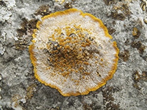
Picture No. 10761709Lichen - Peninsula de Formentor Date
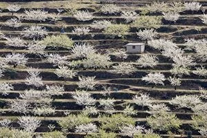
Picture No. 10761716Cherry Tree / Wild Cherry / Sweet Cherry - in full blossom covering the slopes of the Valle del Jerte (Prunus avium) Date
Picture No. 10761718Cherry Tree / Wild Cherry / Sweet Cherry - in full blossom - Valle del Jerte (Prunus avium) Date
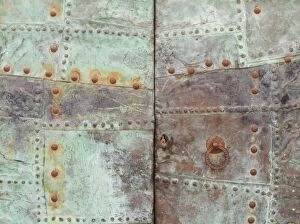
Picture No. 10761712Rusty iron door - Fornalutx Date
Picture No. 10761715Cherry Tree / Wild Cherry / Sweet Cherry - in full blossom covering the slopes of the Valle del Jerte (Prunus avium) Date
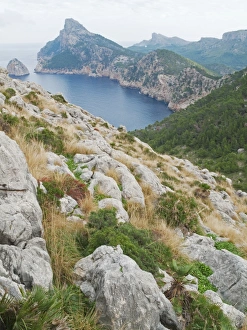
Picture No. 10761708Spain - The Cap de Formentor (in the background on the left) is the northernmost point of the island of Majorca / Mallorca Date
Picture No. 10761713Gate with graffiti - Palma Date