mail_outline sales@mediastorehouse.com
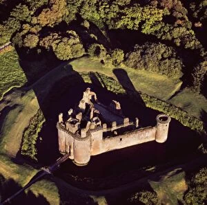
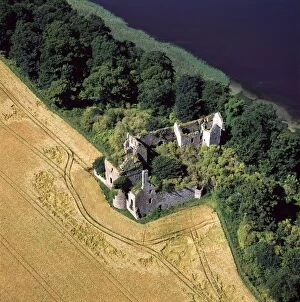
Aerial image of Scotland, UK: Caerlaverock Castle, a 13th-century triangular moated castle in the Caerlaverock NationalAW-6856 Aerial image of Scotland, UK: Caerlaverock Castle a 13th-century triangular moated castle in the Caerlaverock National Nature Reserve area at the Solway Firth, Glencaple
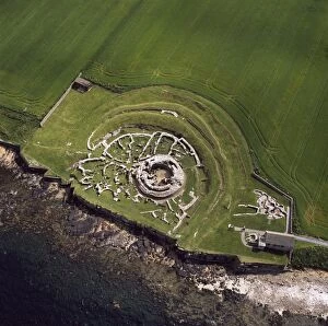
Aerial image of Scotland, UK: The Broch of Gurness, an Iron Age broch with a surrounding settlement on the northwestAW-6854 Aerial image of Scotland, UK: The Broch of Gurness an Iron Age broch with a surrounding settlement on the northwest coast of Mainland Orkney Adrian Warren contact details
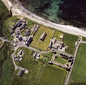
Aerial image of Scotland, UK: Earl's Palace, Birsay, a 16th century ruined castleAW-6850 Aerial image of Scotland, UK: Earl's Palace, Birsay, a 16th century ruined castle north west corner of Mainland Orkney Adrian Warren contact details: prints@ardea.com tel
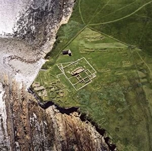
Aerial image of Scotland, UK: Brough of Birsay, a small uninhabited tidal island off the north west coast of MainlandAW-6849 Aerial image of Scotland, UK: Brough of Birsay, a small uninhabited tidal island off the north west coast of Mainland Orkney, north west coast of Orkney Mainland
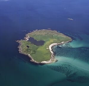
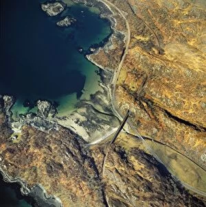
Aerial image of Scotland, UK: Boreray, an island in the Outer Hebrides, lies 2km north of North UistAW-6852 Aerial image of Scotland, UK: Boreray, an island in the Outer Hebrides lies 2km north of North Uist, West Coast Scotland. The island is dominated by Loch Mr ('big loch')
Aerial image of Scotland, UK: Bernera Barracks, Glenelg, HighlandAW-6846 Aerial image of Scotland, UK Bernera Barracks, Glenelg, Highland Adrian Warren contact details: prints@ardea.com tel: +44 (0) 20 8318 1401
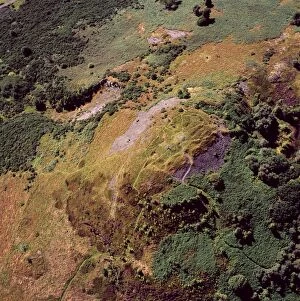
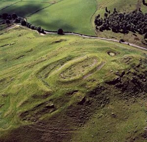
Aerial image of Scotland, UK: Castle Law, an Iron Age hill fort, sits above the confluence of the River TayAW-6829 Aerial image of Scotland, UK: Castle Law, an Iron Age hill fort, sits above the confluence of the River Tay and River Earn Abernethy
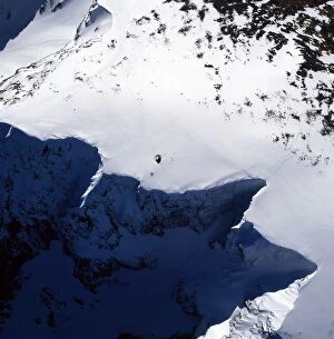
Aerial image of Scotland, UK: Summit of Ben Nevis (Scottish Gaelic: Beinn Nibheis)AW-6845 Aerial image of Scotland, UK: Summit of Ben Nevis (Scottish Gaelic: Beinn Nibheis) the highest mountain in Great Britain
Aerial image of Scotland, UK: Hill of Barra, an Iron Age hill fort withtraces of mediaeval ridgeAW-6839 Aerial image of Scotland, UK: Hill of Barra an Iron Age hill fort with traces of medieval ridge and furrow cultivation
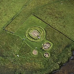
Aerial image of Scotland, UK: The Neolithic Barnhouse Settlement, sited by the shore of Loch of HarrayAW-6838 Aerial image of Scotland, UK: The Neolithic Barnhouse Settlement sited by the shore of Loch of Harray, Orkney Mainland
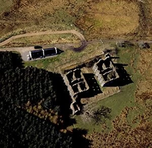
Aerial image of Scotland, UK: Ballinbreich Castle (Chapel Hill, Chapel Of Glenduchie) by the river Tay, FifeAW-6836 Aerial image of Scotland, UK: Ballinbreich Castle (Chapel Hill, Chapel Of Glenduchie) by the river Tay, Fife Adrian Warren contact details: prints@ardea.com tel: +44 (0) 20 8318 1401
Aerial image of Scotland, UK: Ardnambuth beach, Lochailort, Highland, ScotlandAW-6833 Aerial image of Scotland, UK Ardnambuth beach, Lochailort, Highland, Scotland Adrian Warren contact details: prints@ardea.com tel: +44 (0) 20 8318 1401
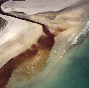
Aerial image of Scotland, UK: Sinclair's Bay, south of Keiss, north-east Caithness, east coast of ScotlandAW-6851 Aerial image of Scotland, UK: Sinclair's Bay south of Keiss, north-east Caithness, east coast of Scotland. Water of the Burn of Lyth flows through Loch of Wester
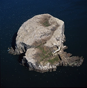
Aerial image of Scotland, UK: Bass Rock (The Bass), Volcanic plug of Phonolite in the Firth of Forth, near AuldhameAW-6841 Aerial image of Scotland, UK: Bass Rock (The Bass) Volcanic plug of Phonolite in the Firth of Forth, near Auldhame, East Lothian
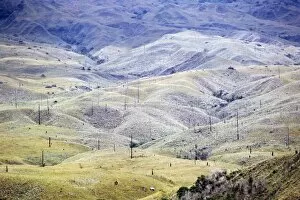
Aerial image of Venezuela, South America: Skeleton forest (damaged from forest fire) on La Gran SabanaAW-6749 Aerial image of Venezuela, South America Skeleton forest (damaged from forest fire) on La Gran Sabana, Canaima National Park