mail_outline sales@mediastorehouse.com
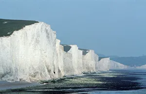
CHALK CLIFFS - Seven Sisters, white cliffs of dover. East SussexDAD-946 CHALK CLIFFS - Seven Sisters, white cliffs of dover. East Sussex UK David C Dixon Please note that prints are for personal display purposes only and may not be reproduced in any way
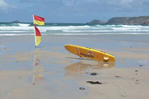
Picture No. 11073692Lifeguards Surfboard and warning flags on beach Sennen Cove, Cornwall, UK
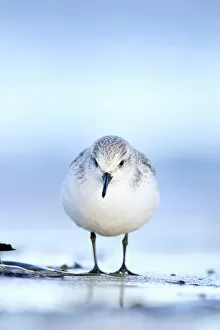
Sanderling Face on portrait from a ground level perspective. South Gare, Cleveland. UKROY-263 Sanderling - Face on portrait from a ground level perspective South Gare, Cleveland. UK calidris alba Roy Glen Please note that prints are for personal display purposes only
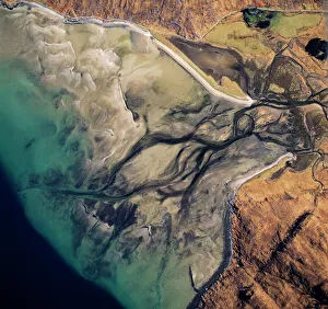
Aerial image of Scotland, UK: Barrisdale Bay, fresh water channels flow out through the sands into the fjord of LochAW-6840 Aerial image of Scotland, UK: Barrisdale Bay fresh water channels flow out through the sands into the fjord of Loch Hourn, the Knoydart Peninsula, near Corran
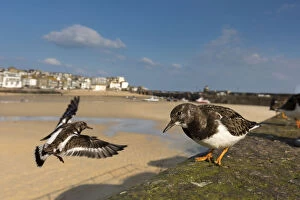
Picture No. 12010262Turnstone - St Ives - Cornwall - UK Date:
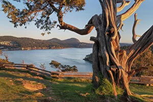
Washington Park Anacortes, Washington State Date: 09-02-2021
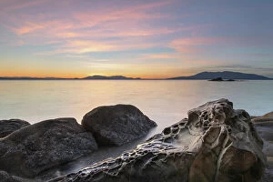
Sunset at Wildcat Cove, looking out to Samish Bay and the San Juan Islands, Larrabee State Park, Washington State Date: 23-12-2020
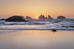
Sunset on Bandon Beach at low tide, Bandon, , Oregon Date: 12-04-2021
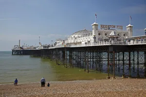
DDE-90182263Brighton Pier (c. 1899), Brighton, East Sussex, England Date: 18-05-2010
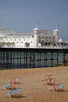
DDE-90182264Brighton Pier (c. 1899), and beach chairs, Brighton, East Sussex, England Date: 18-05-2010
DDE-90038645Falkland Islands, West Falkland, Saunders Island. Coastal sunrise. Date: 29/06/2010
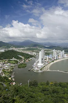
DDE-90038312Brazil, Santa Catarina, Camboriu. Balneario Camboriu Beach. Date: 10/06/2009
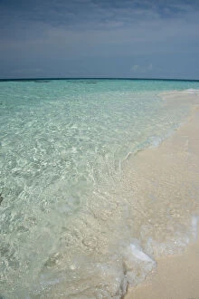
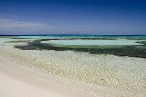
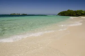
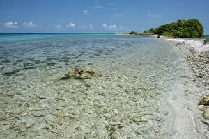
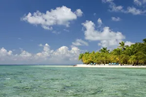
DDE-90038137Belize. Goff Caye, a popular Barrier Reef island just offshore from Belize City. White sand beach with crystal clear water (Large format sizes available). Date: 15/05/2010
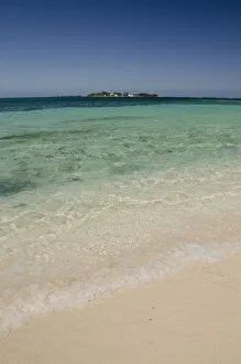
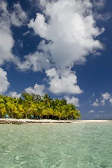
DDE-90038136Belize. Goff Caye, a popular Barrier Reef island just offshore from Belize City. White sand beach with crystal clear water (Large format sizes available). Date: 15/05/2010
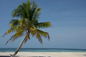
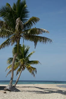
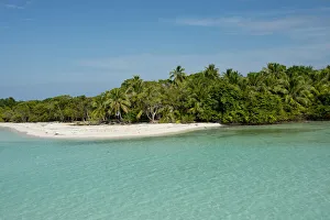
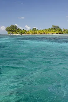
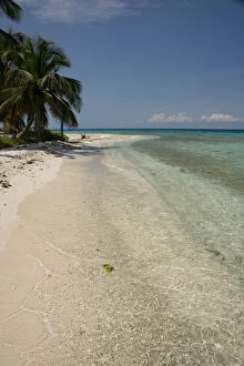
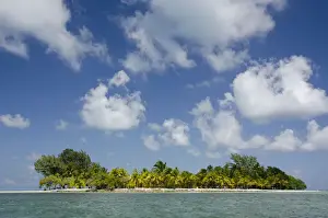
DDE-90038135Belize. Goff Caye, a popular Barrier Reef island just offshore from Belize city. Palm tree and white sand beach (Large format sizes available). Date: 15/05/2010
DDE-90038134Belize. Goff Caye, a popular Barrier Reef island just offshore from Belize city. Palm tree and white sand beach (Large format sizes available). Date: 15/05/2010
DDE-90038133Belize, Wild Orchid Caye (aka Moho Caye). Small private island in the Caribbean Sea. Waterfront beach and reef view. Date: 15/05/2010
DDE-90038132Belize, Wild Orchid Caye (aka Moho Caye). Small private island in the Caribbean Sea along the Barrier Reef. Date: 15/05/2010
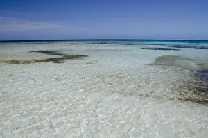
DDE-90038127Belize, Toledo, The Cayes. West Snake Caye located in the Belize Coastal Zone (Large format sizes available). Date: 15/05/2010
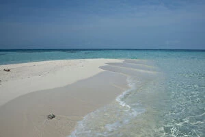
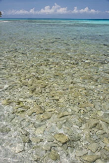
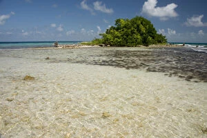
DDE-90038128Belize, Toledo, The Cayes. West Snake Caye located in the Belize Coastal Zone. Clear shallow blue lagoon. Date: 15/05/2010
DDE-90038126Belize, Toledo, Sapodilla Cayes Marine Reserve, Lime Caye. Clear Caribbean Sea beach view of Lime Caye with other outer cayes in the distance. Date: 15/05/2010
DDE-90038125Belize, Toledo, Sapodilla Cayes Marine Reserve, Lime Caye. Clear Caribbean Sea beach view of Lime Caye with other outer cayes in the distance. Date: 15/05/2010
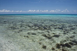
DDE-90038123Belize, Stann Creek District. South Water Caye Marine Reserve, a 12-acre tropical island in the Caribbean Sea. Clear blue ocean view of the island and reef. Date: 15/05/2010
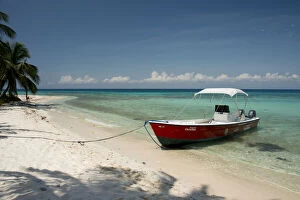
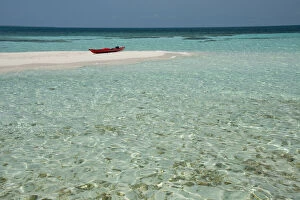
DDE-90038122Belize, Stann Creek District. Laughing Bird Caye National Park. Red boat on beach (Large format sizes available). Date: 15/05/2010
DDE-90038121Belize, Stann Creek District. Laughing Bird Caye National Park. Red boat on beach (Large format sizes available). Date: 15/05/2010
DDE-90038119Belize, Stann Creek District, South Water Caye Marine Reserve (SWCMR). Palm lined island path with shallow lagoon along the Belize Barrier Reef. Date: 15/05/2010
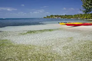
DDE-90038118Belize, Stann Creek District, South Water Caye Marine Reserve (SWCMR). Colorful kayaks in shallow lagoon along the Belize Barrier Reef. Date: 15/05/2010
DDE-90038115Belize, Stann Creek District near Placencia. Laughing Bird Caye National Park located on the Belize Barrier Reef. Shallow coral covered lagoon. (Large format sizes available). Date: 15/05/2010
DDE-90038114Belize, Stann Creek District near Placencia. Laughing Bird Caye National Park located on the Belize Barrier Reef. Shallow coral covered lagoon. (Large format sizes available). Date: 15/05/2010
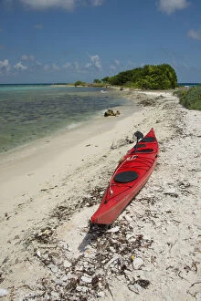
DDE-90038113Belize, Stann Creek District near Placencia. Laughing Bird Caye National Park located on the Belize Barrier Reef. Red kayak on beach (Large format sizes available). Date: 15/05/2010
DDE-90038112Belize, Stann Creek District near Placencia. Laughing Bird Caye National Park located on the Belize Barrier Reef. Outer island, bird nesting site protected sanctuary (Large format sizes available)
DDE-90038111Belize, Stann Creek District near Placencia. Laughing Bird Caye National Park located on the Belize Barrier Reef. Beach view (Large format sizes available). Date: 15/05/2010
DDE-90038110Belize, Stann Creek District near Placencia. Laughing Bird Caye National Park located on the Belize Barrier Reef (Large format sizes available). Date: 15/05/2010
DDE-90038107Belize, Stann Creek District near Placencia. Laughing Bird Caye National Park located on the Belize Barrier Reef (Large format sizes available). Date: 15/05/2010
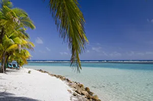
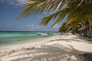
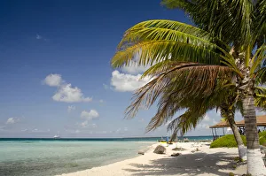
DDE-90038105Belize, Placencia. Sandy beach along the Placencia port area (Large format sizes available). Date: 15/05/2010
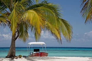
DDE-90038102Belize, Belize. Goff's Caye, popular Barrier Reef island just off shore from Belize city. Red kayak on white sand beach (Large format sizes available). Date: 15/05/2010
DDE-90038092Belize, Caribbean Sea, Goff Caye. A small island off the shore of Belize City, Belize along the Barrier Reef. UNESCO. Date: 30/04/2009
DDE-90038091Belize, Stann Creek, Southwater Cay. White sand beach in the Caribbean Sea off the coast of Southwater Cay. UNESCO. Date: 30/04/2009
DDE-90038090Belize, Stann Creek, Southwater Cay. Caribbean Sea view of the island of Southwater Cay. UNESCO. Date: 30/04/2009
DDE-90038089Belize, Stann Creek, Southwater Cay. Clear water Caribbean Sea view of the coastline off Southwater Cay. UNESCO. Date: 30/04/2009
DDE-90037973Argentina, Aguas Verdes, seaside resort town. Date: 15/04/2010
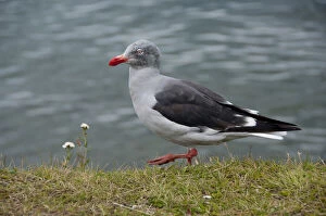
DDE-90037813Argentina, Ushuaia. Immature Dolphin gull (wild: Leucophaeus scoresbii) aka localy Red-billed gull. Date: 28/06/2006
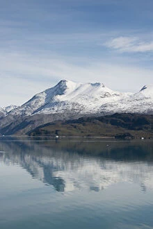
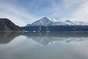
DDE-90036610Greenland, Tunulliarfik, near Brattahlid. Scenic fjord with icebergs and fresh Fall snow on mountain tops. (Large format sizes available) Date: 17/02/2010
DDE-90036609Greenland, Tunulliarfik, near Qassiarsuk. Brattahlid, the historic location of Erik the Red's Eastern Settlement Viking. (Large format sizes available) Date: 17/02/2010
DDE-90036608Greenland, Tunulliarfik, near Brattahlid. Scenic fjord with icebergs and fresh Fall snow on mountain tops. (Large format sizes available) Date: 17/02/2010
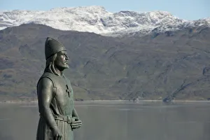
DDE-90036607Greenland, Tunulliarfik, Qassiarsuk. Home to historic Brattahlid, Erik the Red's Eastern Settlement. Leif Erikson statue. (Large format sizes available) Date: 17/02/2010
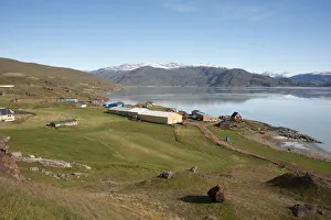
DDE-90036606Greenland, Tunulliarfik, Overview of Qassiarsuk and Brattahlid, Erik the Red's Eastern Settlement Viking colony. Farm fields. (Large format sizes available) Date: 17/02/2010
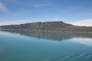
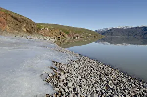
DDE-90036600Greenland, Tunulliarfik, Qassiarsuk and Brattahlid. Rocky coastline of Erik's Fjord with fresh ice and early morning reflections. Date: 17/02/2010