mail_outline sales@mediastorehouse.com
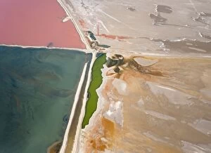
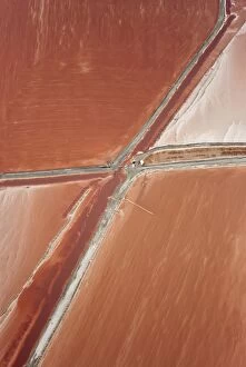
Picture No. 10761247Namibia - Aerial view of saline water at the salt works of Walvis Bay between Namib Desert and Atlantic Ocean Date:
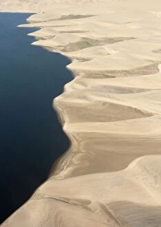
Picture No. 10761276Aerial view - Namib Desert and Atlantic Ocean south of Walvis Bay. Date:
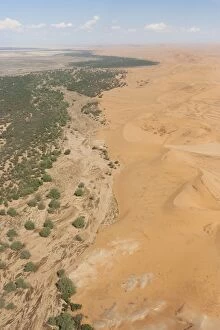
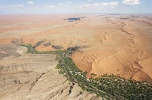
Picture No. 10761271Aerial view of the dry bed of the Kuiseb river with its green belt at the edge of the Namib Desert Date:
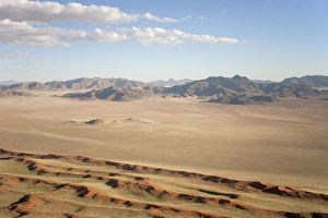
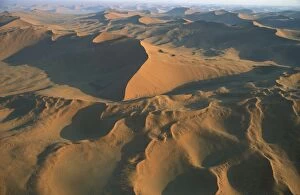
Picture No. 10761290Aerial view of sand dunes and isolated mountain ridges at the edge of the Namib Desert. Date:
Picture No. 10761248Namibia - Aerial view of saline water at the salt works of Walvis Bay between Namib Desert and Atlantic Ocean Date:
Picture No. 10761272Aerial view of the flooding Kuiseb river and its green belt at the edge of the Namib Desert. Date:
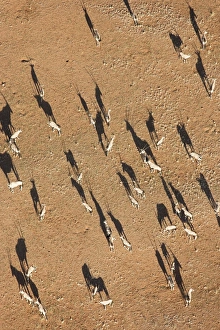
Picture No. 10761185Gemsbok - on a sandy plain at the edge of the Namib Desert. Aerial view from a hot-air balloon (Oryx gazella) Date:
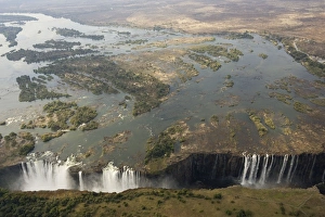
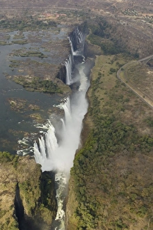
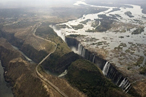
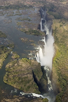
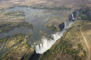
Picture No. 10761081Zimbabwe / Zambia - Aerial view of the Zambezi River and the Victoria Falls (all together 1700m wide). Date:
Picture No. 10761084Zimbabwe / Zambia - Aerial view of the Zambezi River and the Victoria Falls (1700m wide). Date:
Picture No. 10761082Zimbabwe / Zambia - Aerial view of the Zambezi River and the Victoria Falls (1700m wide) Date:
Picture No. 10761085Zimbabwe / Zambia - Aerial view of the Zambezi River and the Victoria Falls (1700m wide). Date:
Picture No. 10761080Zimbabwe / Zambia - Aerial view of the Zambezi River and the Victoria Falls (1700m wide). Date:
Picture No. 10760722Namibia - Sand dunes in the Namib Desert; aerial view Date:
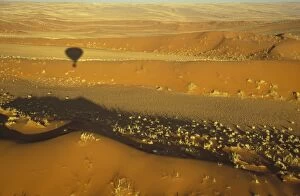
Picture No. 10760643Balloon Safari, Namibia - The shadow of the hot-air balloon and sand dunes grown with bushman grass (Stipagrostis sp.) Date:
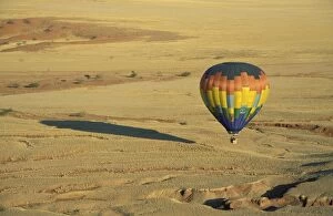
Picture No. 10760640Balloon Safari, Namibia - The hot-air balloon above eroded landscape at the edge of the Namib Desert. Date:
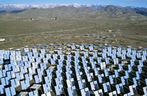
Picture No. 10760604SOLAR Energy plant - in the Tabernas desert Date:
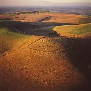
Picture No. 10741338Mount Caburn with the remains of an Iron Age hill fort, east of Lewes, East Sussex Date:
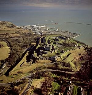
Picture No. 10741342Dover Castle, Dover Harbour, Kent Date:
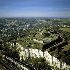
Picture No. 10741343Dover Castle over the white cliff of Dover, Kent ( ) Date:
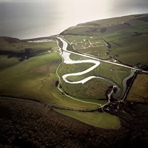
Picture No. 10741339Cuckmere river, Seven Sisters, East Sussex Date:
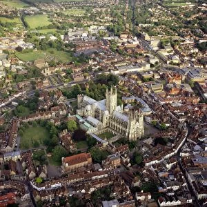
Picture No. 10741341Canterbury City and Cathedral (cathedral of the Archbishop of Canterbury, leader of the Church of England and symbolic leader of the worldwide Anglican Communion), Kent Date:
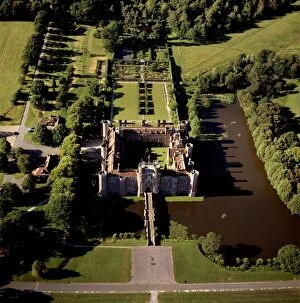
Picture No. 10741337Herstmonceux Castle, a brick-built Tudor castle near Herstmonceux, East Sussex Date:
Picture No. 10741334Battle Abbey (St. Martin's Abbey), built on the scene of the Battle of Hastings and dedicated to St. Martin, Battle, East Sussex Date:
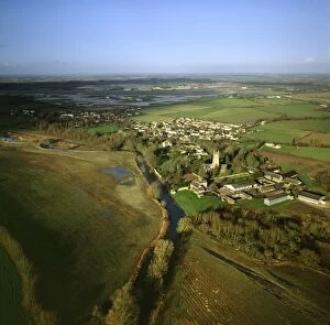
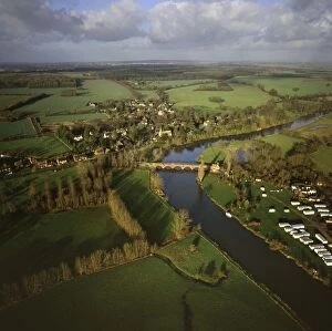
Picture No. 10741333England - Aerial view, Kempsford and River Thames, Gloucestershire Date:
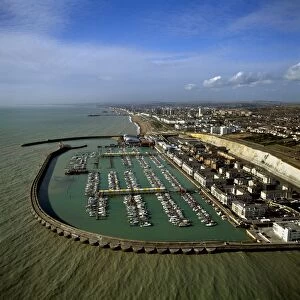
Picture No. 10741336Brighton Marina, Est Sussex, East Sussex Date:
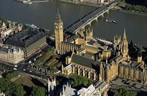
Picture No. 10741331Houses of Parliament (the Palace of Westminster), Big Ben, Westminster Date:
Picture No. 10741330England - Aerial view, Chalk Quarry with Westbury White Horse in background Date:
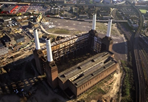
Picture No. 10741332Battersea Power Station, an unused coal-fired power station on the south bank of the River Thames, Battersea Date:
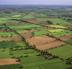
Picture No. 10741326England - Aerial view, Field system near Helperby, North Yorkshire Date:
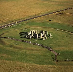
Picture No. 10741328England - Aerial view of Stonehenge, with the main road shown in the background. Wiltshire. Date:
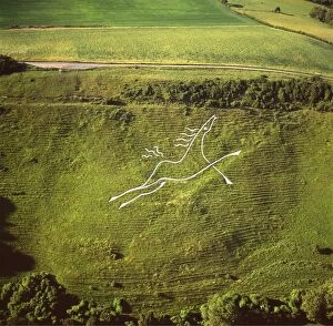
Picture No. 10741324England - Aerial view, Folkestone White Horse, Kent Date:
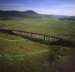
Picture No. 10741325England - Aerial view, Ribblehead Railway Viaduct, Ingleborough in background, Yorkshire Dales, Yorkshire Date:
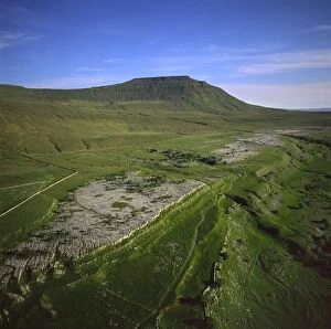
Picture No. 10741323England - Aerial view, Ingleborough Peak, Yorkshire Dales, Yorkshire Date:
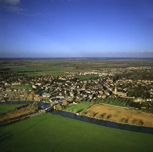
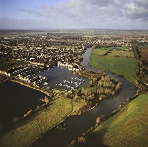
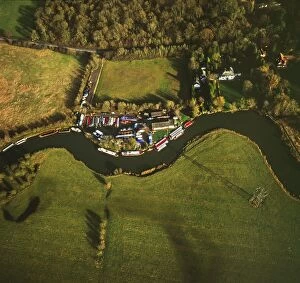
Picture No. 10741322England - Aerial view, Lechlade and River Thames, Gloucestershire Date:
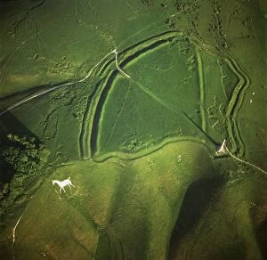
Picture No. 10741321England - Aerial view, Oldbury White Horse (or Cherhill White Horse) and Oldbury Camp, Wiltshire. Date:
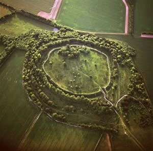
Picture No. 10741318England - Aerial view, Danebury Ring, Middle Wallop, Wiltshire Date:
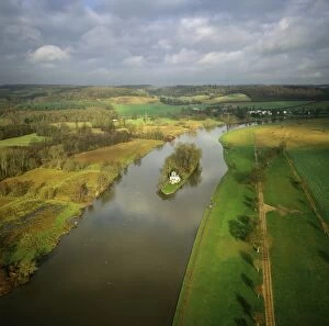
Picture No. 10741313England - Aerial view, River Thames at Abingdon, Oxfordshire Date:
Picture No. 10741317England - Aerial view, Temple Island, 1.5 mile downstream from Henley-on-Thames, Oxfordshire Date:
Picture No. 10741312England - Aerial view, River Thames downstream from Farmoor Reservoir, Oxfordshire Date:
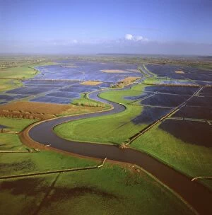
Picture No. 10741316England - Aerial view of the River Tone in flood. Part of the Somerset Levels. Date:
Picture No. 10741315England - Aerial view, River Thames at Clifton Hampden, Oxfordshire Date:
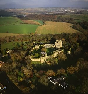
Picture No. 10741309England - Aerial view, Saltwood Castle, Kent Date:
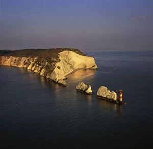
Picture No. 10741311England - Aerial view, The Needles, Isle of Wight, UK Date:
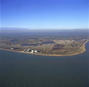
Picture No. 10741308England - Aerial view of Dungeness Power Station and shingle coastline. Kent Date:
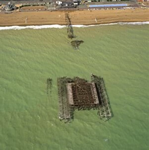
Picture No. 10741305England - Aerial view, Brighton West Pier - having been damaged by a fire, East Sussex Date:
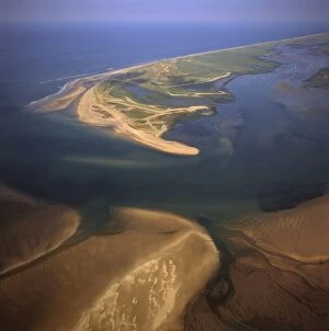
Picture No. 10741310England - Aerial view, Blakeney Point, Norfolk. Date:
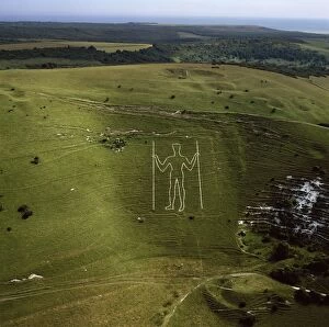
Picture No. 10741244Long Man of Wilmington, East Sussex, England Date:
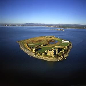
Picture No. 10741197England - Aerial view, Piel Castle Date: