mail_outline sales@mediastorehouse.com
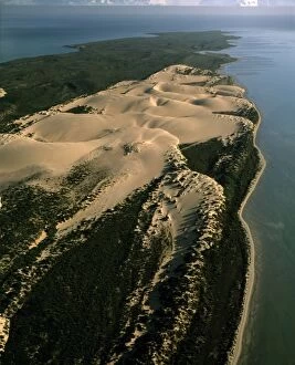
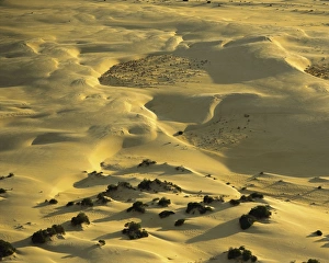
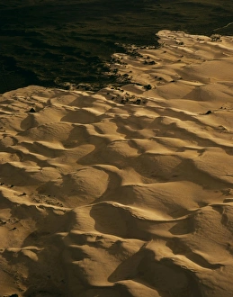
Aerial - Bellefin Prong sand dunes, Shark Bay Marine Park, Western Australia JPF44917JPF-13682 Aerial - Bellefin Prong sand dunes Shark Bay Marine Park, Western Australia Jean-Paul Ferrero Please note that prints are for personal display purposes only
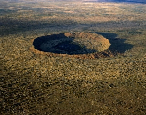
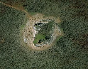
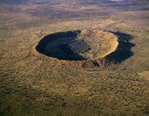
Wolfe Creek Crater - Wolfe Creek Crater National Park, Kimberley region, Western Australia JPF43544JPF-13605 Wolfe Creek Crater - Wolfe Creek Crater National Park Kimberley region, Western Australia Jean-Paul Ferrero Please note that prints are for personal display purposes only
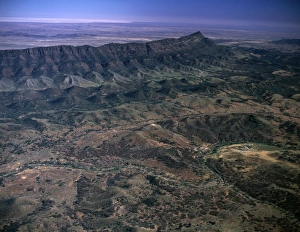
South of Brachina Gorge Flinders Ranges National Park, South Australia JPF42895JPF-13584 South of Brachina Gorge Flinders Ranges National Park, South Australia Jean-Paul Ferrero Please note that prints are for personal display purposes only and may not be reproduced in anyway
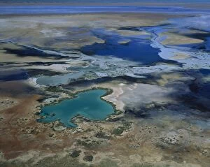
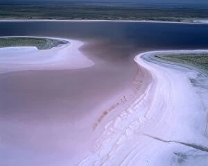
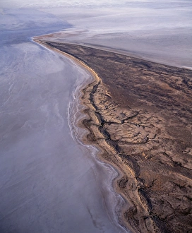
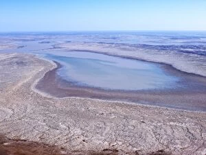
Lake MacLeod salt lake mineral-laden artesian water surfacing on lake's edge. Aerial. Western Australia JPF44357JPF-13627 Lake MacLeod salt lake mineral-laden artesian water surfacing on lakes edge Aerial. Western Australia Jean-Paul Ferrero Please note that prints are for personal display purposes only
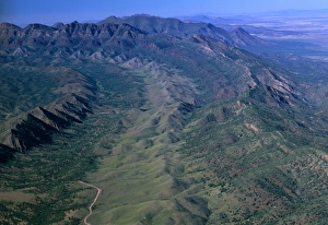
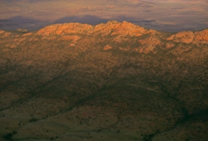
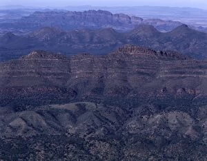
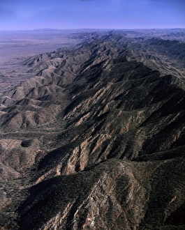
Aerial - South Flinders Ranges South Australia JPF42982JPF-13583 Aerial - South Flinders Ranges South Australia Jean-Paul Ferrero Please note that prints are for personal display purposes only and may not be reproduced in anyway
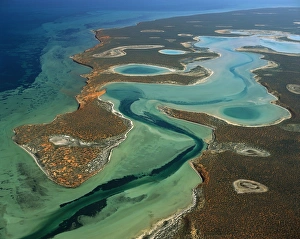
Big Lagoon Aerial from 2000 feet. Francois Peron National Park, Shark Bay, Western Australia JPF43555JPF-13602 Big Lagoon Aerial from 2000 feet. Francois Peron National Park, Shark Bay, Western Australia Jean-Paul Ferrero Please note that prints are for personal display purposes only
Aerial: ‘The Pinnacles Nambung National Park, Western Australia JPF43790JPF-13619 Aerial: The Pinnacles Nambung National Park, Western Australia Jean-Paul Ferrero Please note that prints are for personal display purposes only and may not be reproduced in anyway
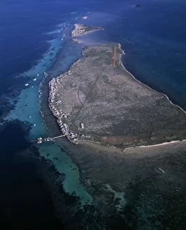
Aerial - Easter Group (Rat & Little Islands) with lobster fishermen's houses, Houtman Abrolhos IslandsJPF-13670 Aerial - Easter Group (Rat & Little Islands) with lobster fishermens houses Houtman Abrolhos Islands, Western Australia Jean-Paul Ferrero Please note that prints are for personal display
Aerial - Lake Eyre National Park (south) South Australia JPF44343JPF-13631 Aerial - Lake Eyre National Park (south) South Australia Jean-Paul Ferrero Please note that prints are for personal display purposes only and may not be reproduced in anyway
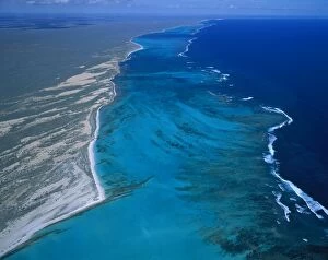
Ningaloo Reef aerial, Ningaloo Marine Park, Western Australia JPF44352JPF-13629 Ningaloo Reef aerial Ningaloo Marine Park, Western Australia Jean-Paul Ferrero Please note that prints are for personal display purposes only and may not be reproduced in anyway
Aerial - Madura Cave - a sinkhole Nullarbor Plain, Western Australia JPF44465JPF-13637 Aerial - Madura Cave a sinkhole Nullarbor Plain, Western Australia Jean-Paul Ferrero Please note that prints are for personal display purposes only and may not be reproduced in anyway
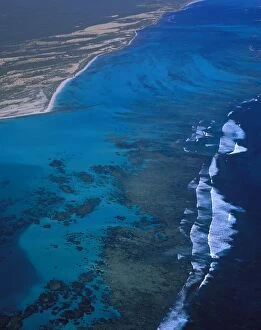
Aerial: Ningaloo Reef Ningaloo Marine Park, Western Australia JPF44353JPF-13628 Aerial: Ningaloo Reef Ningaloo Marine Park Western Australia Jean-Paul Ferrero Please note that prints are for personal display purposes only and may not be reproduced in anyway
Aerail - Tanami Desert - Northern Territory - Australia JPF45096JPF-13675 Aerial - Tanami Desert Northern Territory - Australia Jean-Paul Ferrero Please note that prints are for personal display purposes only and may not be reproduced in anyway
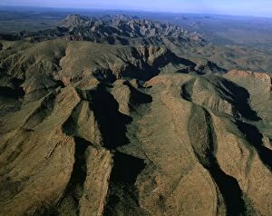
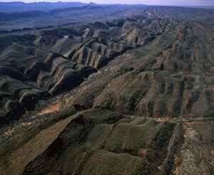
Aerial - Brinkley Bluff area West MacDonnell National Park, Northern Territory, Australia JPF44756JPF-13662 Aerial - Brinkley Bluff area West MacDonnell National Park Northern Territory, Australia Jean-Paul Ferrero Please note that prints are for personal display purposes only
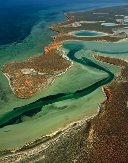
Big Lagoon, Shark Bay Western Australia JPF43573JPF-13601 Big Lagoon, Shark Bay Western Australia Jean-Paul Ferrero Please note that prints are for personal display purposes only and may not be reproduced in anyway
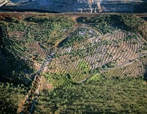
Aerial - Resurfacing and replanting former open-cut iron mine aerial, Koolan Island, Western Australia JPF45635JPF-13687 Aerial - Resurfacing and replanting former open-cut iron mine aerial Koolan Island, Western Australia Jean-Paul Ferrero Please note that prints are for personal display purposes only
Aerial: sand dunes Nambung National Park, Western Australia JPF43782JPF-13620 Aerial: sand dunes Nambung National Park Western Australia Jean-Paul Ferrero Please note that prints are for personal display purposes only and may not be reproduced in anyway
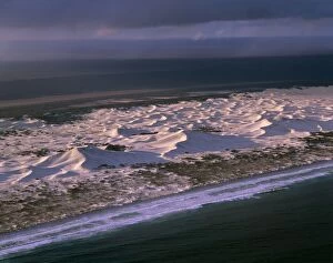
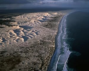
Coastal dunes Nuytsland Nature Reserve, Western Australia JPF45648JPF-13684 Coastal dunes Nuytsland Nature Reserve Western Australia Jean-Paul Ferrero Please note that prints are for personal display purposes only and may not be reproduced in anyway
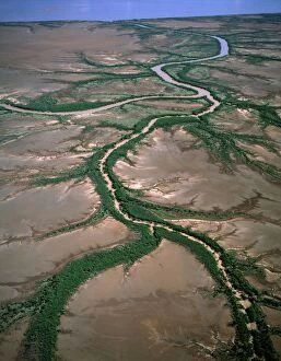
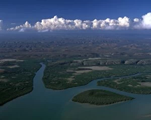
Aerial - King Sound near Derby: tidal flats, mangrove-lined river and dendritic drainage Kimberley regionJPF-13677 Aerial - King Sound near Derby: tidal flats, mangrove-lined river and dendritic drainage Kimberley region Western Australia Jean-Paul Ferrero Please note that prints are for personal
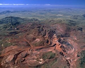
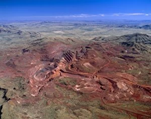
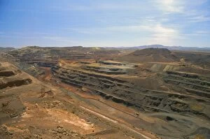
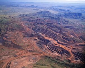
Aerial - Tom Price iron ore-open cut mine Hamersley Range, Pilbara Region, Western Australia JPF45003JPF-13679 Aerial - Tom Price iron ore-open cut mine Hamersley Range Pilbara Region, Western Australia Jean-Paul Ferrero Please note that prints are for personal display purposes only
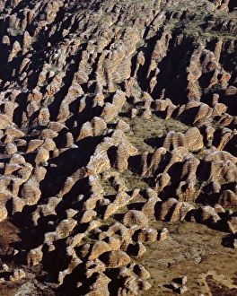
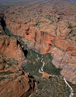
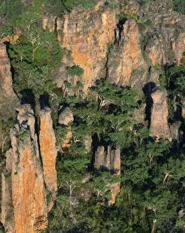
Aerial: Bungle Bungle Range Purnululu National Park, Kimberley region, Western Australia JPF43703JPF-13621 Aerial: Bungle Bungle Range Purnululu National Park Kimberley region, Western Australia Jean-Paul Ferrero Please note that prints are for personal display purposes only
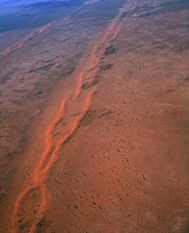
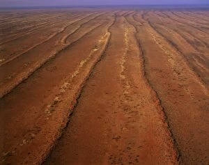
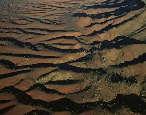
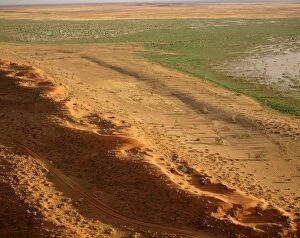
Aerial - Desert - parallel longitudinal sand dunes and sandy interdune corridors, north west Simpson DesertJPF-13678 Aerial - Desert - parallel longitudinal sand dunes and sandy interdune corridors north west Simpson Desert, Northern Territory
Aerial - North Flinders Ranges, aerial South Australia JPF43064JPF-13580 Aerial - North Flinders Ranges aerial South Australia Jean-Paul Ferrero Please note that prints are for personal display purposes only and may not be reproduced in anyway
Aerial - Coastal dunes between Wylie Scarp & Southern ocean (Great Australian Bight) Nuytsland Nature ReserveJPF-13685 Aerial - Coastal dunes between Wylie Scarp & Southern ocean (Great Australian Bight) Nuytsland Nature Reserve, Western Australia Jean-Paul Ferrero Please note that prints are for personal
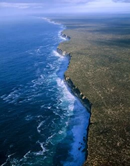
Aerial - Baxter Cliffs at edge of Nullarbor Plain Nuytsland Nature Reserve, Great Australian BightJPF-13633 Aerial - Baxter Cliffs at edge of Nullarbor Plain Nuytsland Nature Reserve, Great Australian Bight, Western Australia Jean-Paul Ferrero Please note that prints are for personal display
Aerial - King Sound: mangrove-lined river & hills Kimberley region, Western Australia JPF44711JPF-13666 Aerial - King Sound: mangrove-lined river & hills Kimberley region, Western Australia Jean-Paul Ferrero Please note that prints are for personal display purposes only
Wolfe Creek meteor crater, aerial Wolfe Creek Crater National Park, Kimberley region, Western Australia JPF43550JPF-13603 Wolfe Creek meteor crater, aerial Wolfe Creek Crater National Park, Kimberley region, Western Australia Jean-Paul Ferrero Please note that prints are for personal display purposes only
Aerial - Tom Price open-cut iron ore mine Hamersley Range, Pilbara Region, Western Australia JPF44455JPF-13638 Aerial - Tom Price open-cut iron ore mine Hamersley Range Pilbara Region, Western Australia Jean-Paul Ferrero Please note that prints are for personal display purposes only
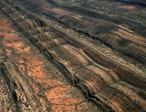
Aerial - Folded mountains near Glen Helen & Finke Gorge West MacDonnell National Park, Northern TerritoryJPF-13665 Aerial - Folded mountains near Glen Helen & Finke Gorge West MacDonnell National Park, Northern Territory, Australia Jean-Paul Ferrero Please note that prints are for personal display
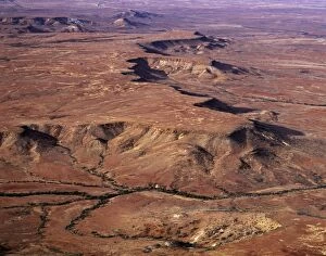
Aerial: MacDonnell ranges near Finke Gorge, Northern Territory, Australia JPF43849JPF-13614 Aerial: MacDonnell ranges near Finke Gorge Northern Territory, Australia Jean-Paul Ferrero Please note that prints are for personal display purposes only
Aerial: south-western side of Hamersley Range the Pilbara seabed rose to form one of Earth's first permanent landJPF-13630 Aerial: south-western side of Hamersley Range Pilbara region, Western Australia the Pilbara seabed rose to form one of Earths first permanent land masses about 3.5 billion years ago
Aerial - Simpson Desert near Dalhousie homestead, Witjira National Park, northeastern South Australia JPF45567JPF-13689 Aerial - Simpson Desert near Dalhousie homestead Witjira National Park, northeastern South Australia Jean-Paul Ferrero Please note that prints are for personal display purposes only
Bungle Bungle Range Purnululu National Park, Kimberley region, Western Australia JPF43641JPF-13599 Bungle Bungle Range Purnululu National Park Kimberley region, Western Australia Jean-Paul Ferrero Please note that prints are for personal display purposes only
Lake Eyre north Elliott Price Conservation Park, Sth Australia JPF41355JPF-13563 Lake Eyre north Elliott Price Conservation Park Sth Australia Jean-Paul Ferrero Please note that prints are for personal display purposes only and may not be reproduced in anyway
North of Brachina Gorge Flinders Ranges National Park, South Australia JPF41751JPF-13557 North of Brachina Gorge Flinders Ranges National Park, South Australia Jean-Paul Ferrero Please note that prints are for personal display purposes only and may not be reproduced in anyway
Southern Flinders Ranges Aerial South Australia JPF41777JPF-13556 Southern Flinders Ranges Aerial South Australia Jean-Paul Ferrero Please note that prints are for personal display purposes only and may not be reproduced in anyway
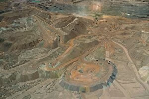
Mount Newman open-cut iron mine Pilbara region, Western Australia JPF34564JPF-13410 Mount Newman open-cut iron mine Pilbara region Western Australia Jean-Paul Ferrero Please note that prints are for personal display purposes only and may not be reproduced in anyway
Mt Newman iron mine on Mt Whaleback open cut mine, Pilbara region, Western australia JPF34573JPF-13409 Mt Newman iron mine on Mt Whaleback open cut mine Pilbara region, Western australia Jean-Paul Ferrero Please note that prints are for personal display purposes only
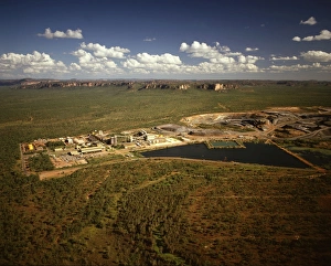
Ranger uranium mine Kakadu National Park (World Heritage Area), Northern Territory, Australia JPF28948JPF-13203 Ranger uranium mine Kakadu National Park (World Heritage Area) Northern Territory, Australia Jean-Paul Ferrero Please note that prints are for personal display purposes only
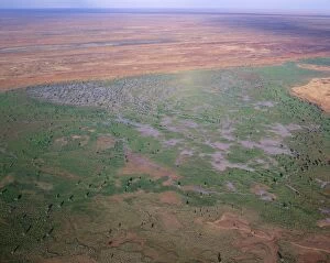
Seasonal swamp by Old Andado station Simpson Desert, Northern Territory, Australia, May JPF52958JPF-12963 Seasonal swamp by Old Andado station Simpson Desert, Northern Territory, Australia, May Jean-Paul Ferrero Please note that prints are for personal display purposes only
Great Victoria Desert - Australia's most vegetated desert, South Australia JPF47893JPF-12962 Great Victoria Desert Australias most vegetated desert, South Australia Jean-Paul Ferrero Please note that prints are for personal display purposes only and may not be reproduced in anyway
Red longitudinal sand dunes Strzelecki Desert, South Australia JPF41295JPF-12959 Red longitudinal sand dunes Strzelecki Desert, South Australia Jean-Paul Ferrero Please note that prints are for personal display purposes only and may not be reproduced in anyway
Sand Dunes - aerial Lake Eyre National Park, South Australia JPF41304JPF-12918 Sand Dunes - aerial Lake Eyre National Park, South Australia Jean-Paul Ferrero Please note that prints are for personal display purposes only and may not be reproduced in anyway
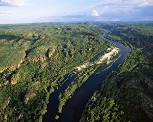
Australia East Alligator River cutting through Sandstone of the Arhem Land PlateauJPF-12426 Australia - Northern Territory - Kakadu National Park East Alligator River River cutting through Sandstone of the Arhem Land Plateau Jean Paul Ferrero Please note that prints are for
Australia - seasonal swamp by Old Andado station, Simpson Desert, Northern TerritoryJPF-11723 Australia - seasonal swamp by Old Andado station Simpson Desert, Northern Territory. Jean Paul Ferrero Please note that prints are for personal display purposes only
Flood water flow into the Warbuton Groove-top of Lake Eyre. - Lake Eyre north South AustraliaJLR-97 Flood water flow into the Warbuton Groove - top of Lake Eyre Lake Eyre north South Australia. 2009 flood Lake Eyre is an extensive salt sink
Australia - sandstone kombolgie formation (early Proterozoic 1700 Ma) Mt Brockman area 9detached part of the ArnhemJPF-12429 Australia - sandstone kombolgie formation (early Proterozoic 1700 Ma) Mt Brockman area 9 detached part of the Arnhem Land Plateau / Escarpment) Kakadu National Park
Australia - mining iron ore-open cut mine. Pilbara region, Hamersley RangeJPF-11728 Australia - mining iron ore-open cut mine. Pilbara region, Hamersley Range Jean Paul Ferrero Please note that prints are for personal display purposes only