mail_outline sales@mediastorehouse.com
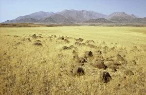
Picture No. 10761810Namibia - basaltic rocks and Bushman grass (Stipagrostis sp) Date:
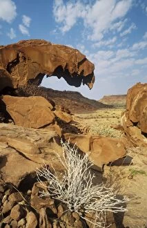
Picture No. 10761813Namibia - sandstone rock formations at Twyfelfontein in the Damaraland west of the town of Khorixas Date:
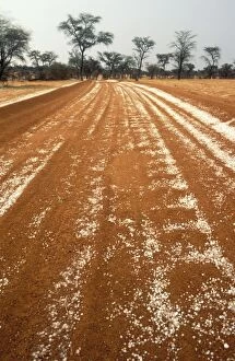
Picture No. 10761816Namibia - hailstones on a road in the Kalahari Desert with Camelthorn Trees (Acacia erioloba) in the background Date:
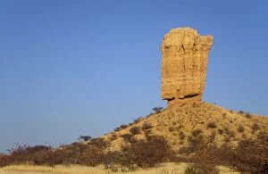
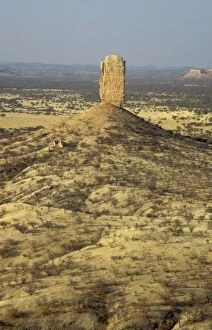
Picture No. 10761812Namibia - the Vingerklip (Rock Finger) in the Damaraland east of Khorixas is surrounded by Mopane (Colophospermum mopane) and thornbush savanna Date:
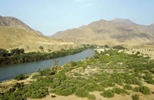
Picture No. 10761808Namibia - Kunene River (border river between Namibia and Angola) at the Marienfluss Valley in the Kaokoveld Date:
Picture No. 10761815Namibia - so-called petrified dunes (they are not really petrified but solidified) at the edge of the Namib Desert Date:
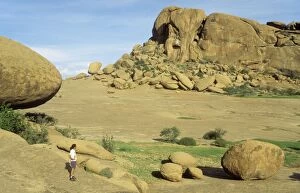
Picture No. 10761814Namibia - Bull's Party and Elephant's Head are granite rock formations on the land of the Ameib Ranch in the Erongo mountains Date:
Picture No. 10761811Namibia - the Vingerklip (Rock Finger) in the Damaraland east of Khorixas is surrounded by Mopane (Colophospermum mopane) and thornbush savanna Date:
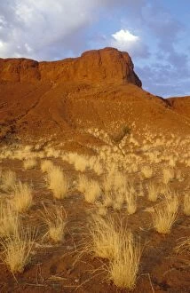
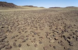
Picture No. 10761809Namibia - basaltic rocks in the Damaraland north of the Uniab River Date:
Picture No. 10761755Anti-war slogans - on rear of a car as it was seen in Santa Fe Date:
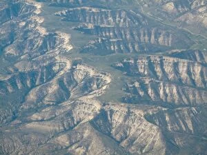
Picture No. 10761750Fissured Ridges - Aerial view Date:
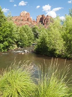
Picture No. 10761758Oak Creek and Cathedral Rock which is the most prominent natural landmark of the Red Rock Country around the town of Sedona and considered a strong vortex point Date:
Picture No. 10761756Mailboxes Date:
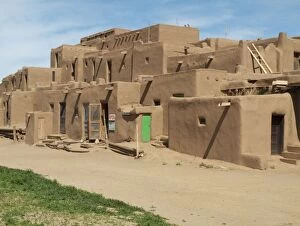
Picture No. 10761757Multy-storey Adobe Complex of the Pueblo Indians in Taos Pueblo at the northern outskirts of the town of Taos Date:
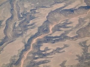
Picture No. 10761746Dried-up riverbeds arid desert country - Aerial view Date:
Picture No. 10761748Dried-up riverbeds arid desert country Date:
Picture No. 10761752Rocky Mountains foothills - Aerial view Date:
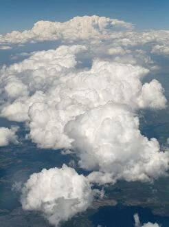
Picture No. 10761751Cloud-covered Rocky Mountains foothills Date:
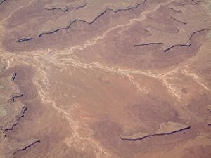
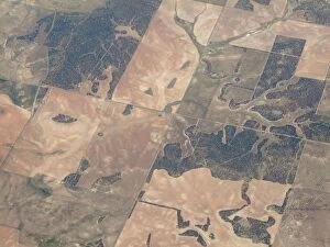
Picture No. 10761749Segmented land - Aerial view Date:
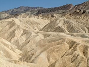
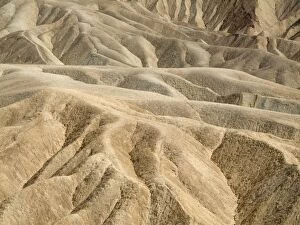
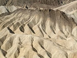
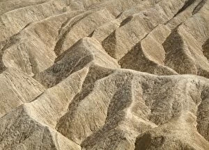
Picture No. 10761743Eroded badlands around Zabriskie Point in the Death Valley Date:
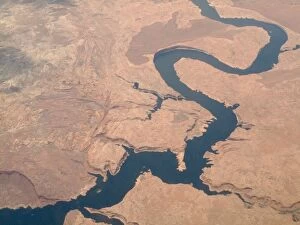
Picture No. 10761747Colorado River - Aerial view Date:
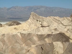
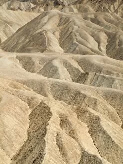
Picture No. 10761745Manley Beacon and the eroded badlands around Zabriskie Point in the Death Valley - in the background one of the whitish salt pans of the Death Valley and the Panamint Range Date:
Picture No. 10761742Eroded badlands around Zabriskie Point in the Death Valley Date:
Picture No. 10761744Eroded badlands around Zabriskie Point in the Death Valley Date:
Picture No. 10761740Eroded badlands around Zabriskie Point in the Death Valley Date:
Picture No. 10761741Eroded badlands around Zabriskie Point in the Death Valley Date:
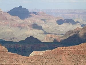
Picture No. 10761736USA - View of the Grand Canyon from Yavapai Point at the South Rim Date:
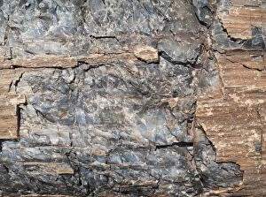
Picture No. 10761733Crystals embedded in the logs of Petrified Wood Date:
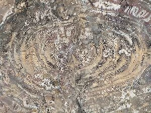
Picture No. 10761734Crystals embedded in the logs of Petrified Wood - Crystal Forest Date:
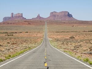
Picture No. 10761738Monument Valley - long straight road (US 163) leading across flat desert towards sandstone buttes and pinnacles of rock Date:
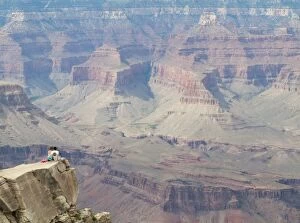
Picture No. 10761737Couple on a rock spur at the South Rim high above the Grand Canyon Date:
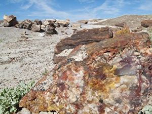
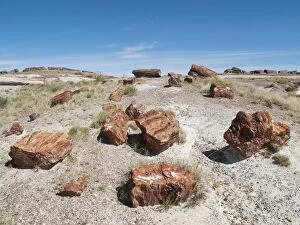
Picture No. 10761727Logs of Petrified Wood - Long Logs Trail at the southern end of the park Date:
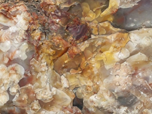
Picture No. 10761732Crystals embedded in the logs of Petrified Wood Date:
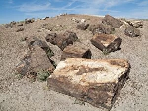
Picture No. 10761728Logs of Petrified Wood at the Crystal Forest Date:
Picture No. 10761731Crystals embedded in the logs of Petrified Wood Date:
Picture No. 10761722USA - The Tepees (on the left) are cone-shaped formations of differently coloured layers of minerals, mainly iron, carbon and manganese. Date:
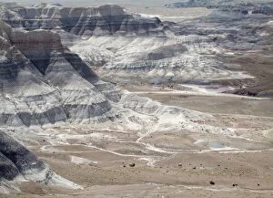
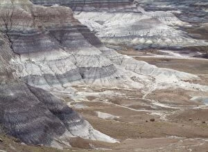
Picture No. 10761725Badland hills of bluish bentonite clay at Blue Mesa Date:
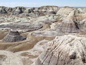
Picture No. 10761726Badland hills of bluish bentonite clay at Blue Mesa Date:
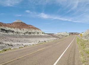
Picture No. 10761724Badland hills of bluish bentonite clay at Blue Mesa Date:
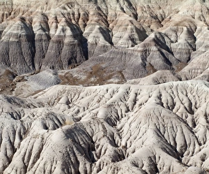
Picture No. 10761723Badland hills of bluish bentonite clay at Blue Mesa Date:
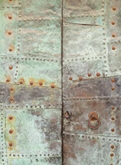
Picture No. 10761712Rusty iron door - Fornalutx Date:
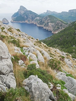
Picture No. 10761708Spain - The Cap de Formentor (in the background on the left) is the northernmost point of the island of Majorca / Mallorca Date:
Picture No. 10761713Gate with graffiti - Palma Date:
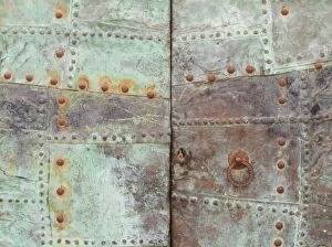
Picture No. 10761711Rusty iron door Date:
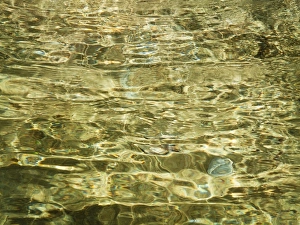
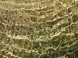
Picture No. 10761704Reflections in mountain stream Date:
Picture No. 10761703Reflections in mountain stream Date:
Picture No. 10761710Sunlight that shines through the stained-glass windows creates this play of colours in the interior of the Cathedral in the city of Palma Date:
Picture No. 10761700Spain - Nazarenos (= penitents) at the Semana Santa (= Holy Week) of Malaga Date: