mail_outline sales@mediastorehouse.com
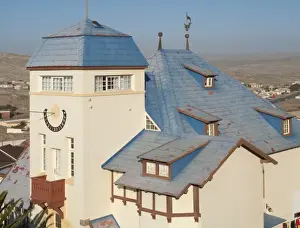
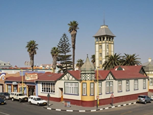
Picture No. 10761313The historic Goerke House (built in 1909) is one of the landmarks of the coastal town of Lz. Date:
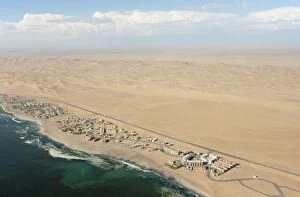
Picture No. 10761311Namibia - Aerial view of holiday resorts along the road from Swakopmund to Walvis Bay between Namib Desert and Atlantic Ocean. Date:
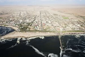
Picture No. 10761310Namibia - Aerial view of Swakopmund between Namib Desert and Atlantic Ocean. Date:
Picture No. 10761306The baroque-style Hohenzollern Building in the seaside town of Swakopmund Date:
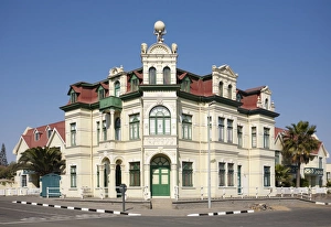
Picture No. 10761307The Woerman House with its Damara Tower was completed in 1905 and is one of the finest historic buildings in the seaside town of Swakopmund. Date:
Picture No. 10761305Little dolls displayed for sale at a stall in the centre of Namibia's capital Windhoek. Date:
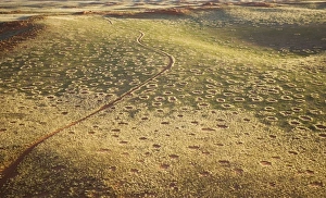
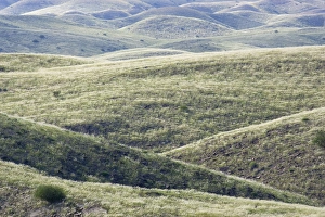
Picture No. 10761295Aerial view of grass-grown sand dunes at the edge of the Namib Desert. Date:
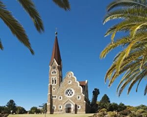
Picture No. 10761302The Christuskirche (Church of Christ) is an Evangelical Lutheran Church, was consecrated in 1910 Date:
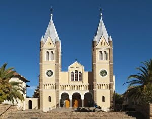
Picture No. 10761301The beautiful facade of St. Mary's Cathedral, a Roman Catholic church in Namibia's capital Windhoek. Date:
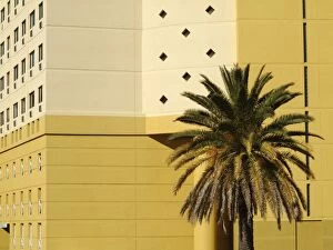
Picture No. 10761303Namibia - Modern high-rise architecture in Namibia's capital Windhoek. Date:
Picture No. 10761299Aerial view of the main building of the exclusive Wolwedans safari camps at the edge of the Namib Desert Date:
Picture No. 10761300Namibia - View of the capital Windhoek with the Auas Mountains in the background. Date:
Picture No. 10761296The "green" desert during the rainy season Date:
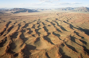
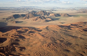
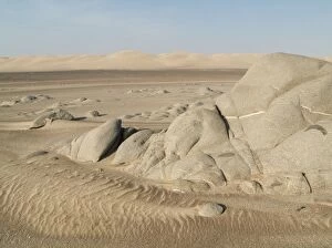
Picture No. 10761293Aerial view of grass-grown sand dunes and isolated mountain ridges at the edge of the Namib Desert Date:
Picture No. 10761297The "green" desert during the rainy season. Date:
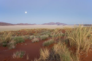
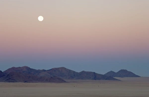
Picture No. 10761287Landscape at dawn with full moon and bushman grass (Stipagrostis sp.) Date:
Picture No. 10761291Aerial view of grass-grown sand dunes and Camelthorn Trees (Acacia erioloba) against the background of the Losberg at the edge of the Namib Desert. Date:
Picture No. 10761294Aerial view of grass-grown sand dunes and isolated mountain ridges at the edge of the Namib Desert. Date:
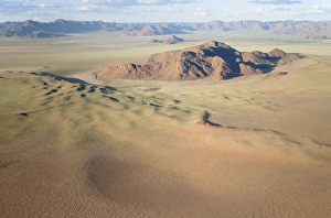
Picture No. 10761292Aerial view of grass-grown sand dunes and isolated mountain ridges at the edge of the Namib Desert. Date:
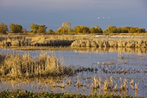
Picture No. 10756425Lakes and marsh at Sacramento National Wildlife Reserve (Colusa section) with Snow Geese and other waterfowl Date:
Picture No. 10761288The "green" desert during the rainy season. Date:
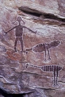
Picture No. 10735858Aboriginal Rock Art - Emu - Brush turkey and Spirit Figures Date:
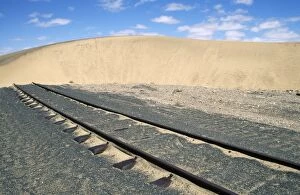
Picture No. 10760543Namibia - railway line blocked by moving sand dune Date:
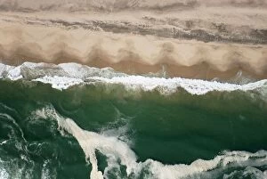
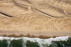
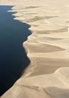
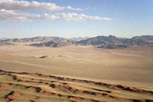
Picture No. 10761274Aerial view - Namib Desert and Atlantic Ocean south of Walvis Bay Date:
Picture No. 10761275Aerial view - Namib Desert and Atlantic Ocean south of Walvis Bay Date:
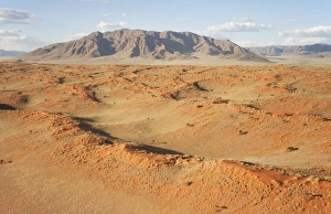
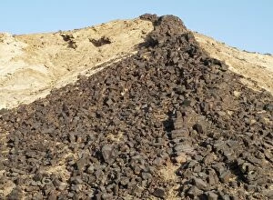
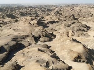
Picture No. 10761246Namibia - A vein of basaltic rock emerged at the ridge of a rocky hill due to the erosion of the surrounding softer rock - East of Swakopmund, northern Namib-Naukluft Park Date:
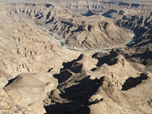
Picture No. 10761256The Fish River Canyon is with a length of 160 km the second largest canyon in the world and the largest in Africa. Date:
Picture No. 10761273Aerial view - Namib Desert and Atlantic Ocean south of Walvis Bay Date:
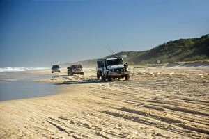
Picture No. 10758244Beach driving - offroad driving at 75-Mile Beach on Fraser Island. Date:
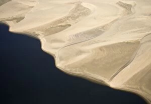
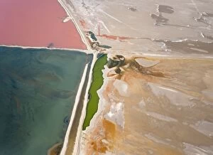
Picture No. 10761247Namibia - Aerial view of saline water at the salt works of Walvis Bay between Namib Desert and Atlantic Ocean Date:
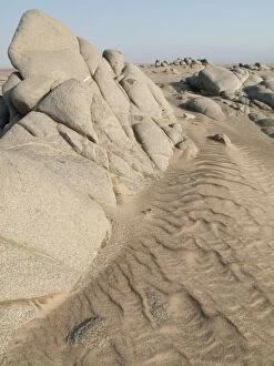
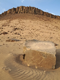
Picture No. 10761264Grey-white rocks in the sand of the Namib Desert near Torra Bay Date:
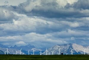
Picture No. 10756615Windmills at Pincher Creek, Alberta, with the Rockies beyond, in stormy weather Date:
Picture No. 10761286Dawn with full moon at the edge of the Namib Desert Date:
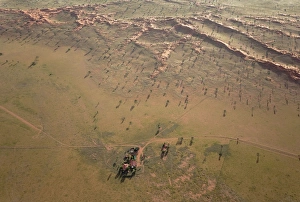
Picture No. 10761249Namibia - Fissured landscape in the vicinity of the Kuiseb Canyon. During the rainy season with green vegetation Date:
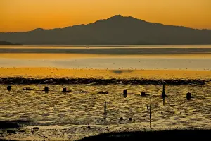
Picture No. 10756417Mount Tamalpais seen across San Francisco Bay Date:
Picture No. 10761276Aerial view - Namib Desert and Atlantic Ocean south of Walvis Bay. Date:
Picture No. 10761245Namibia - The Moon Landscape east of Swakopmund. Date:
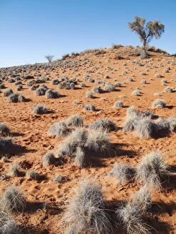
Picture No. 10761253Grass-grown red Kalahari dune east of the town of Gochas Date:
Picture No. 10761262Landscape at the Oranje River which is border river between Namibia and South Africa Date:
Picture No. 10761263Grey-white rocks and sand dunes in the Namib Desert at Torra Bay Date:
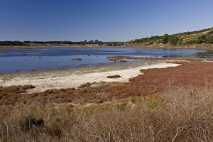
Picture No. 10756427Saltmarsh, mudflats and estuarine habitat at Elkhorn Slough National Estuarine Research Reserve, California, United States Date:
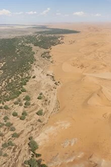
Picture No. 10761271Aerial view of the dry bed of the Kuiseb river with its green belt at the edge of the Namib Desert Date:
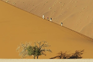
Picture No. 10761267Tourists at a sand dune with Camelthorn tree (Acacia erioloba) in the Namib Desert. Date:
Picture No. 10760340Recycling - plastic container made into lobster traps Date:
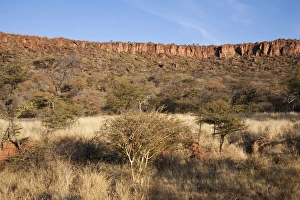
Picture No. 10761236Namibia - The red sandstone rocks of the Waterberg Plateau high above the surrounding savannah. Date:
Picture No. 10760375Print / Illustration - Sioux Indian bear dance from G. Catlin's North American portfolio 1844 Date:
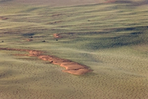
Picture No. 10761290Aerial view of sand dunes and isolated mountain ridges at the edge of the Namib Desert. Date:
Picture No. 10761268Tourists at a sand dune with Camelthorn tree (Acacia erioloba) in the Namib Desert. Date: