mail_outline sales@mediastorehouse.com
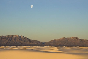
Picture No. 10760999White Sands in the Tularosa Basin Date:
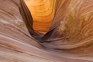
Picture No. 10760991Rock wall at the North Coyote Buttes Date:
Picture No. 10760998White Sands in the Tularosa Basin Date:
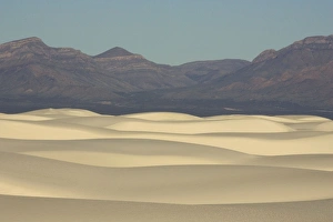
Picture No. 10760997White Sands in the Tularosa Basin Date:
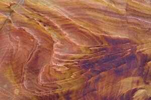
Picture No. 10760990Detail of a rock wall at the North Coyote Buttes Date:
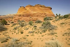
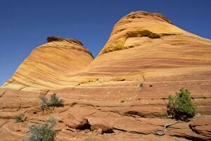
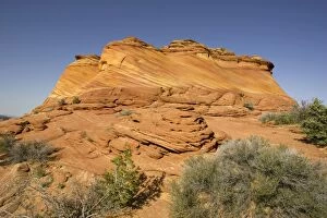
Picture No. 10760984Beautiful red and yellow striated Navajo sandstone at the North Coyote Buttes Date:
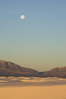
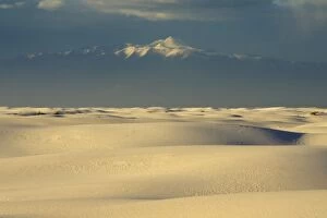
Picture No. 10760996White Sands in the Tularosa Basin Date:
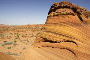
Picture No. 10760987Beautiful red and yellow striated Navajo sandstone at the North Coyote Buttes Date:
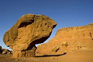
Picture No. 10760982A Balanced Rock is created by softer rock which erodes away, leaving overhangs of hard rock. Date:
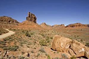
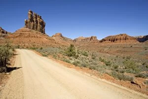
Picture No. 10760981Valley of the Gods, Utah, USA. Date:
Picture No. 10760986Beautiful red and yellow striated Navajo sandstone at the North Coyote Buttes Date:
Picture No. 10760985Beautiful red and yellow striated Navajo sandstone at the North Coyote Buttes. Date:
Picture No. 10760980Valley of the Gods, Utah, USA. Date:
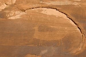
Picture No. 10760971Rock engraving probably of Anazasi origin in the Mystery Valley, which is a side valley of the Monument Valley. Date:
Picture No. 10760972Yei Bi Chei and Totem Pole (on the right) rock formations in the southeastern part of the Monument Valley Date:
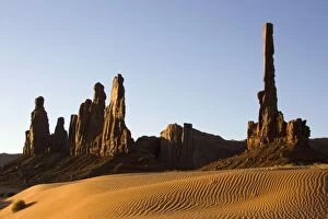
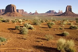
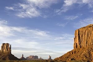
Picture No. 10760964Sandstone buttes and pinnacles Date:
Picture No. 10760969sandstone buttes and pinnacles of rock in the Monument Valley, seen from the North Window. Date:
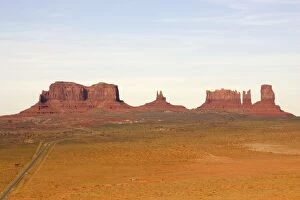
Picture No. 10760961Rock formation in the Monument Valley Date:
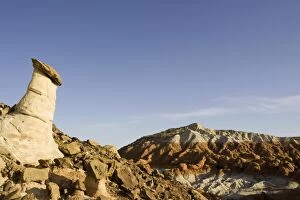
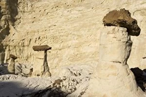
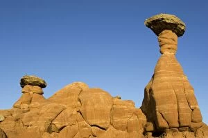
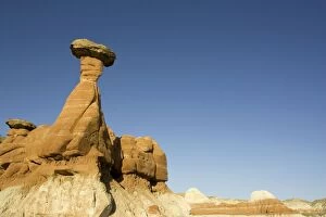
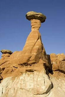
Picture No. 10760951Erosion - Toadstool, also called Hoodoo, in the Paria River Rimrock area near the US-89 highway. Date:
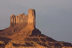
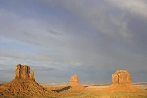
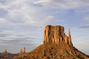
Picture No. 10760959West Mitten, East Mitten and Merrick Butte Date:
Picture No. 10760958West Mitten Butte (on the left) and Merrick Butte Date:
Picture No. 10760957West Mitten Butte Date:
Picture No. 10760950Erosion - Toadstools, also called Hoodoos, in the Paria River Rimrock area near the US-89 highway. Date:
Picture No. 10760949Erosion - Toadstools, also called Hoodoos, in the Paria River Rimrock area near the US-89 highway. Date:
Picture No. 10760948Erosion - Toadstools, also called Hoodoos, in the Paria River Rimrock area near the US-89 highway Date:
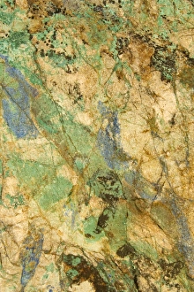
Picture No. 10760946Copper Ore Date:
Picture No. 10760947Erosion - toadstools, also called Hoodoos, in the Paria River Rimrock area near the US-89 highway Date:
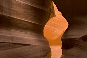
Picture No. 10760913Sandstone rock in the Upper Antelope Canyon, probably the most famous "slot canyon" in the Southwest. Date:
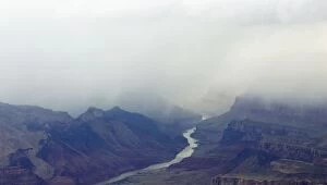
Picture No. 10760909USA - Grand Canyon with Colorado River Date:
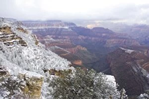
Picture No. 10760905View of the eastern Grand Canyon from Desert View at the South Rim Date:
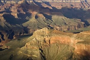
Picture No. 10760903View of the Grand Canyon from the Rim Trail at the South Rim Date:
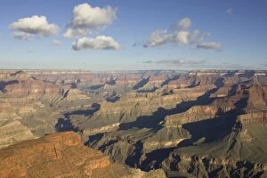
Picture No. 10760900View of the Grand Canyon from Hermit Road (West Rim Drive) at the South Rim. Date:
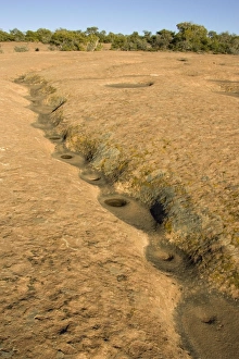
Picture No. 10760856Erosion by water created this sequence of little pools in the sandstone Date:
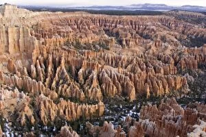
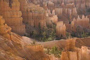
Picture No. 10760845Pinnacles of limestone rock (so-called hoodoos) and eroding fins Date:
Picture No. 10760847Pinnacles of limestone rock (so-called hoodoos) and eroding fins Date:
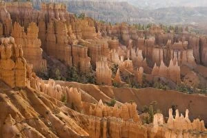
Picture No. 10760844Pinnacles of limestone rock (so-called hoodoos) and eroding fins Date:
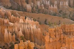
Picture No. 10760846Pinnacles of limestone rock (so-called hoodoos) and eroding fins Date:
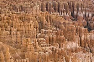
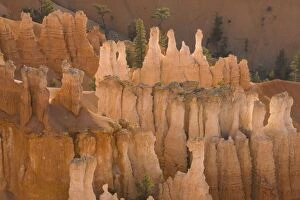
Picture No. 10760848Pinnacles of limestone rock (so-called hoodoos) and eroding fins Date:
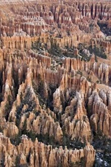
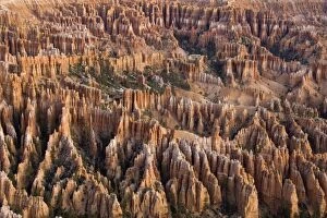
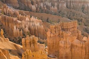
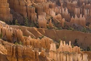
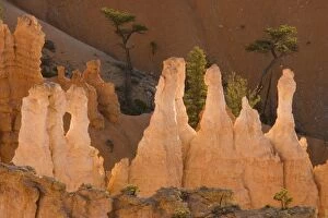
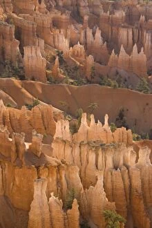
Picture No. 10760838Pinnacles of limestone rock (so-called hoodoos) and eroding fins in the spectacular Bryce Amphitheatre Date:
Picture No. 10760843Pinnacles of limestone rock (so-called hoodoos) and eroding fins Date:
Picture No. 10760837Pinnacles of limestone rock (so-called hoodoos) and eroding fins Date:
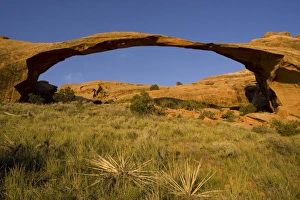
Picture No. 10760832Landscape Arch is the longest sandstone rock sculpture in the Arches National Park, measuring 306 feet from base to base. Date:
Picture No. 10760841Pinnacles of limestone rock (so-called hoodoos) and eroding fins Date:
Picture No. 10760834Pinnacles of limestone rock (so-called hoodoos) and eroding fins Date:
Picture No. 10760840Pinnacles of limestone rock (so-called hoodoos) and eroding fins Date:
Picture No. 10760836Pinnacles of limestone rock (so-called hoodoos) and eroding fins Date:
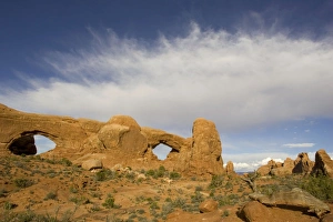
Picture No. 10760827USA - The sandstone rock sculpture of South Window. Date:
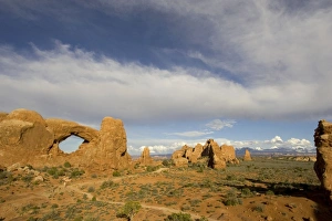
Picture No. 10760826USA - The sandstone rock sculpture of North Window and South Window Date: