mail_outline sales@mediastorehouse.com
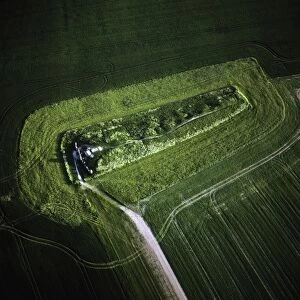
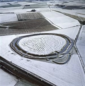
Picture No. 10741214Normanton Down Barrows, a Neolithic and Bronze Age barrow cemetery in snow. It consists of a Neolithic long barrow and Bronze Age round barrows, Wiltshire Date:
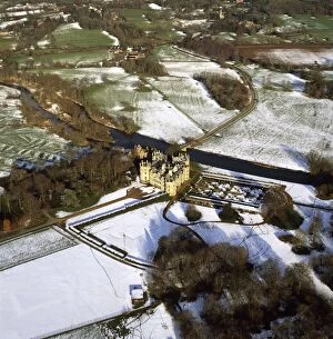
Picture No. 10741238Longford Castle in snow, south of Salisbury, Wiltshire Date:
Picture No. 10741224Badbury Rings, An Iron Age hill fort), Dorset Date:
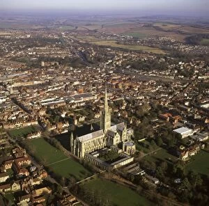
Picture No. 10741256Salisbury Cathedral and city in snow, Wiltshire Date:
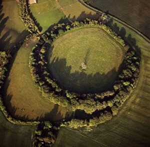
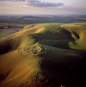
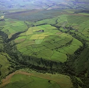
Picture No. 10741222Beacon Hill, an Iron Age hill fort, Burghclere, Hampshire Date:
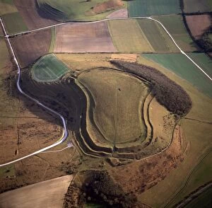
Picture No. 10741228Maiden Castle, an Iron Age hill fort, Winterborne Monkton, near Dorchester, Dorset Date:
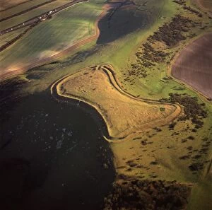
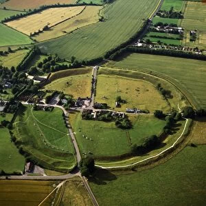
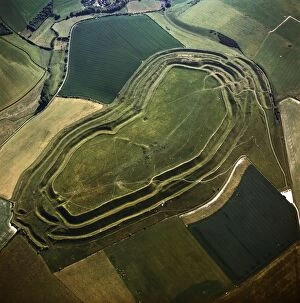
Picture No. 10741225Bury Hill Fort, hill-fort, hillfort, Wiltshire Date:
Picture No. 10741215Avebury, Neolithic Monument, site of a large henge and serval stone circles, Wiltshire Date:
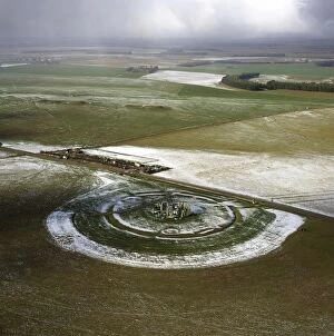
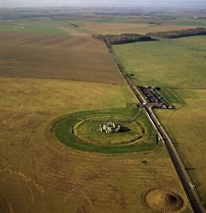
Picture No. 10741211Stonehenge, World Heritage Site, prehistoric monument and stone circle in snow, Wiltshire Date:
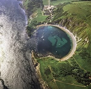
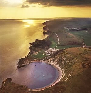
Picture No. 10741206Lulworth Cove, a natural landform harbour, near West Lulworth, on the Jurassic Coast World Heritage Site, Dorset Date:
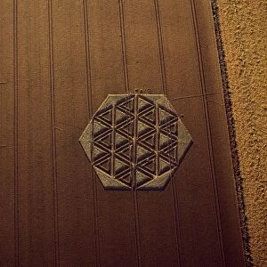
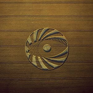
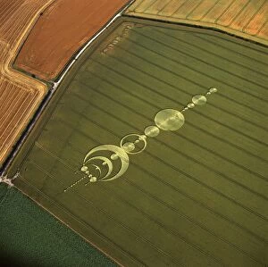
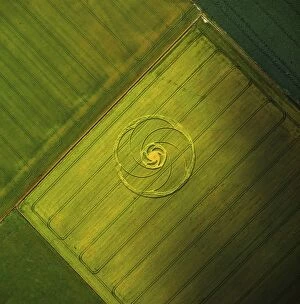
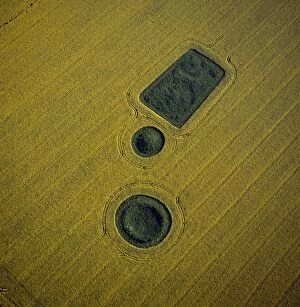
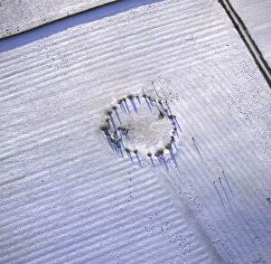
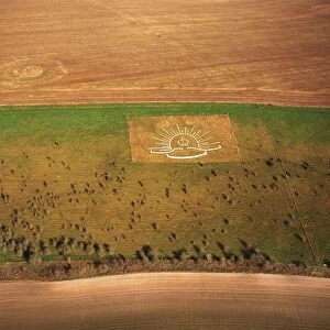
Picture No. 10741235Crop Circle, Wiltshire Date:
Picture No. 10741272England - Aerial view of sea stacks Date:
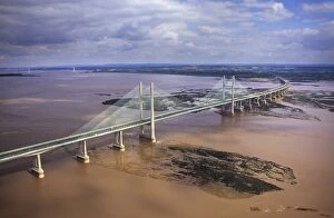
Picture No. 10741307England - Aerial view, Second Severn Bridge, Gloucestershire Date:
Picture No. 10741234Crop Circle, Wiltshire Date:
Picture No. 10741257Salisbury Cathedral and city, Wiltshire Date:
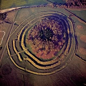
Picture No. 10741193Rybury Camp, an Iron Age hill fort with Neolithic causewayed enclosure, Wiltshire Date:
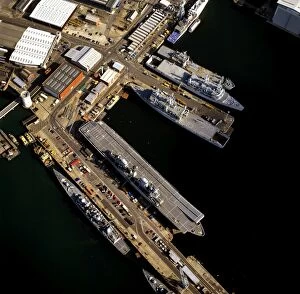
Picture No. 10741251Portsmouth's Dockyard and HM Naval Base, Portsmouth Harbour, Hampshire Date:
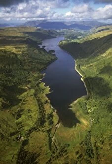
Picture No. 10741253England - Aerial view, Lake Thirlmere, Date:
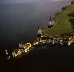
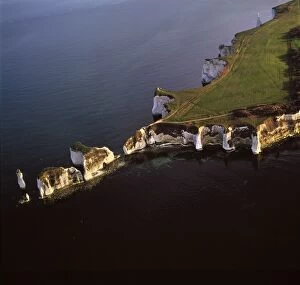
Picture No. 10741202Old Harry Rocks, chalk stacks located directly east of Studland, north of Swanage, Dorset Date:
Picture No. 10741233Crop Circle, Wiltshire Date:
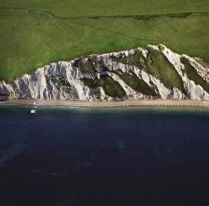
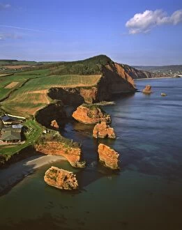
Picture No. 10741209Chalk Cliff just east of White Nothe, on the Jurassic Coast World Heritage Site, Dorset Date:
Picture No. 10741254Pig farm, Wltshire Date:
Picture No. 10741269England - Aerial view of red Permian sandstone stacks and crags with evocative names such as Tower of Babel, the Razor and the Lost World. Date:
Picture No. 10741236Crop Circle, Wiltshire Date:
Picture No. 10741227Maiden Castle, an Iron Age hill fort, Winterborne Monkton, near Dorchester, Dorset Date:
Picture No. 10741205Lulworth Cove, a natural landform harbour, near West Lulworth, on the Jurassic Coast World Heritage Site, Dorset Date:
Picture No. 10741266England - Aerial view of the oval shaped hill of Abney Low, 347 metres above sea level. Date:
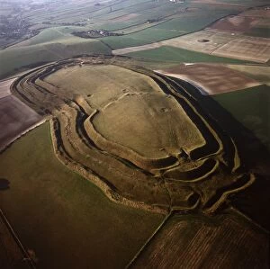
Picture No. 10741221Battlesbury Camp, an Iron Age Hill fort, Warminster, Wiltshire Date:
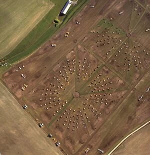
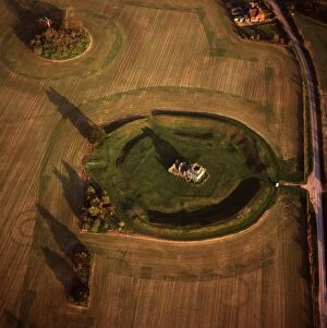
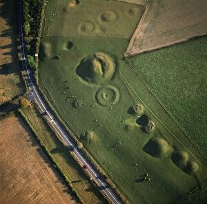
Picture No. 10741273England - Aerial view. Cluster of Neolithic sacred sites and Bronze Age barrows situated to the south-west of Cranbourne Date:
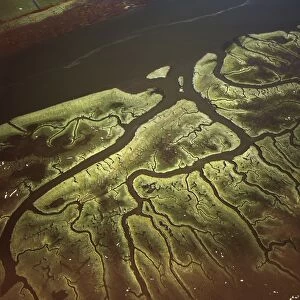
Picture No. 10741199Salt Marsh on River Lune, Lancaster, Lancashire Date:
Picture No. 10741212Stonehenge, , World Heritage Site, prehistoric monument and stone circle, Wiltshire Date:
Picture No. 10741217West Kennet Long Barrow, a Neolithic tomb or barrow, on a prominent chalk ridge, near Silbury Hill, Avebury, Wiltshire Date:
Picture No. 10741218Round and square Barrows at North Down in rape field, near Calstone wellington, Wiltshire Date:
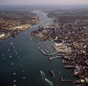
Picture No. 10741255Cowes, on the west bank of the estuary of the River Medina facing the smaller town of East Cowes on the east Bank, Isle of Wight Date:
Picture No. 10741220Winterbourne Poor Lot (Round) Barrows, Winterbourne Abbas, Dorset Date:
Picture No. 10741262England - Aerial view, Castlerigg Stone Circle, Date:
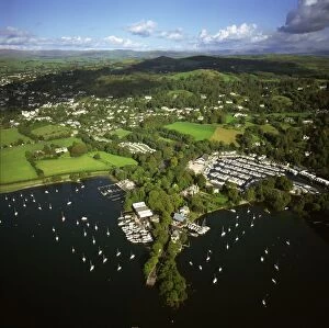
Picture No. 10741263England - Aerial view, Bowness-on-Windermere, Date:
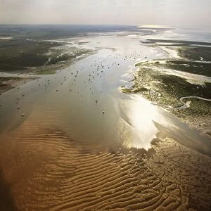
Picture No. 10741280England - Aerial view, Blakeney Point Date:
Picture No. 10741250Lamb Down Military Badge, The badge of the Australian Commonwealth Military Forces cut on a steep slope just by the A36, at the top of Lamb down, Wiltshire Date:
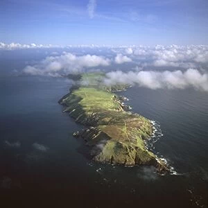
Picture No. 10741268England - Aerial view. Lundy Island. Date:
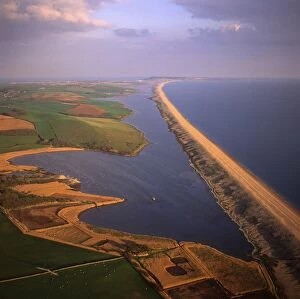
Picture No. 10741271England - Aerial view of linear storm beach of shingle, stretching 29 kilometres from Bridport to the Isle of Portland. Date:
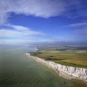
Picture No. 10741277England - Aerial view White Cliffs at Beachy Head. The English Channel. Date:
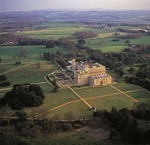
Picture No. 10741240Osborne House, Isle of Wight Date:
Picture No. 10741223Yarnbury Castle (Hill Fort) in snow, Wiltshire Date:
Picture No. 10741282England - Aerial view, Norfolk Broads at Ludham Bridge Date:
Picture No. 10741198Solway Firth, Mudflats with sunset, border between England and Scotland, between Cumbria and Dumfries and Galloway Date:
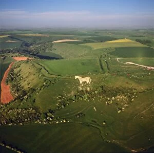
Picture No. 10741249Westbury White Horse, and an Iron Age Bratton Camp Hill Fort, Wiltshire Date: