mail_outline sales@mediastorehouse.com
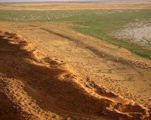
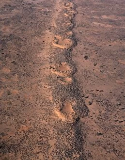
Aerial - Simpson Desert near Dalhousie homestead, Witjira National Park, northeastern South Australia JPF45567JPF-13689 Aerial - Simpson Desert near Dalhousie homestead Witjira National Park, northeastern South Australia Jean-Paul Ferrero Please note that prints are for personal display purposes only
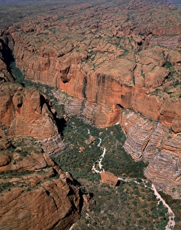
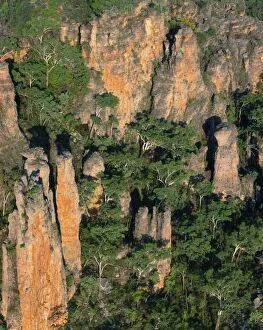
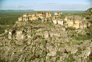
Bungle Bungle Range Purnululu National Park, Kimberley region, Western Australia JPF43641JPF-13599 Bungle Bungle Range Purnululu National Park Kimberley region, Western Australia Jean-Paul Ferrero Please note that prints are for personal display purposes only
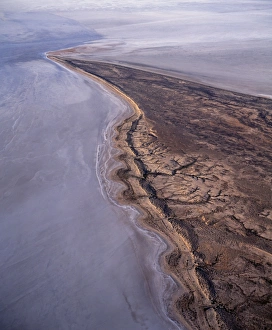
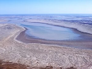
Lake Eyre north Elliott Price Conservation Park, Sth Australia JPF41355JPF-13563 Lake Eyre north Elliott Price Conservation Park Sth Australia Jean-Paul Ferrero Please note that prints are for personal display purposes only and may not be reproduced in anyway
North of Brachina Gorge Flinders Ranges National Park, South Australia JPF41751JPF-13557 North of Brachina Gorge Flinders Ranges National Park, South Australia Jean-Paul Ferrero Please note that prints are for personal display purposes only and may not be reproduced in anyway
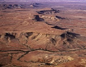
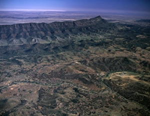
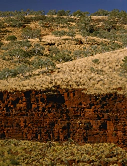
Southern Flinders Ranges Aerial South Australia JPF41777JPF-13556 Southern Flinders Ranges Aerial South Australia Jean-Paul Ferrero Please note that prints are for personal display purposes only and may not be reproduced in anyway
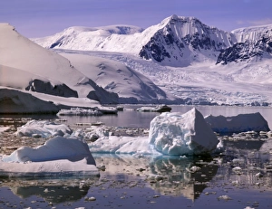
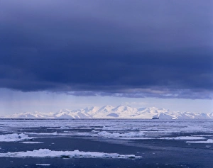
Southern end of Lemaire Channel Girard Bay, Antarctic Peninsula JPF41789JPF-13553 Southern end of Lemaire Channel Girard Bay Antarctic Peninsula Jean-Paul Ferrero Please note that prints are for personal display purposes only and may not be reproduced in anyway
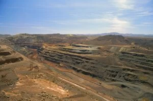
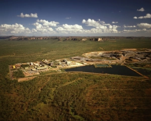
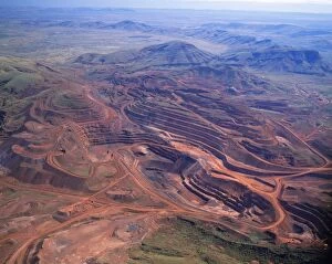
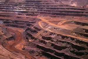
Mount Newman open-cut iron mine Pilbara region, Western Australia JPF34564JPF-13410 Mount Newman open-cut iron mine Pilbara region Western Australia Jean-Paul Ferrero Please note that prints are for personal display purposes only and may not be reproduced in anyway
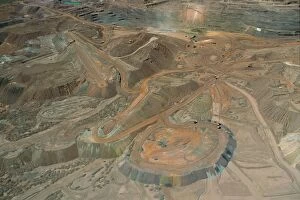
Mt Newman iron mine on Mt Whaleback open cut mine, Pilbara region, Western australia JPF34573JPF-13409 Mt Newman iron mine on Mt Whaleback open cut mine Pilbara region, Western australia Jean-Paul Ferrero Please note that prints are for personal display purposes only
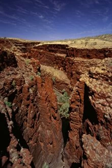
Western Australia, Karijini National Park, Pilbara region. Junction of Red, Joffre and Hancock Gorges. JPF28110JPF-13256 Western Australia, Karijini National Park, Pilbara region Junction of Red, Joffre and Hancock Gorges. Jean-Paul Ferrero Please note that prints are for personal display purposes only
Joffre Gorge Karijini National Park, Pilbara region, Western Australia JPF28667JPF-13225 Joffre Gorge Karijini National Park Pilbara region, Western Australia Jean-Paul Ferrero Please note that prints are for personal display purposes only and may not be reproduced in anyway
Ranger uranium mine Kakadu National Park (World Heritage Area), Northern Territory, Australia JPF28948JPF-13203 Ranger uranium mine Kakadu National Park (World Heritage Area) Northern Territory, Australia Jean-Paul Ferrero Please note that prints are for personal display purposes only
Royal Society Range TransAntarctic Mountains, Victoria Land, Antarctica JPF21009JPF-13124 Royal Society Range TransAntarctic Mountains Victoria Land, Antarctica Jean-Paul Ferrero Please note that prints are for personal display purposes only and may not be reproduced in anyway
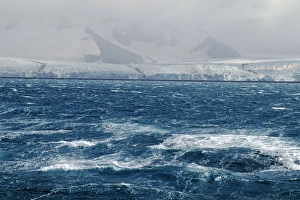
Stormy sea caused by katabatic wind (blowing from land), South Georgia, Sub-Antarctic Islands, Antarctica JPF31316JPF-13008 Stormy sea caused by katabatic wind (blowing from land), South Georgia, Sub-Antarctic Islands, Antarctica Jean-Paul Ferrero Please note that prints are for personal display purposes only
Seasonal swamp by Old Andado station Simpson Desert, Northern Territory, Australia, May JPF52958JPF-12963 Seasonal swamp by Old Andado station Simpson Desert, Northern Territory, Australia, May Jean-Paul Ferrero Please note that prints are for personal display purposes only
Great Victoria Desert - Australia's most vegetated desert, South Australia JPF47893JPF-12962 Great Victoria Desert Australias most vegetated desert, South Australia Jean-Paul Ferrero Please note that prints are for personal display purposes only and may not be reproduced in anyway
Red longitudinal sand dunes Strzelecki Desert, South Australia JPF41295JPF-12959 Red longitudinal sand dunes Strzelecki Desert, South Australia Jean-Paul Ferrero Please note that prints are for personal display purposes only and may not be reproduced in anyway
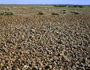
Gibber / Stony desert Sturt National Park, far western New South Wales, Australia JPF44375JPF-12925 Gibber / Stony desert Sturt National Park far western New South Wales, Australia Jean-Paul Ferrero Please note that prints are for personal display purposes only
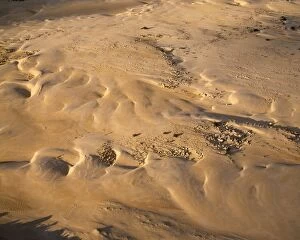
Sand Dunes - aerial Lake Eyre National Park, South Australia JPF41304JPF-12918 Sand Dunes - aerial Lake Eyre National Park, South Australia Jean-Paul Ferrero Please note that prints are for personal display purposes only and may not be reproduced in anyway
Fitzroy River cutting through ancient limestone coral reef formed during Devonion period (350 milion years ago)JLR-410 Fitzroy River cutting through ancient limestone coral reef formed during Devonion period (350 milion years ago) Geikie Gorge National Park, Kimberley region
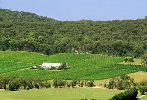
Cathcart Ridge Winery Ararat, western Victoria, Australia JLR07640JLR-391 Cathcart Ridge Winery Ararat western Victoria, Australia Jean-marc La Roque Please note that prints are for personal display purposes only and may not be reproduced in anyway
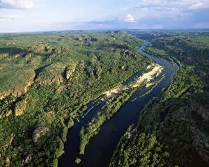
Australia East Alligator River cutting through Sandstone of the Arhem Land PlateauJPF-12426 Australia - Northern Territory - Kakadu National Park East Alligator River River cutting through Sandstone of the Arhem Land Plateau Jean Paul Ferrero Please note that prints are for
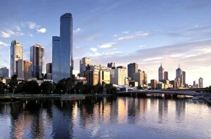
Melbourne from Southbank Melbourne, Victoria, Australia JLR07962JLR-426 Melbourne from Southbank Melbourne Victoria, Australia Jean-marc La Roque Please note that prints are for personal display purposes only and may not be reproduced in anyway
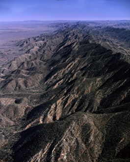
The Armchair from the Ridge Road Arkaroola-Mount Painter Wildlife Sanctuary, South Australia JLR08042JLR-424 The Armchair from the Ridge Road Arkaroola-Mount Painter Wildlife Sanctuary South Australia Jean-marc La Roque Please note that prints are for personal display purposes only
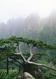
China - Pine (Pinus huangshanensis) endemic Mt Huangshan Yellow Mountains, ChinaJPF-10079 Mount Huangshan / Yellow Mountains, endemic pine (Pinus huangshanensis) - In mist CHINA sub-tropical Jean Paul Ferrero Please note that prints are for personal display purposes only
Flood water flow into the Warbuton Groove-top of Lake Eyre. - Lake Eyre north South AustraliaJLR-97 Flood water flow into the Warbuton Groove - top of Lake Eyre Lake Eyre north South Australia. 2009 flood Lake Eyre is an extensive salt sink
Beechworth Bakery Northeastern Victoria, Australia JLR07730JLR-415 Beechworth Bakery Northeastern Victoria Australia Jean-marc La Roque Please note that prints are for personal display purposes only and may not be reproduced in anyway
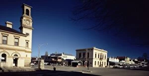
Beechworth - 19th-century gold town main street, Northeastern Victoria, Australia JLR07733JLR-414 Beechworth - 19th-century gold town main street Northeastern Victoria, Australia Jean-marc La Roque Please note that prints are for personal display purposes only
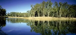
Murray River - near Barmah, Victoria, Australia JLR07720JLR-416 Murray River - near Barmah Victoria, Australia Jean-marc La Roque Please note that prints are for personal display purposes only and may not be reproduced in anyway
Australia - sandstone kombolgie formation (early Proterozoic 1700 Ma) Mt Brockman area 9detached part of the ArnhemJPF-12429 Australia - sandstone kombolgie formation (early Proterozoic 1700 Ma) Mt Brockman area 9 detached part of the Arnhem Land Plateau / Escarpment) Kakadu National Park
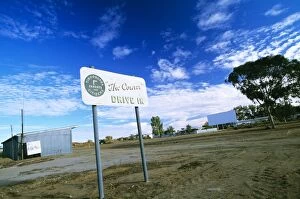
Tibooburra, drive-in cinema outback New South Wales, Australia JLR08031JLR-425 Tibooburra, drive-in cinema outback New South Wales Australia Jean-marc La Roque Please note that prints are for personal display purposes only and may not be reproduced in anyway
Australia - mining iron ore-open cut mine. Pilbara region, Hamersley RangeJPF-11728 Australia - mining iron ore-open cut mine. Pilbara region, Hamersley Range Jean Paul Ferrero Please note that prints are for personal display purposes only
Western Australia - The Pinnacles aerial view. Limestone pillars formed underground by vertical seepageJPF-11735 Western Australia - The Pinnacles aerial view. Nambung National Park, Western Australia. Limestone pillars formed underground by vertical seepage. Dissolved lime cemented
Arnhem Land Escarpment Kakadu National Park (World Heritage Area) - Northern Territory, Australia JLR00361JLR-241 Arnhem Land Escarpment Kakadu National Park (World Heritage Area) Northern Territory, Australia Jean-marc La Roque Please note that prints are for personal display purposes only
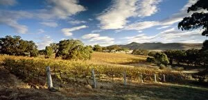
Long Gully Winery Yarra Valley, Victoria, Australia JLR03779JLR-273 Long Gully Winery Yarra Valley Victoria, Australia Jean-marc La Roque Please note that prints are for personal display purposes only and may not be reproduced in anyway
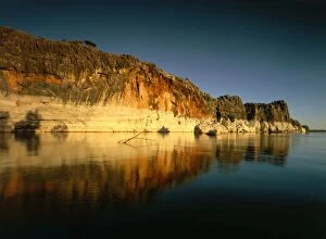
Tathra South coast, New South Wales, Australia JLR00527JLR-236 Tathra South coast New South Wales, Australia Jean-marc La Roque Please note that prints are for personal display purposes only and may not be reproduced in anyway
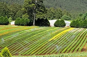
Blue Dandenong Bulbs farm near Healesville, Victoria, Australia JLR03773JLR-274 Blue Dandenong Bulbs farm near Healesville Victoria, Australia Jean-marc La Roque Please note that prints are for personal display purposes only and may not be reproduced in anyway
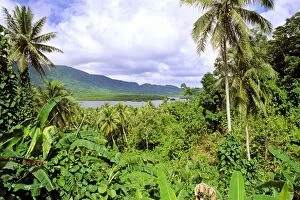
Pohnpei Island view through dense vegetation to a bay Micronesia JLR04158JLR-300 Pohnpei Island view through dense vegetation to a bay Micronesia Jean-marc La Roque Please note that prints are for personal display purposes only and may not be reproduced in anyway
Discovery Bay Coastal Park southwest Victoria, Australia JLR07205JLR-371 Discovery Bay Coastal Park southwest Victoria Australia Jean-marc La Roque Please note that prints are for personal display purposes only and may not be reproduced in anyway
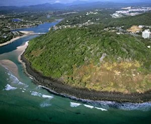
Basalt hill Burleigh Head National Park, Tallebudgera Creek near Southport, Gold Coast, Queensland, Australia JLR06983JLR-348 Basalt hill Burleigh Head National Park, Tallebudgera Creek near Southport, Gold Coast, Queensland, Australia Jean-marc La Roque Please note that prints are for personal display purposes only
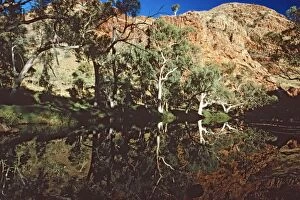
Ormiston Gorge area West MacDonnell National Park, Northern Territory, Australia JLR00384JLR-239 Ormiston Gorge area West MacDonnell National Park, Northern Territory, Australia Jean-marc La Roque Please note that prints are for personal display purposes only
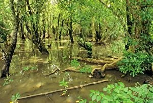
Mangrove forest Pohnpei Island, Micronesia JLR04147JLR-302 Mangrove forest Pohnpei Island, Micronesia Jean-marc La Roque Please note that prints are for personal display purposes only and may not be reproduced in anyway
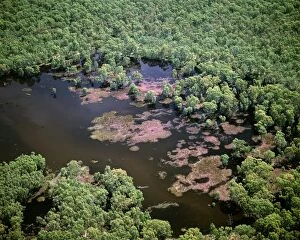
Aerial - Murray River and billabong - near Wentworth, New South Wales, Australia, JLR06370JLR-228 Aerial - Murray River and billabong near Wentworth, New South Wales, Australia Jean-marc La Roque Please note that prints are for personal display purposes only
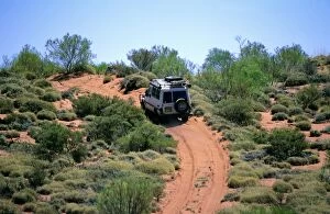
Canning Stock Route and 4WD vehicle Little Sandy Desert, Western Australia JLR03117JLR-283 Canning Stock Route and 4WD vehicle Little Sandy Desert Western Australia Jean-marc La Roque Please note that prints are for personal display purposes only
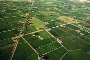
Aerial - Citrus and apricot orchards - Murray River irrigation area Mildura, Victoria, Australia JLR06622JLR-367 Aerial - Citrus and apricot orchards Murray River irrigation area Mildura, Victoria, Australia Jean-marc La Roque Please note that prints are for personal display purposes only
Stuart Highway cattle crossing warning sign Northern Territory, Australia JLR03135JLR-282 Stuart Highway cattle crossing warning sign Northern Territory, Australia Jean-marc La Roque Please note that prints are for personal display purposes only
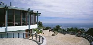
Sky High Restaurant Mount Dandenong Victoria, Australia JLR06991JLR-386 Sky High Restaurant Mount Dandenong Victoria Australia Jean-marc La Roque Please note that prints are for personal display purposes only and may not be reproduced in anyway
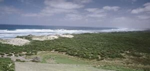
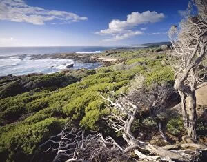
Cape Freycinet Leeuwin - Naturaliste National Park, Western Australia JLR08080JLR-212 Cape Freycinet Leeuwin Naturaliste National Park, Western Australia Jean-marc La Roque Please note that prints are for personal display purposes only and may not be reproduced in anyway
Mount Newman iron mine on Mount Whaleback, open-cut operation Western Australia JLR03073JLR-286 Mount Newman iron mine on Mount Whaleback open-cut operation Western Australia Jean-marc La Roque Please note that prints are for personal display purposes only