mail_outline sales@mediastorehouse.com
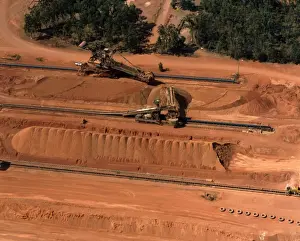
Aerial - Bauxite mining used in aluminium manufacture Weipa, Cape York, Queensland, Australia JPF52276JPF-13963 Aerial - Bauxite mining used in aluminium manufacture Weipa, Cape York, Queensland, Australia Jean-Paul Ferrero Please note that prints are for personal display purposes only
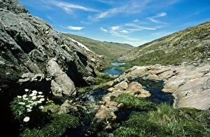
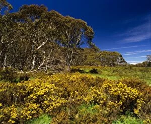
Mountain creek in spring Kosciuszko National Park, New South Wales, Australia JPF02815JPF-14110 Mountain creek in spring Kosciuszko National Park New South Wales, Australia Jean-Paul Ferrero Please note that prints are for personal display purposes only
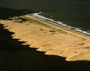
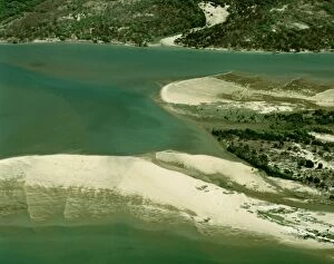
Aerial - Pattern of sand dunes south of Hat Head aerial, New South Wales, Australia JPF52864JPF-13994 Aerial - Pattern of sand dunes south of Hat Head aerial, New South Wales, Australia Jean-Paul Ferrero Please note that prints are for personal display purposes only
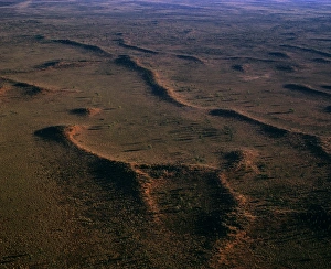
Aerial - Sand dunes near Ayers Rock / Uluru Uluru-Kata Tjuta National Park (World Heritage Area), Northern TerritoryJPF-13995 Aerial - Sand dunes near Ayers Rock / Uluru Uluru-Kata Tjuta National Park (World Heritage Area) Northern Territory
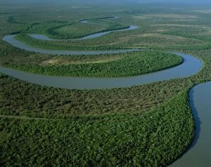
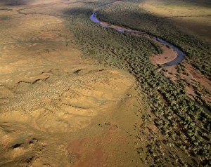
Aerial - North Kennedy River with mangrove-lined banks, Lakefield National Park, far north QueenslandJPF-13956 Aerial - North Kennedy River with mangrove-lined banks Lakefield National Park, far north Queensland, Australia Jean-Paul Ferrero Please note that prints are for personal display purposes
Clear-felling Derwent Valley, Tasmania, Australia JPF00666JPF-14041 Clear-felling Derwent Valley Tasmania, Australia Jean-Paul Ferrero Please note that prints are for personal display purposes only and may not be reproduced in anyway
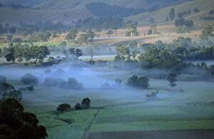
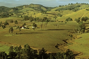
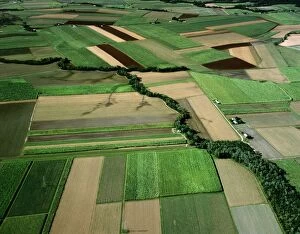
Rural scene upper Hunter Valley, New South Wales, Australia JPF52673JPF-13982 Rural scene upper Hunter Valley New South Wales, Australia Jean-Paul Ferrero Please note that prints are for personal display purposes only and may not be reproduced in anyway
Rural scene Hunter Valley with cows in field New South Wales, Australia JPF52680JPF-13967 Rural scene Hunter Valley with cows in field New South Wales, Australia Jean-Paul Ferrero Please note that prints are for personal display purposes only and may not be reproduced in anyway
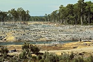
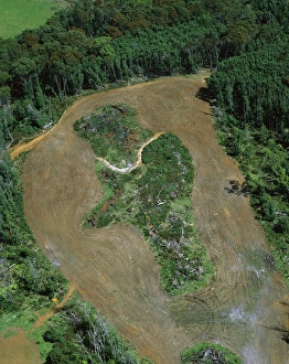
Logging roads & forest clearing showing loss of biodiversity near Cumberland Lake, West coast, TasmaniaJPF-13955 Logging roads & forest clearing showing loss of biodiversity near Cumberland Lake West coast, Tasmania, Australia Jean-Paul Ferrero Please note that prints are for personal display purposes
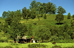
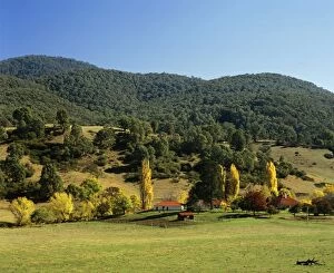
Brindabella Homestead Brindabella Ranges, New South Wales, Australia JPF3046aJPF-14099 Brindabella Homestead Brindabella Ranges New South Wales, Australia Jean-Paul Ferrero Please note that prints are for personal display purposes only and may not be reproduced in anyway
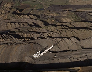
Aerial - Curragh open cut coal mine north of Blackwater, Queensland, Australia JPF52264JPF-13962 Aerial - Curragh open cut coal mine north of Blackwater Queensland, Australia Jean-Paul Ferrero Please note that prints are for personal display purposes only
Rural scene Hunter Valley, New South Wales, Australia JPF52681JPF-13966 Rural scene Hunter Valley New South Wales, Australia Jean-Paul Ferrero Please note that prints are for personal display purposes only and may not be reproduced in anyway
Oakover River aerial, near Great Sandy Desert, east of Isabella Range, Western Australia JPF52504JPF-13973 Oakover River aerial, near Great Sandy Desert, east of Isabella Range Western Australia Jean-Paul Ferrero Please note that prints are for personal display purposes only
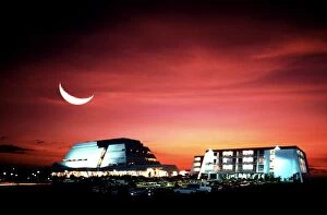
Darwin Casino at night with crescent moon, Darwin, Northern Territory, Australia JPF09658JPF-13981 Darwin Casino at night with crescent moon Darwin, Northern Territory, Australia Jean-Paul Ferrero Please note that prints are for personal display purposes only
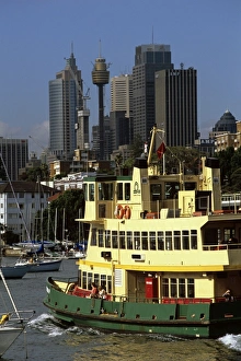
Commuters taking a ferry from a harbourside suburb to go to work in the city Sydney, New South WalesJPF-13977 Commuters taking a ferry from a harbourside suburb to go to work in the city Sydney New South Wales, Australia Jean-Paul Ferrero Please note that prints are for personal display purposes
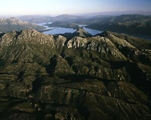
Brindabella Range Namadgi National Park, Australian Capital Territory JPF02986JPF-14101 Brindabella Range Namadgi National Park Australian Capital Territory Jean-Paul Ferrero Please note that prints are for personal display purposes only and may not be reproduced in anyway
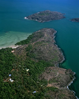
Aerial - Tip of Cape York with Cape York Island beyond and Eborac Island on rightJPF-13972 Aerial - Tip of Cape York with Cape York Island beyond and Eborac Island on right, northernmost point of continental Australia, Cape York Peninsula, Queensland
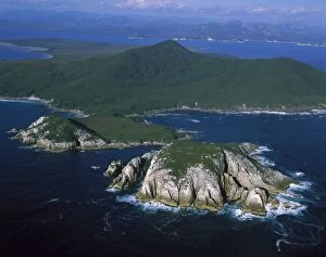
Aerial - Port Davey, Hilliard Head, Stephens Bay, Mt Rugby beyond Southwest National ParkJPF-13835 Aerial - Port Davey, Hilliard Head, Stephens Bay, Mt Rugby beyond Southwest National Park Tasmania (World Heritage Area)
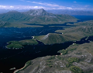
Aerial - Bathurst Channel, Pim Point, Mt Rugby and Bathurst Harbour Southwest National ParkJPF-13838 Aerial - Bathurst Channel, Pim Point, Mt Rugby and Bathurst Harbour Southwest National Park Tasmania (World Heritage Area)
Aerial - Duck Creek, Gulf of Carpentaria Cape York Peninsula, Queensland, Australia JPF50098JPF-13863 Aerial - Duck Creek Gulf of Carpentaria Cape York Peninsula, Queensland, Australia Jean-Paul Ferrero Please note that prints are for personal display purposes only
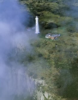
Aerial - Tasman Island and lighthouse Tasman Peninsula, Tasmania, AustraliaJPF-13854 Aerial - Tasman Island and lighthouse Tasman Peninsula Tasmania, Australia Jean-Paul Ferrero Please note that prints are for personal display purposes only
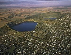
Aerial - Mount Gambier and Blue Lake South Australia JPF49542JPF-13844 Aerial - Mount Gambier and Blue Lake South Australia Jean-Paul Ferrero Please note that prints are for personal display purposes only and may not be reproduced in anyway
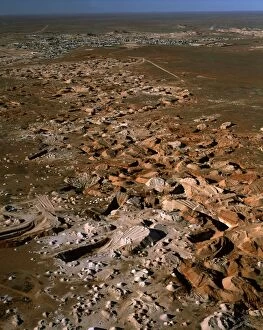
Aerial - Opal mining from the air, and town of Coober Pedy beyond - South Australia JPF51910JPF-13919 Aerial - Opal mining from the air and town of Coober Pedy beyond - South Australia Jean-Paul Ferrero Please note that prints are for personal display purposes only
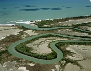
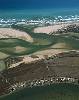
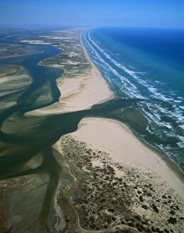
Aerial - Murray River mouth & Hindmarsh island, with Younghusband Pneinsula & Sir Richard Peninsula South AustraliaJPF-13858 Aerial - Murray River mouth & Hindmarsh island, with Younghusband Peninsula & Sir Richard Peninsula South Australia Jean-Paul Ferrero Please note that prints are for personal display
Aerial - Canefields near Cairns North Queensland, Australia JPF50155JPF-13860 Aerial - Canefields near Cairns North Queensland, Australia Jean-Paul Ferrero Please note that prints are for personal display purposes only and may not be reproduced in anyway
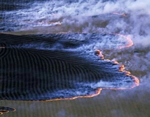
Fire (burning-off) Southern Australia, February, Tasmania JPF49472JPF-13846 Fire (burning-off) Southern Australia February, Tasmania Jean-Paul Ferrero Please note that prints are for personal display purposes only and may not be reproduced in anyway
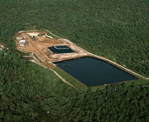
Jabiluka Uranium Mine Kakadu National Park (World Heritage Area), Northern Territory, Australia JPF51440JPF-13914 Jabiluka Uranium Mine Kakadu National Park (World Heritage Area) Northern Territory, Australia Jean-Paul Ferrero Please note that prints are for personal display purposes only
Aerial - Cape York Peninsula - Nassau & Scrutton Rivers - Queensland - Australia JPF50105JPF-13861 Aerial - Cape York Peninsula Nassau & Scrutton Rivers - Queensland - Australia Jean-Paul Ferrero Please note that prints are for personal display purposes only
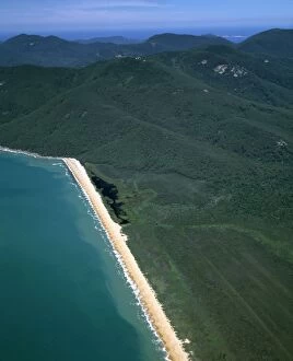
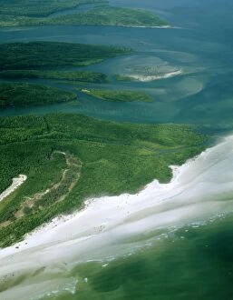
Aerial - Five Mile Beach - Wilsons Promontory National Park, Victoria, Australia JPF49704JPF-13856 Aerial - Five Mile Beach Wilsons Promontory National Park, Victoria, Australia Jean-Paul Ferrero Please note that prints are for personal display purposes only
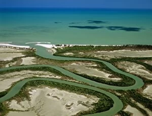
Aerial - Murray River mouth with Sir Richard Peninsula (bottom) and Younghusband Peninsula (top)JPF-13842 Aerial - Murray River mouth with Sir Richard Peninsula (bottom) and Younghusband Peninsula (top) Coorong National Park, South Australia
Aerial - SW Cape Mountain Range, Bathurst harbour Southwest National Park, Tasmania (World Heritage Area)JPF-13853 Aerial - SW Cape Mountain Range, Bathurst harbour Southwest National Park, Tasmania (World Heritage Area), Australia Jean-Paul Ferrero Please note that prints are for personal display
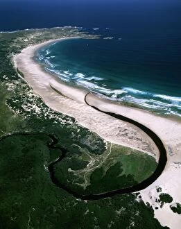
Aerial - Sandy Cape - Arthur Pieman Protected Area, Tasmania, Australia JPF49284JPF-13849 Aerial - Sandy Cape - Arthur Pieman Protected Area Tasmania, Australia Jean-Paul Ferrero Please note that prints are for personal display purposes only and may not be reproduced in anyway
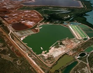
Aerial - Bauxite mine, Gove eastern Arnhemland, Northern Territory, Australia JPF49980JPF-13850 Aerial - Bauxite mine, Gove eastern Arnhemland Northern Territory, Australia Jean-Paul Ferrero Please note that prints are for personal display purposes only
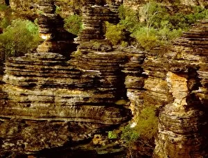
Eroded sandstone on western edge of the Arnhemland Escarpment Kombolgie FormationJPF-13884 Eroded sandstone on western edge of the Arnhemland Escarpment Kombolgie Formation: sediments deposited in early Proterozoic(1700 Ma), Ubirr, Kakadu National Park (World Heritage Area)
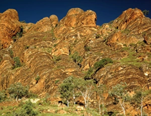
Northern Bungle Bungle Range near Froghole Gorge dissected sandstone. Palms are undescribed endemics, Livistona spJPF-13928 Northern Bungle Bungle Range near Froghole Gorge dissected sandstone Palms are undescribed endemics, Livistona sp
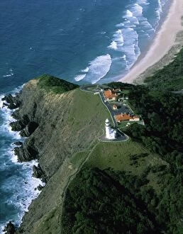
Byron Bay lighthouse - aerial, Byron Bay, New South Wales, Australia JPF48933JPF-13830 Byron Bay lighthouse - aerial Byron Bay, New South Wales, Australia Jean-Paul Ferrero Please note that prints are for personal display purposes only and may not be reproduced in anyway
Aerial - Sisters Beach and farmland north coast Tasmania, Australia JPF49103JPF-13839 Aerial - Sisters Beach and farmland north coast Tasmania, Australia Jean-Paul Ferrero Please note that prints are for personal display purposes only and may not be reproduced in anyway
Aerial - Tropical rainforest near Cape Tribulation Daintree National Park, Queensland, Australia JPF50058JPF-13866 Aerial - Tropical rainforest near Cape Tribulation Daintree National Park Queensland, Australia Jean-Paul Ferrero Please note that prints are for personal display purposes only
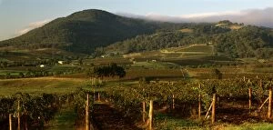
Vineyards of the Lower Hunter Valley on the slopes of Broken Back Range, Hunter Valley, New South WalesJPF-13829 Vineyards of the Lower Hunter Valley on the slopes of Broken Back Range Hunter Valley, New South Wales, Australia Jean-Paul Ferrero Please note that prints are for personal display purposes
Aerial - Murray River mouth, with Sir Richard Peninsula & Younghusband Peninsula South Australia JPF49635JPF-13841 Aerial - Murray River mouth, with Sir Richard Peninsula & Younghusband Peninsula South Australia Jean-Paul Ferrero Please note that prints are for personal display purposes only
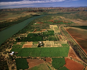
Aerial - Ord River Irrigation Scheme near Kununurra, Western Australia JPF51804JPF-13921 Aerial - Ord River Irrigation Scheme near Kununurra Western Australia Jean-Paul Ferrero Please note that prints are for personal display purposes only and may not be reproduced in anyway
Aerial - Newcastle Bay and Kennedy Inlet with mangroves, Cape York Peninsula, Queensland, Australia JPF49938JPF-13852 Aerial - Newcastle Bay and Kennedy Inlet with mangroves Cape York Peninsula, Queensland, Australia Jean-Paul Ferrero Please note that prints are for personal display purposes only
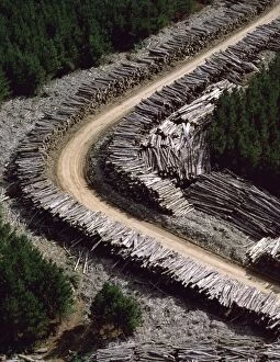
Aerial - Timber loading Northeastern Tasmania, Australia JPF49498JPF-13845 Aerial - Timber loading Northeastern Tasmania, Australia Jean-Paul Ferrero Please note that prints are for personal display purposes only and may not be reproduced in anyway
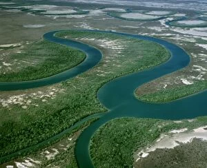
Aerial - Duck Creek - with ox-bows and mangrove-lined river banks, Gulf of Carpentaria, Cape York PeninsulaJPF-13862 Aerial - Duck Creek - with ox-bows and mangrove-lined river banks Gulf of Carpentaria, Cape York Peninsula, Queensland
Aerial - Cape York Peninsula - Gulf of Carpentaria - Mitchell River - MangrovesJPF-13864 Aerial - Cape York Peninsula - Gulf of Carpentaria Mitchell River - Mangroves and sand banks - Queensland - Australia Jean-Paul Ferrero Please note that prints are for personal display
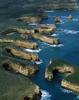
Aerial - Port Campbell National Park with Muttonbird Island in foreground, the Island ArchwayJPF-13825 Aerial - Port Campbell National Park with Muttonbird Island in foreground the Island Archway, and Twelve Apostles beyond, Victoria
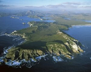
Aerial - Port Davey (northern shores) North Head - World Heritage Area, Southwest National ParkJPF-13836 Aerial - Port Davey (northern shores) North Head World Heritage Area, Southwest National Park, Tasmania (World Heritage Area)