mail_outline sales@mediastorehouse.com
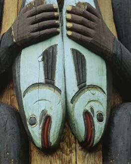
Picture No. 10762649Alaska - Tlingit Indian Totem at Totem Bight Totem Park, Ketchikan, Alaska. "Salmon." Date:
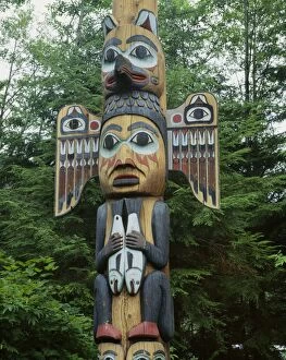
Picture No. 10762650Southeast Alaska Totem -Tlingit Indian Totem at Totem Bight Totem Park, Ketchikan, Alaska Date:
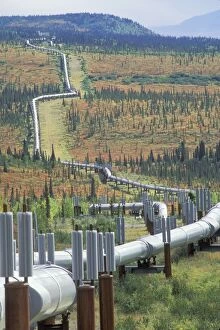
Picture No. 10762610Oil pipeline Date:
Picture No. 10761841Namibia - in the Namib Desert inside the restricted Diamond Area south of Lderitz Date:
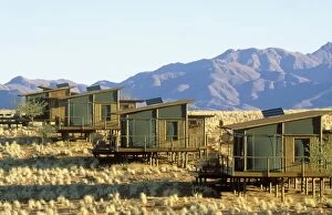
Picture No. 10761843Namibia - the chalets of the exclusive Wolwedans dunes lodge Date:
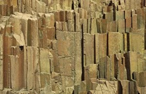
Picture No. 10761844Namibia - the so-called organ pipes are basaltic rock formations Date:
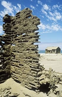
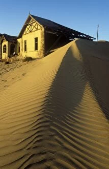
Picture No. 10761839Namibia - Kolmanskop the abandoned ghost town of the diamond days Date:
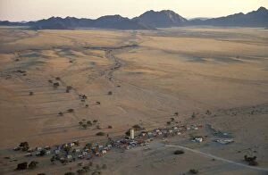
Picture No. 10761842Sossusvlei Lodge - near Sesriem at the edge of the Namib Desert - aerial view from a hot-air balloon shortly after sunrise Date:
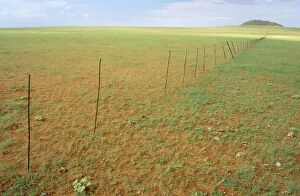
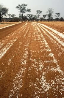
Picture No. 10761837Namibia - Rainy Season with green vegetation - fence separating farmland at the edge of the Namib Desert near Solitaire Date:
Picture No. 10761840Namibia - Kolmanskop the abandoned ghost town of the diamond days Date:
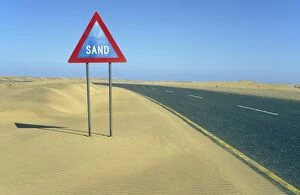
Picture No. 10761833Namibia - traffic sign in the Namib Desert ist of Lderitz at the tarred road B 4 Date:
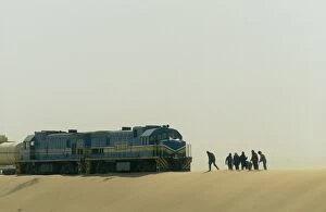
Picture No. 10761834Namibia - rails and shifting dune (barchan dune) east of Lderitz, Namib Desert Date:
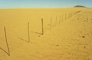
Picture No. 10761836Namibia - Dry Season - fence separating farmland at the edge of the Namib Desert near Solitaire Date:
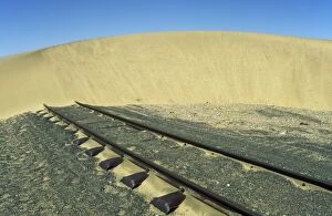
Picture No. 10761835Namibia - the rails in the Namib Desert east of Walvis Bay often are covered with sand and therefore have to be shoveled free Date:
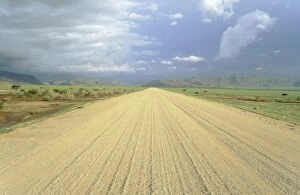
Picture No. 10761830Namibia - the gravel road C 14 between Solitaire and the Naukluft Mountains (in the background) in the rainy season with green surroundings Date:
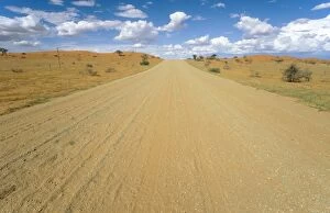
Picture No. 10761831Namibia - gravel road in the typical landscape of the Kalahari Desert Date:
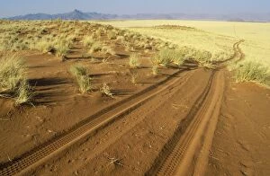
Picture No. 10761832Namibia - sandy track at the edge of the southern Namib Desert inside the NamibRand Nature Reserve Date:
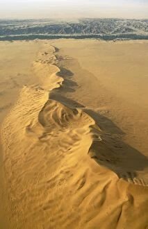
Picture No. 10761822The green belt of the dry Kuiseb riverbed (in the background) is forming the northern boundary of the expanse of dunes of the southern Namib Desert Date:
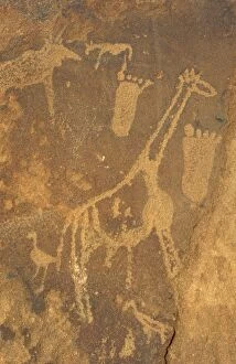
Picture No. 10761828Namibia - giraffe and human footprints at the Twyfelfontein rock engravings west of the town of Khorixas in the Damaraland Date:
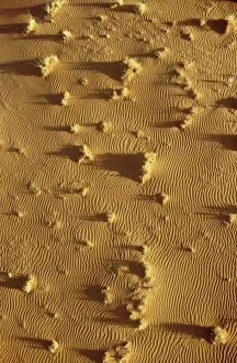
Picture No. 10761824Aerial view of sand dunes in the Namib Desert Date:
Picture No. 10761827Namibia - thunderstorm and lightning over the town of Keetmanshoop during the rainy season (February) - in the evening Date:
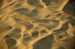
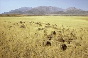
Picture No. 10761823Structural forms and Bushman grass (Stipagrostis sp.) in the Namib Desert - photographed from a hot-air balloon Date:
Picture No. 10761817The Fish River Canyon is with a length of 160 km the second largest canyon in the world and the largest in Africa Date:
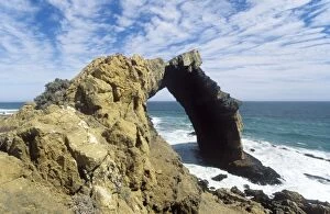
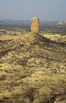
Picture No. 10761819Namibia - the 55 m high Bogenfels rock arch inside the restricted Diamond Area 1 south of Luderitz Date:
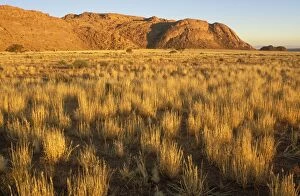
Picture No. 10761818Namibia - Bushman grass (Stipagrostis sp.) and the Tirasberge granite mountains in the evening at the edge of the southern Namib Desert Date:
Picture No. 10761810Namibia - basaltic rocks and Bushman grass (Stipagrostis sp) Date:
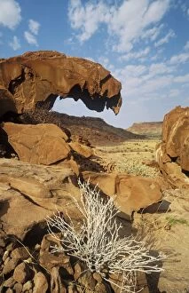
Picture No. 10761813Namibia - sandstone rock formations at Twyfelfontein in the Damaraland west of the town of Khorixas Date:
Picture No. 10761816Namibia - hailstones on a road in the Kalahari Desert with Camelthorn Trees (Acacia erioloba) in the background Date:
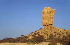
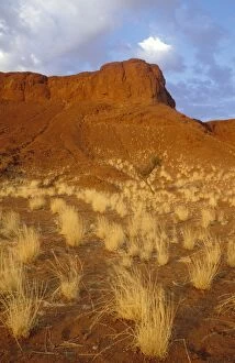
Picture No. 10761812Namibia - the Vingerklip (Rock Finger) in the Damaraland east of Khorixas is surrounded by Mopane (Colophospermum mopane) and thornbush savanna Date:
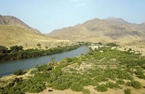
Picture No. 10761808Namibia - Kunene River (border river between Namibia and Angola) at the Marienfluss Valley in the Kaokoveld Date:
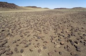
Picture No. 10761815Namibia - so-called petrified dunes (they are not really petrified but solidified) at the edge of the Namib Desert Date:
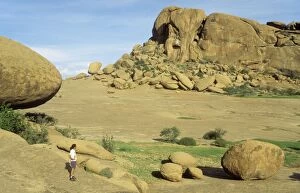
Picture No. 10761814Namibia - Bull's Party and Elephant's Head are granite rock formations on the land of the Ameib Ranch in the Erongo mountains Date:
Picture No. 10761811Namibia - the Vingerklip (Rock Finger) in the Damaraland east of Khorixas is surrounded by Mopane (Colophospermum mopane) and thornbush savanna Date:
Picture No. 10761809Namibia - basaltic rocks in the Damaraland north of the Uniab River Date:
Picture No. 10761755Anti-war slogans - on rear of a car as it was seen in Santa Fe Date:
Picture No. 10761750Fissured Ridges - Aerial view Date:
Picture No. 10761756Mailboxes Date:
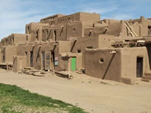
Picture No. 10761757Multy-storey Adobe Complex of the Pueblo Indians in Taos Pueblo at the northern outskirts of the town of Taos Date:
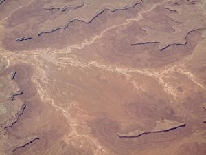
Picture No. 10761746Dried-up riverbeds arid desert country - Aerial view Date:
Picture No. 10761748Dried-up riverbeds arid desert country Date:
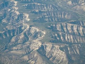
Picture No. 10761752Rocky Mountains foothills - Aerial view Date:
Picture No. 10761751Cloud-covered Rocky Mountains foothills Date:
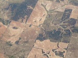
Picture No. 10761749Segmented land - Aerial view Date:
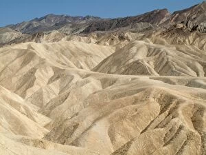
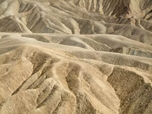
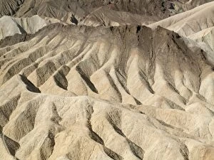
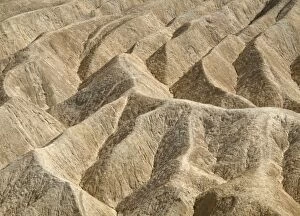
Picture No. 10761743Eroded badlands around Zabriskie Point in the Death Valley Date:
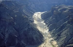
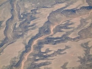
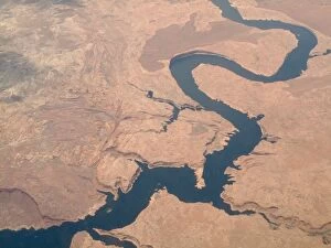
Picture No. 10761747Colorado River - Aerial view Date:
Picture No. 10761742Eroded badlands around Zabriskie Point in the Death Valley Date:
Picture No. 10761744Eroded badlands around Zabriskie Point in the Death Valley Date:
Picture No. 10761740Eroded badlands around Zabriskie Point in the Death Valley Date: